After CASTOR and PUNTA BETTOLINA, we intend to climb the Zumsteinspitze and Signalkuppe, afterwards we are resting for a night at the highest Hut in the whole Alps and even Europe.
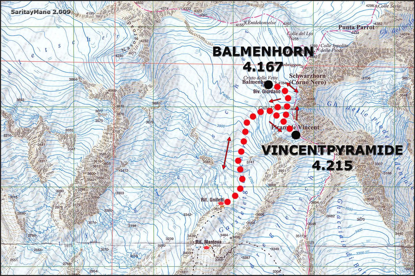
We're climbing the Vincentpyramide and Balmenhorn firstly. This way, we shall take altitude acclimatization.
Spanish version in this link: VINCENTPYRAMIDE, VINCENT PYRAMIDE O PIRAMIDE VINCENT (4.215 m) - BALMENHORN (4.167 m)
SITUATION
Monte Rosa. Boundary Crest of the Valais Oriental. Alps.
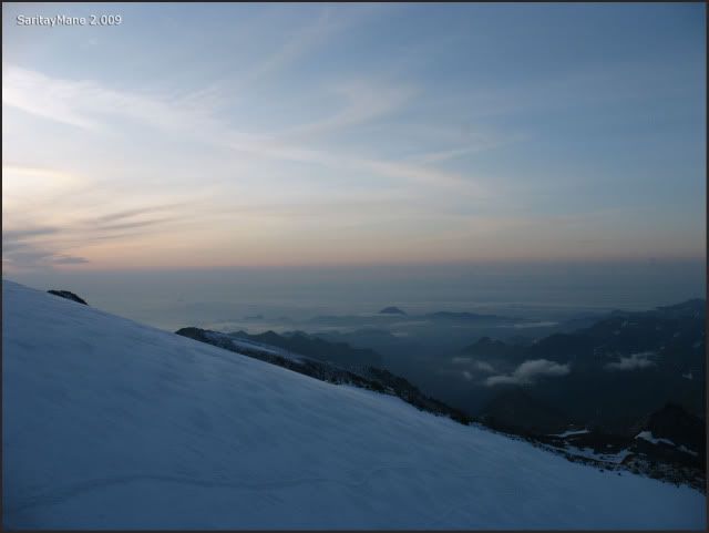
2.009/08/09. CLIMB TO CAPANNA GNIFETTI HUT
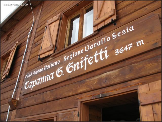
CAPANNA GNIFETTI HUT INFORMATION
Phone number: 0039.0163.78015
Total beds: 180
Keeping season: 30 June - 7 September.
For further information about Capanna Gnifetti Hut, seek in MONTE ROSA 4.000 or instead, CLUB ALPINO ITALIANO.
IMPORTANT
Reservation needed to rest in any fo Monte Rosa Huts, via Booking Center of Monte Rosa. Is indispensable a deposit of 30% total fee payment to confirm the booking.
Without a reservation, relying on our good luck as to find a place in Gniffetti, is likely to finally rest in the "emergency posts", this means: on the floor, only for 6 € per person.
Monte Rosa Booking Center phone number: 0039.0163.922805
e-mail: info@rifugimonterosa.it
You must send e-mail to the Booking Center, via info@rifugimonterosa.it. Attach information about: number of persons, number of nights, dinners and breakfasts.
A first e-mail shall be sended at your request, specifying the reservation data, the fees and the deposit worth. Deposit can be paid by credit card or bank transfer.
Once deposit has been paid, a second e-mail shall be send, attaching detailed information about oneself's booking.
Don't forget to bear a copy of this second e-mail, in order to prevent misunderstandings.
Booking can be made by APPLICATION FORM FOR RESERVATION OF CLUB ALPINO ITALIANO.
STARTING POINT
Passo Salati, settled in Val de Gressoney, inside the Aosta Valley (Italy).
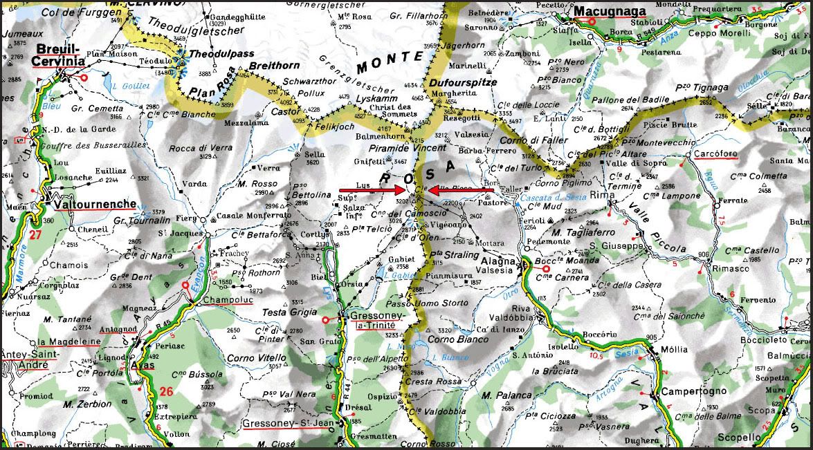
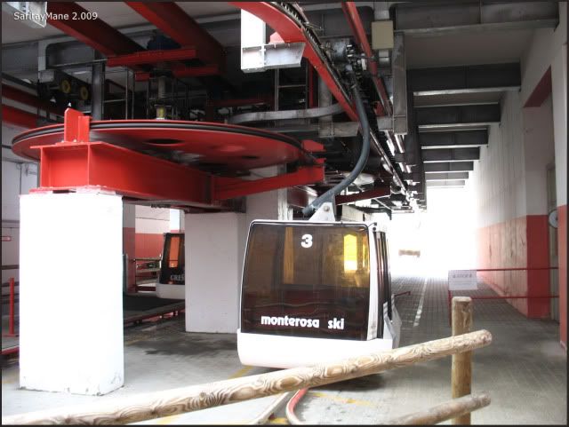
Coming from Gressoney La Trinité, follow the SR 44 (road from Pont-Saint-Martin to Stafal) along the Val de Gressoney. In Stafal is settled the cable car station, to reach some of the high slopes over Monte Rosa, specially to get to Quintino Sella and Capanna Gnifetti Huts.
Stafal is a very busy place at this term of the year. So you'd better get there early, to avoid queues and nuisance.
To get to Gressoney La Trinité, settled in Val de Gressoney, aside Valle de Aosta (Italia), seek in GUIA REPSOL or VIA MICHELIN.
From Stafal, is much better to use the cable cars to get to Passo Salati without any effort.
Only need a single ticket for the whole trip. It takes round 30-45 minutes.
The round trip ticket price is 26 €/person. Ten days is the maximum period of availavility of the ticket. Give back the card to retrieve the ticket deposit of 1 €. You can do this at the proper ticket office.
To find timetables seek in QUINTINO SELLA HUT INFORMATION.
CARTOGRAPHY
Sheet ner. 294 Gressoney 1:50.000. Swisstopo.
Val d'Ayas Val di Gressoney Monte Rosa 1:25.000 L'Escursionista Editions.
MAP
Property of "L'Escursionista Editore".
RESUME
UNEVENNES: 800 m – 2.624 ft (+/-)
TOTAL DISTANCE: 4 km – 2,5 miles.
TOTAL TIME: 03:00 hours.
DIFFICULTY: Easy (E).
An equipped course previous to reach Capanna Gnifetti Hut from the Garstelet Glacier.
Grade II equipped rock scrambling in short parts of the path.
EXPOSURE: Medium - Low.
HARDNESS: Middle.
WATER: Ice melting water all the way.
GUIDANCE: Very good signed path all the time.
GEARS: Anything remarkable.
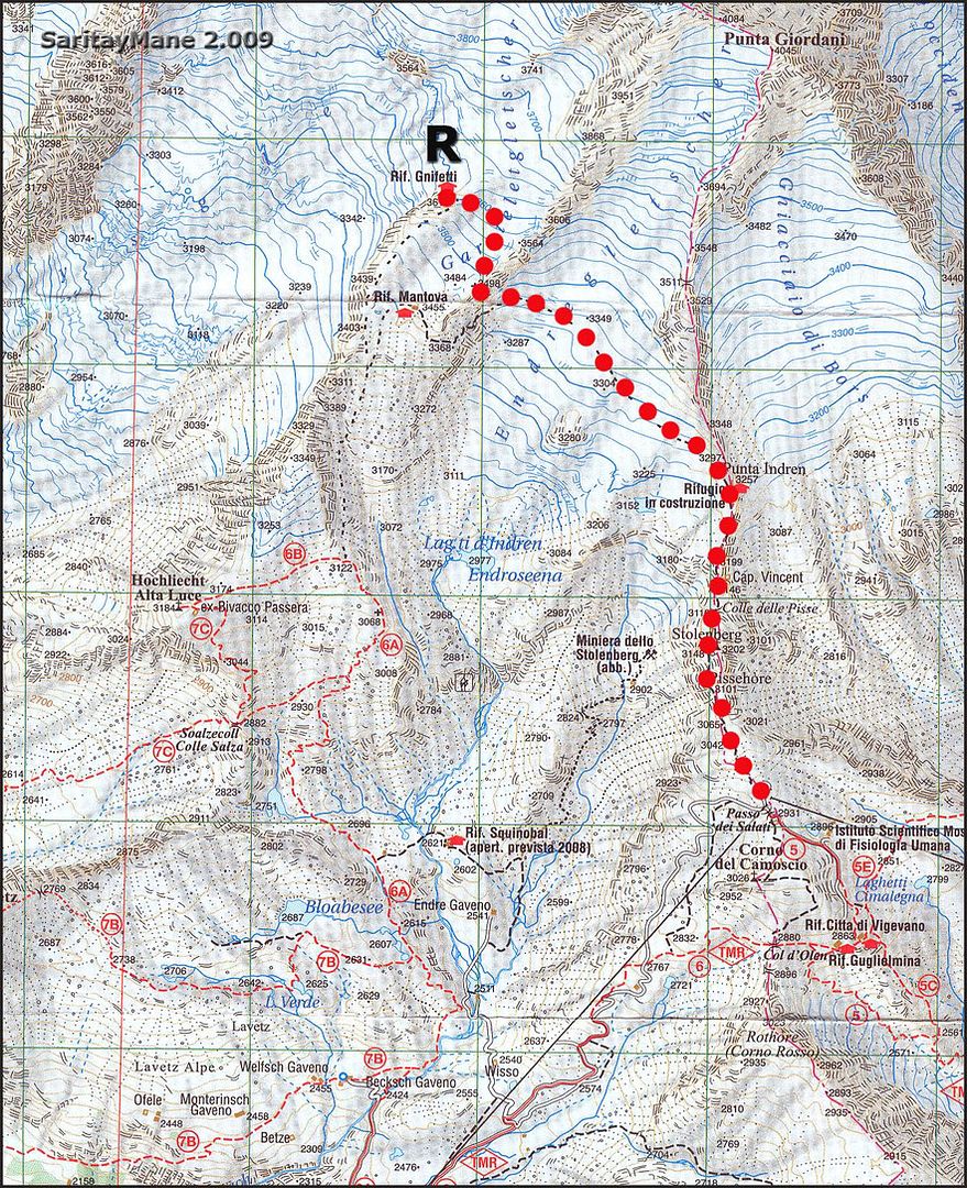
GPS TRACK LOG
Click on: WIKILOC 20090809 REFUGIO GNIFETTI
CAPANNA GNIFETTI HUT ASCENT
The planning is like this: on Sunday 2.009/08/09 ascent to Gnifetti; on Monday 2.009/08/10 Zumsteins and Signalkuppe attempts; on wednesday 2.009/08/11 other 4.000 m peaks attemps while descending from Capanna Margherita, where we shall rest on Monday night.
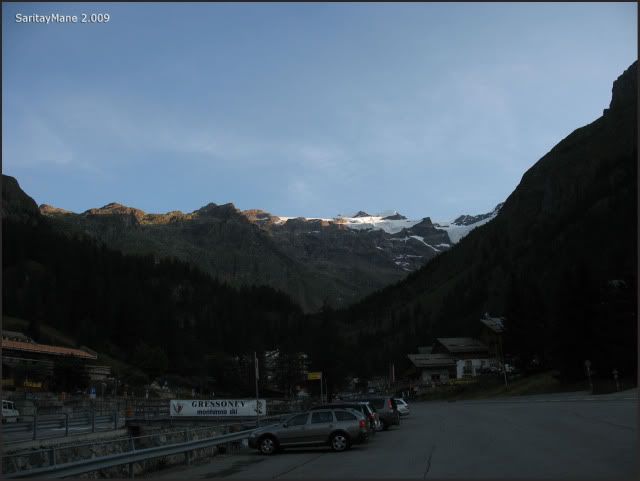
After resting in the parking of Gressoney La Trinité where we had been once before, as described in CLIMB TO QUINTINO SELLA AND CASTOR, we move to Staffal.
Stafal, encore.
We intend to loose weight in our backpacks, by increasing the expected spending in the hut.
First cable car, untill Gabiet.
Leaving Staffal.
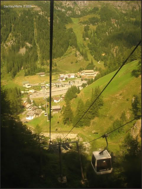
Earning altitude rapidly.
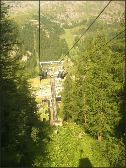
Once at Gabiet, we rush to take the next cable car.
We get to watch the Squinobal Hut, under construction by this time.
Fliying above slopes.
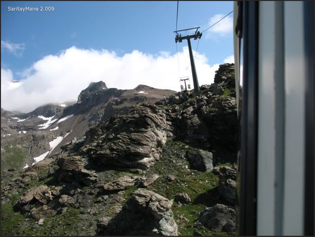
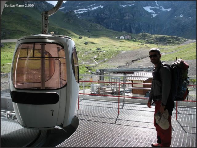
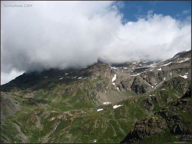
Arriving to the Passo Salati.
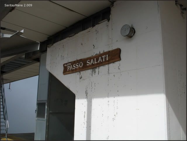
Mane injures in his back when get his backpack out the cabin, a bit more harm...
...and he would like to get rid of the rope.
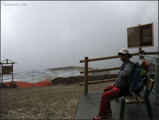
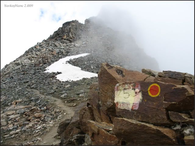
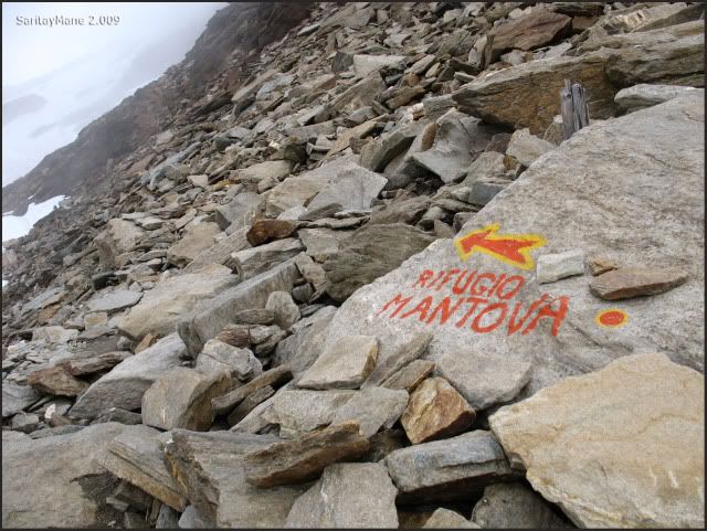
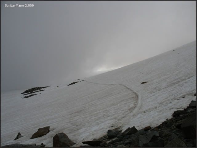
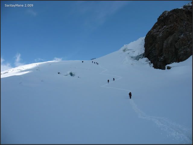
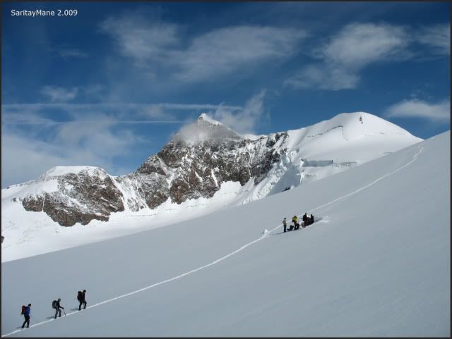
After a short break we begin following the path numbered as 5, leading us to Punta Indren. From this point, it shall turn to Mantova and Gnifetti Huts.
We put on our way.
Following the signs in the path.
Leading us to the Peak Stolemberg. We'll surround it along the west side.
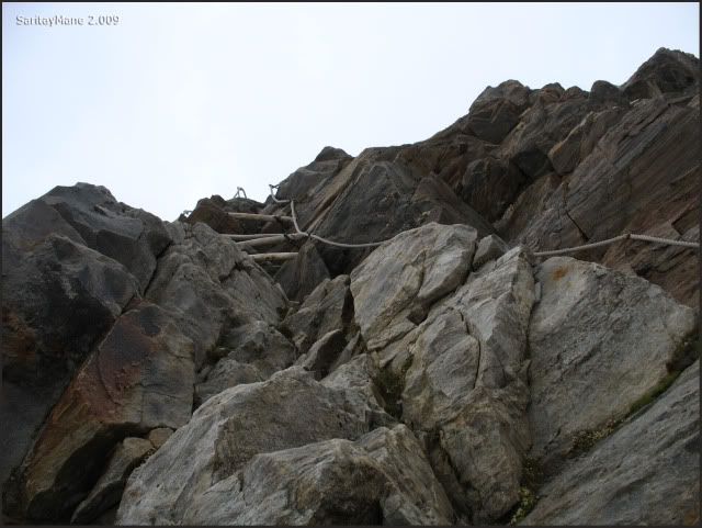
Find some ropes equipped in the path.
Easy to pass.
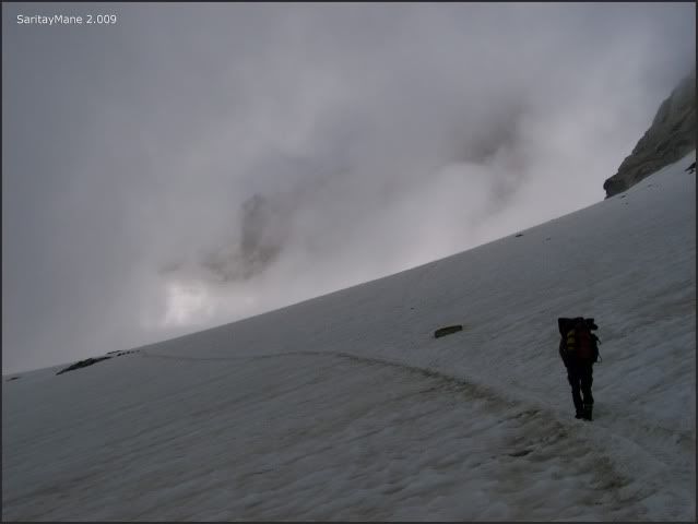
And continue walking.
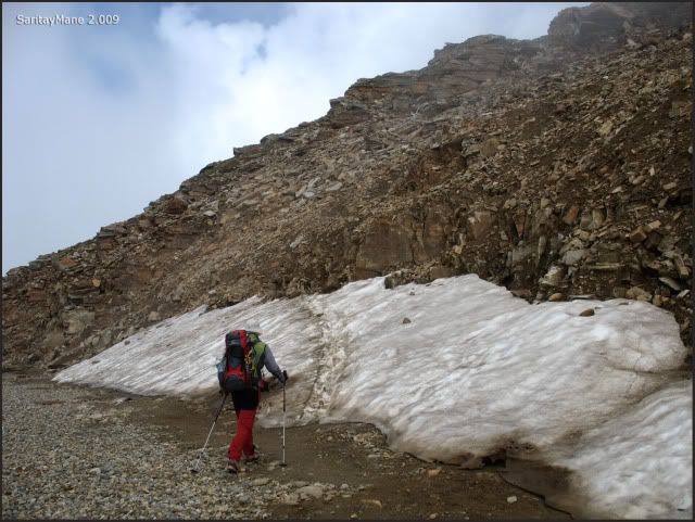
Mane walks his own pace.
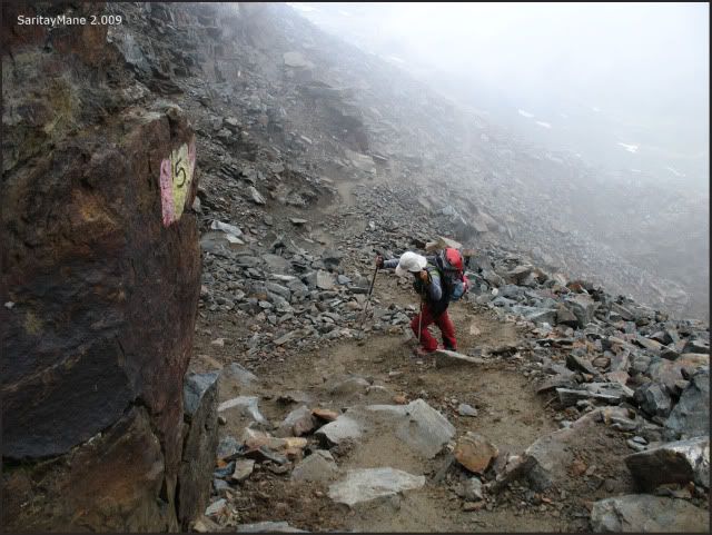
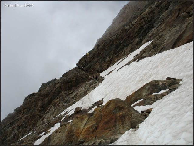
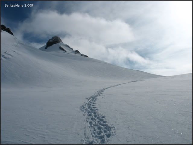
Several meters upwards, this path begins descending to Colle delle Pisse. This pass is settled between Punta Indren and the Summit of Stolemberg. At this point we find a second section, equipped with ropes.
This assists us descending this part of the path.
The rock is wet, so we have to be careful.
This is the next part to ascend.
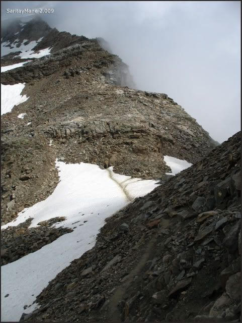
After have passed the Colle de Pisse.
We follow ascending among the rocks.
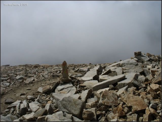
The path is pretty well signed with landmarks.
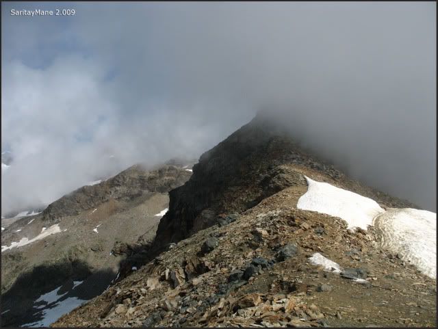
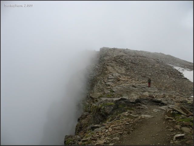
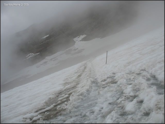
It's foggy around here.
Near Punta Indren, currently it's being built a new hut.
From this point, we take the road to Mantova Hut, settled in proximity to Refugio Gnifetti.
The signed path.
Leaving Punta Indren.
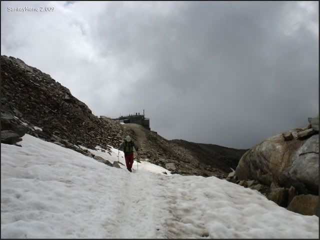
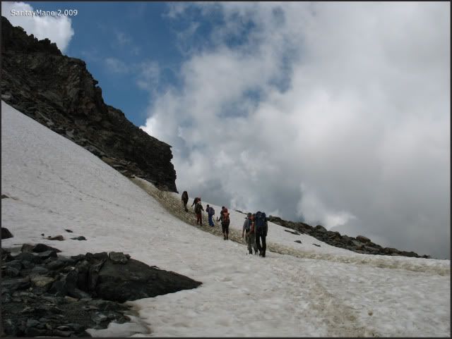
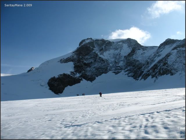
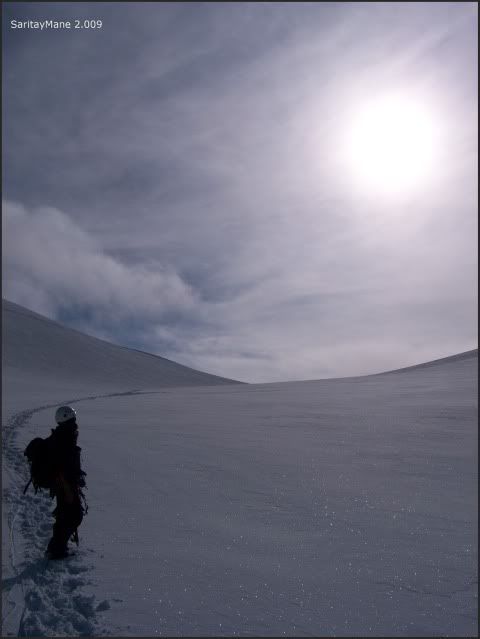
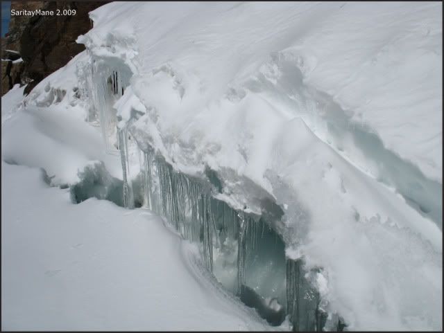
Arriving to the Endre Glacier.
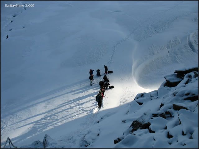
Somebody seems a bit heavy loaded.
The path crosses the Endre Glacier near the its basis.
Sometimes It's stepped on ice.
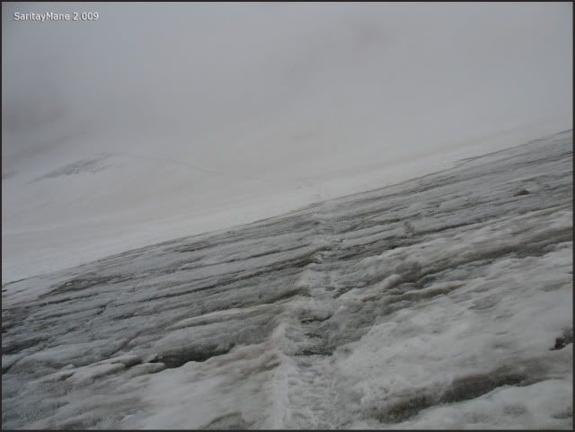
Easily croosed.
Approaching to the border of the glacier.
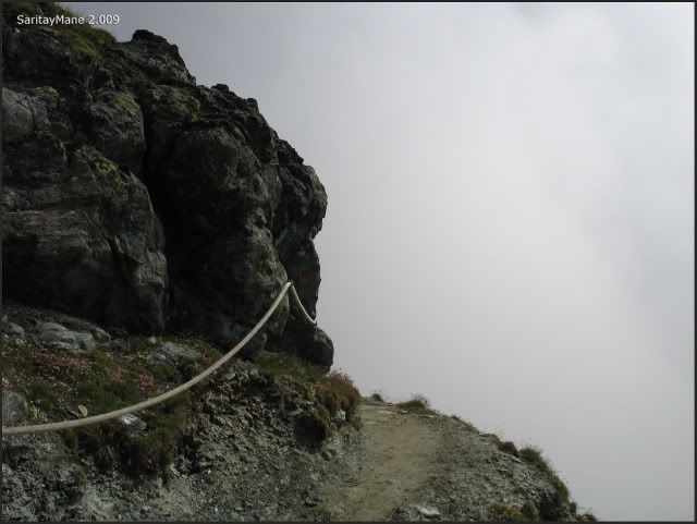
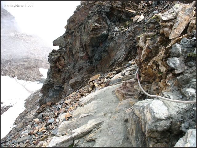
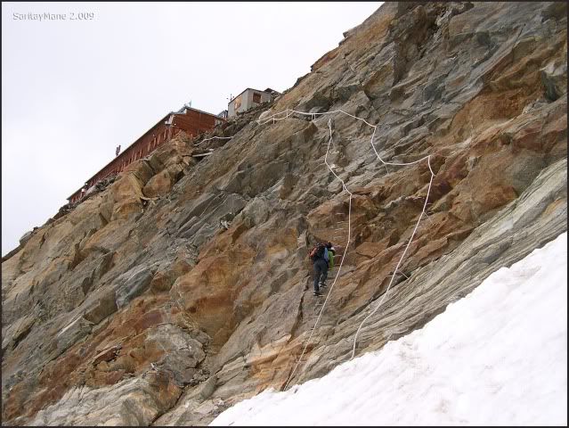
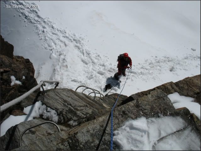
A new section, it's equipped with ropes.
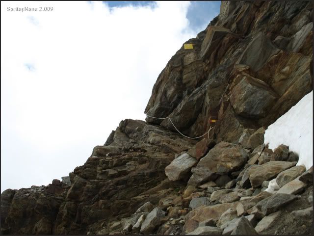
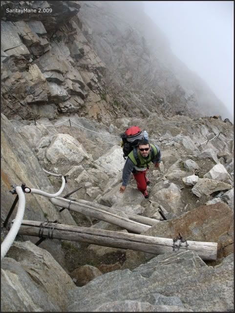
Find some sort of lumber structures, to make easy the path.
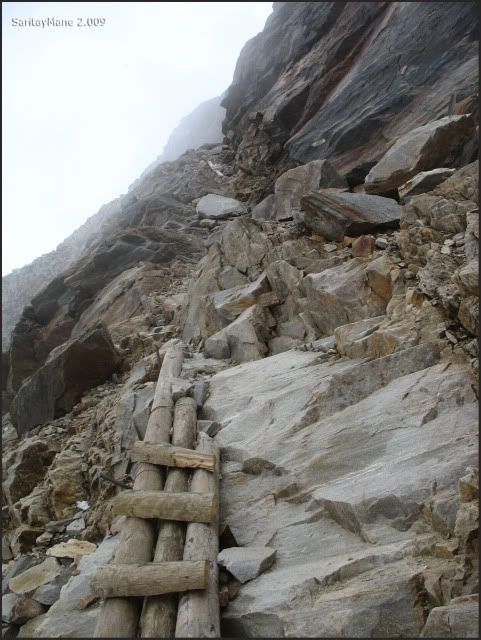
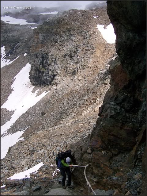
The fourth section, equipped with ropes.
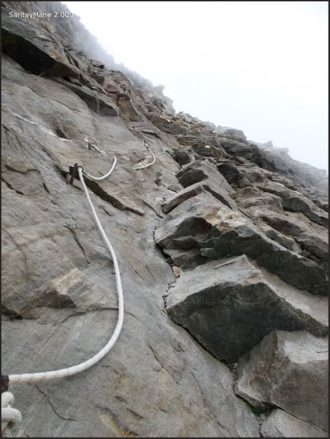
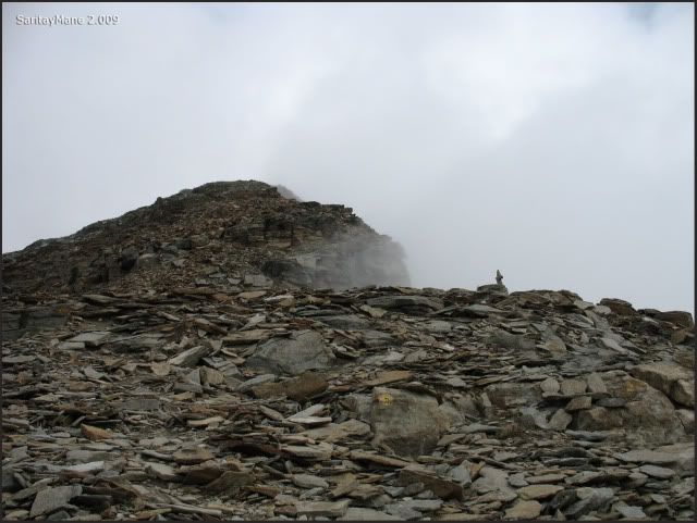
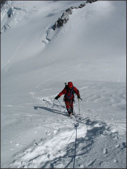
The path steepens strongly, from this point.
Mane climbing this part of the path.
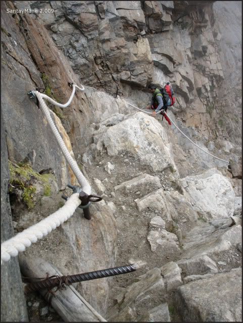
This stretch is expossed.
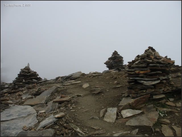
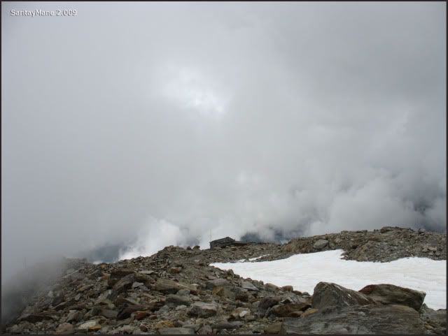
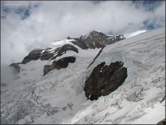
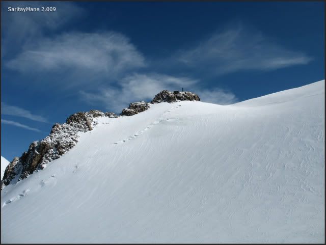
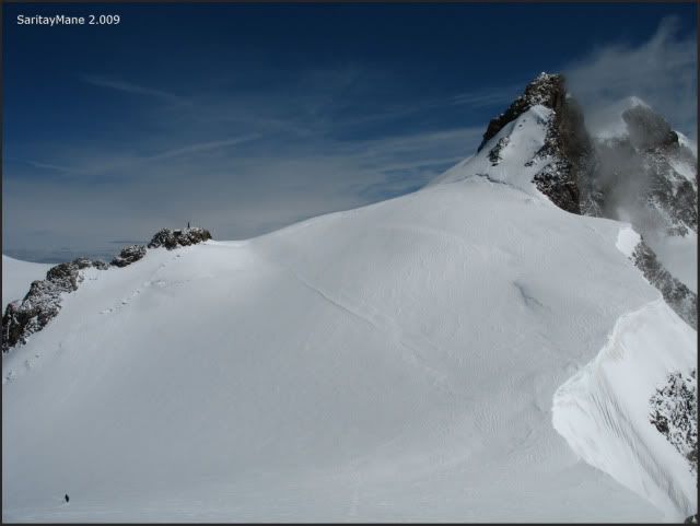
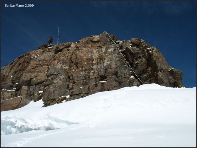
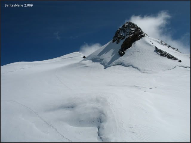
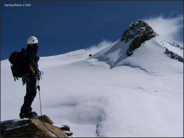
On the top of this climb, it's settled the crest between Garstelet and Ender glaciers.
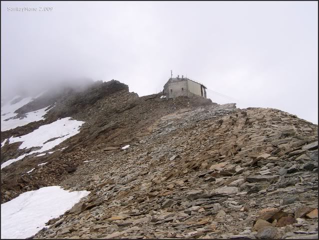
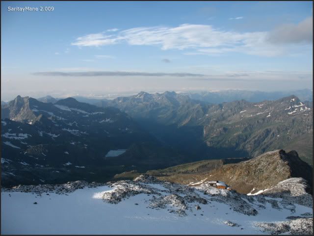
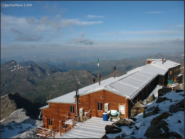
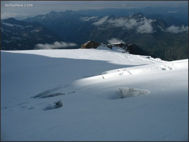
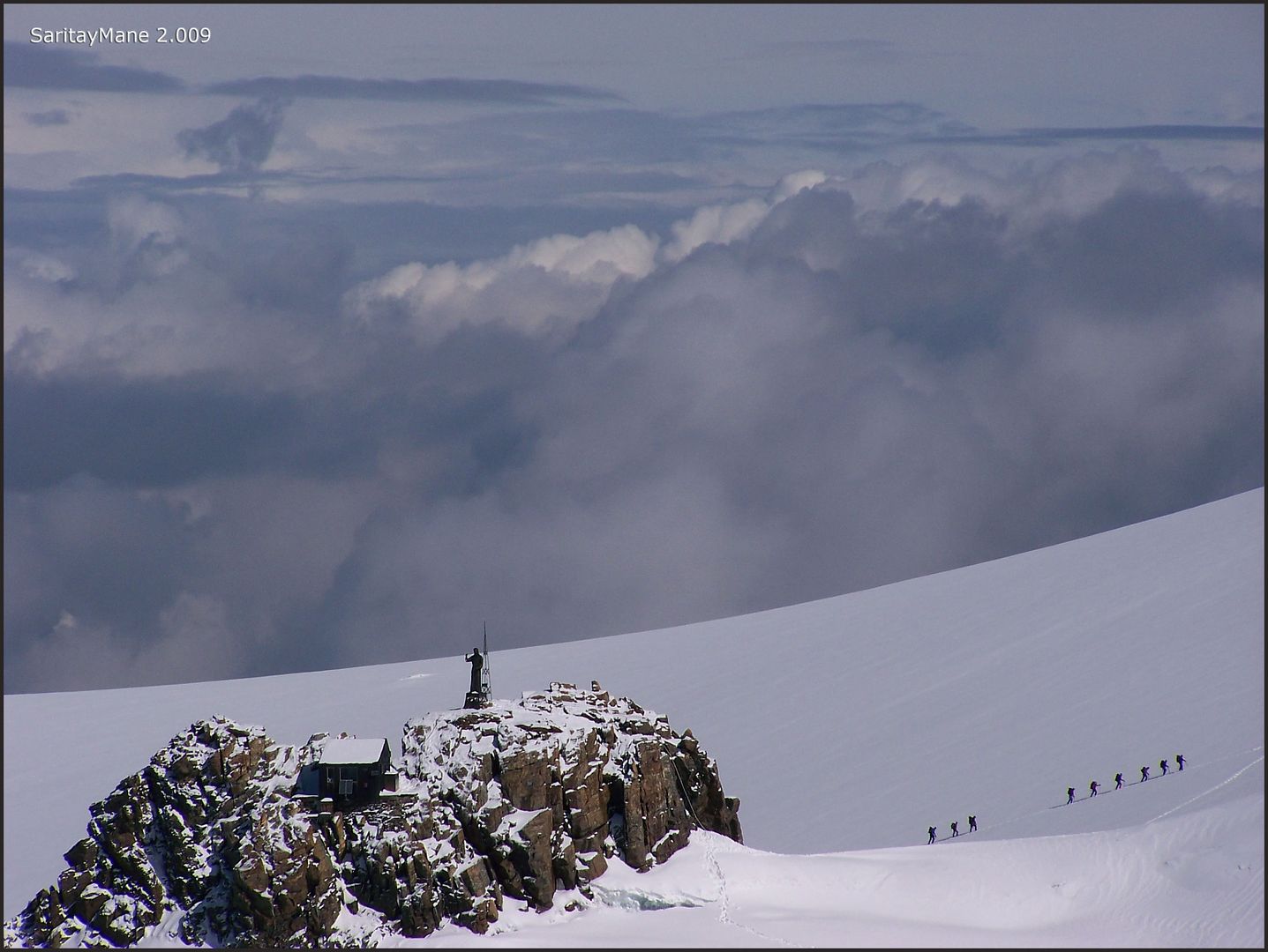
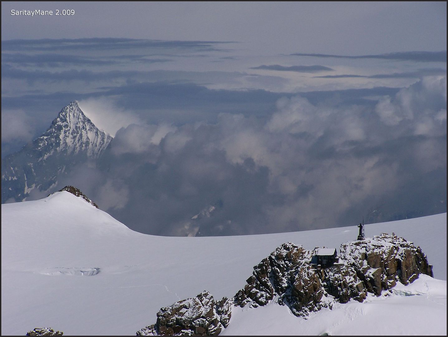
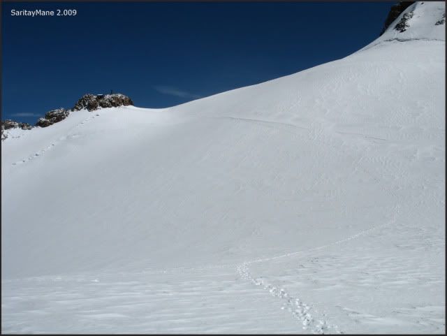
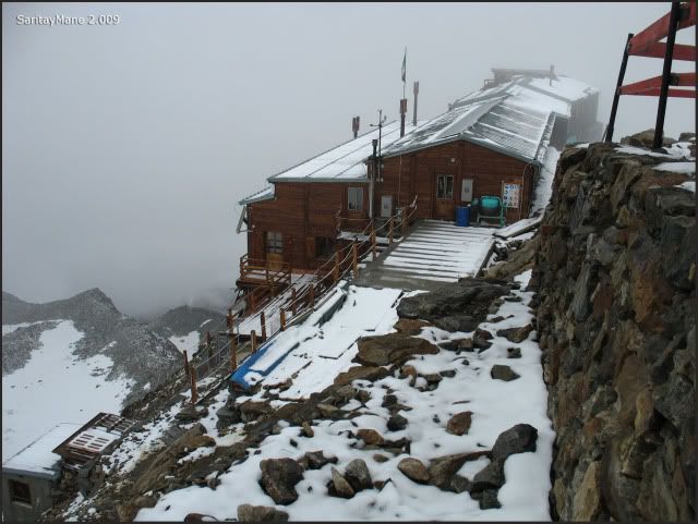
In front of us, is the Gniffetti Hut.
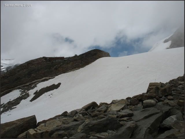
Mantova Hut, settled downwards.
Looking at the Vincent Pyramide.
Zooming in Mantova Hut.
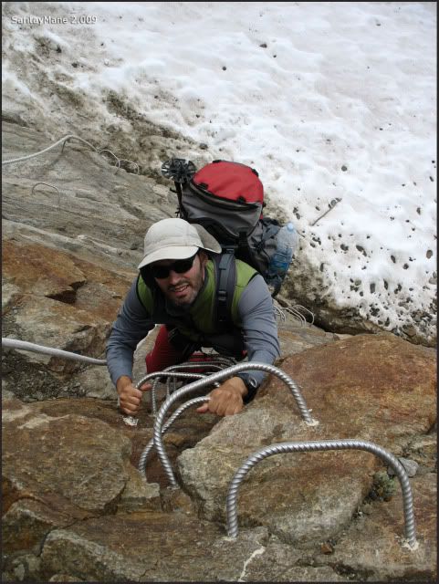
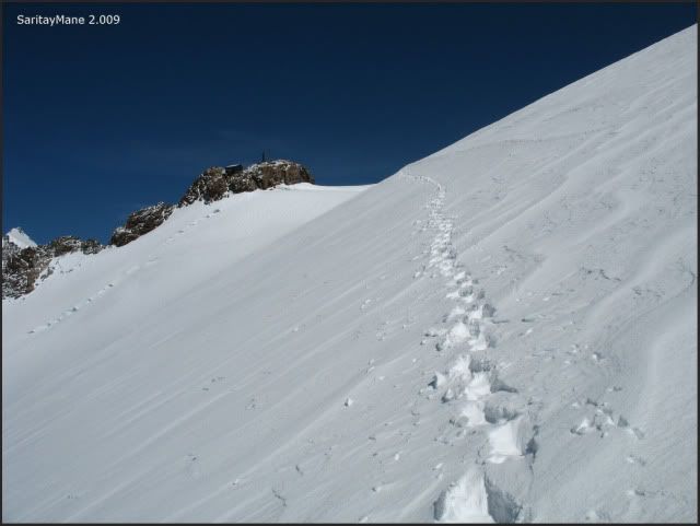
Remain steps to reach Gniffetti Hut.
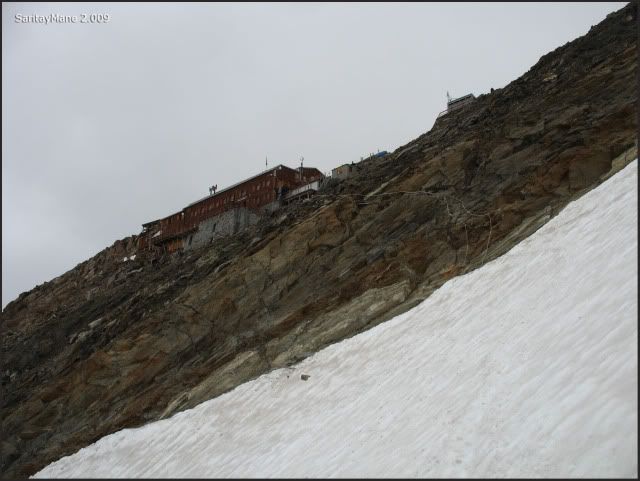
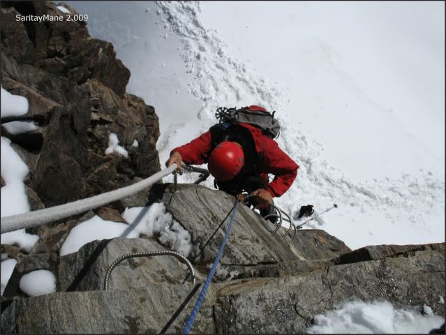
To reach the Hut, you must pass through this climbing equipped with steel staples.
Climbing the equipped way.
It's easy to do.
Near the stairs up to the entrance.
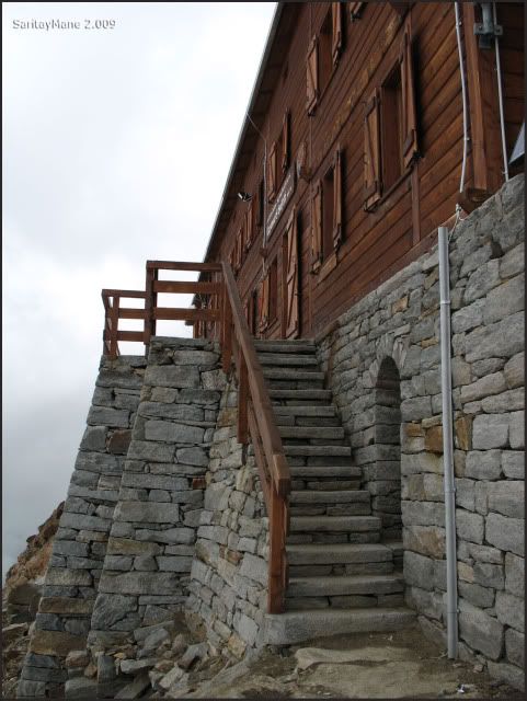
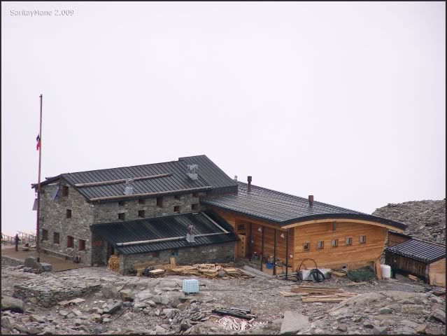
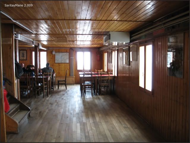
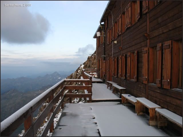
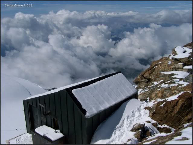
At the Gnifetti Hut.
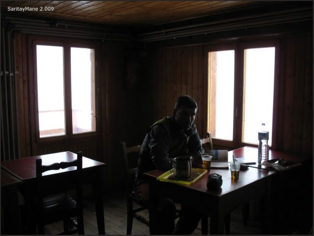
We take our boots off, and register in the hut. We take a room for seven. Fortunately, we're both alone in the room cause it's little busy here.
The view from the window of the room, glancing at the Liskamm.
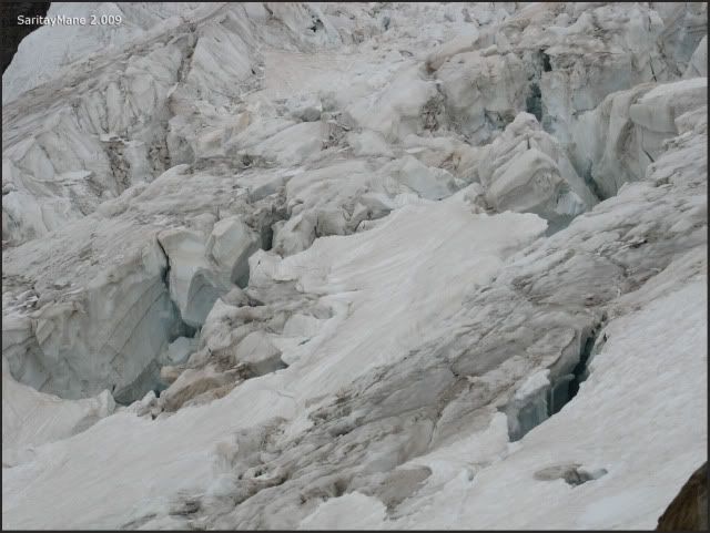
The Lys Glacier, very cracked.
As It's expected bad and stormy weather, specially in the afternoon, we decide to climb Vincent Pyramide tomorrow, and the next day, we shall climb to the Zumsteinspitze and the Signalkuppe
This hut has four floors. There's a bar, and dinig halls in the first two floors. It is a neat hut, despite the amount of pepole using this facilities.
The dining hall in the second floor.
The toilettes are in the fourth room. There's current water,obtained from melting ice. There are also latrines in the toilettes, with no current water, so it stinks really bad!.
There's a small free area for cooking in the first floor, as a part of the original hut.
This night is stormy and it hails. We hope it shall be better day tomorrow.
2.009/08/10. VINCENTPYRAMIDE CLIMB (4.215 m - 13.828 ft) - BALMENHORN (4.167 m – 13.671 ft)
We're climbing both this peaks in order to acclimatize, before climbing Zumsteinspitze and Signalkuppe Peaks...
STARTING POINT
Cappana Gnifetti Hut, keeped from June the 30th to September the 7th.
For further information about this hut, search on MONTE ROSA 4.000 or CLUB ALPINO ITALIANO.
CARTOGRAPHY
Sheet ner 294 Gressoney 1:50.000. Swisstopo.
Val d'Ayas Val di Gressoney Monte Rosa 1:25.000 L'Escursionista Editions.
MAP
Property of L'Escursionista Editore.
SUMMARY
UNEVENNESS: 700 m – 2.296 ft(+/-)
TOTAL DISTANCE: 5,5 km – 3,4 miles.
TOTAL TIME: 04:30 hours.
DIFFICULTY: Easy + (E+).
35º slopes at the end of NW side of Vincentpyramide.
'Vía ferrata' (staple equipped way) to access the Balmenhorn's summit.
MATERIAL: Basic glacier gears. For further information we recommend PROGRESIÓN EN GLACIARES Y RESCATE EN GRIETAS Desnivel Editions, or similar.
GPS TRACK LOG
Click on: WIKILOC 20090810 VINCENTPYRAMIDE - BALMENHORN
THE CLIMB
The day begins pretty fair. We both soon put on our way, in order to avoid the expected storms in the afternoon.
The horizont blushes.
Gnifetti's balcony is covered with snow.
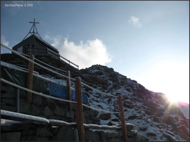
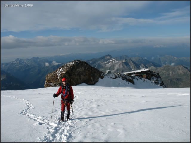
We leave the hut by the storeroom on the firts floor, across the free kitchen. Once there we move to the small chapel settled near the top of the rocks.
The Mantova Hut, downwards.
Gnifetti's chapel.
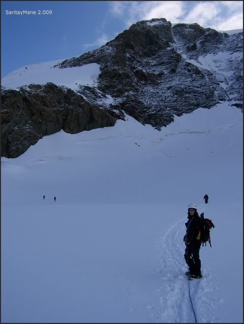
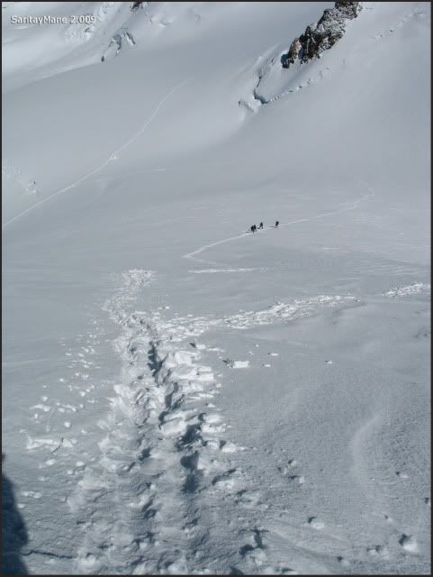
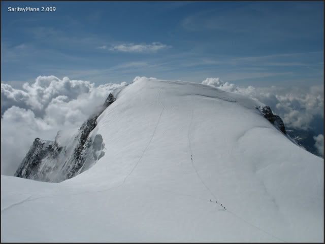
Seeing a few climbers tying up on the glacier.
Perspective of Gnifetti.
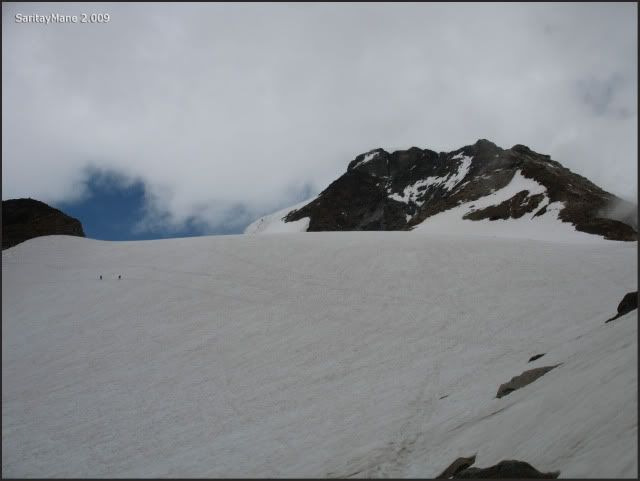
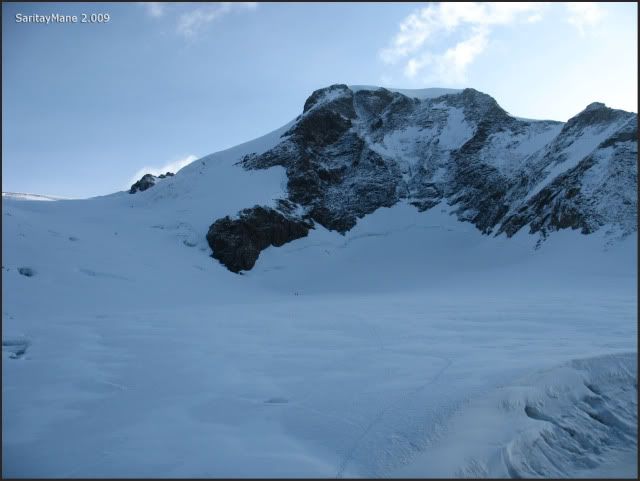
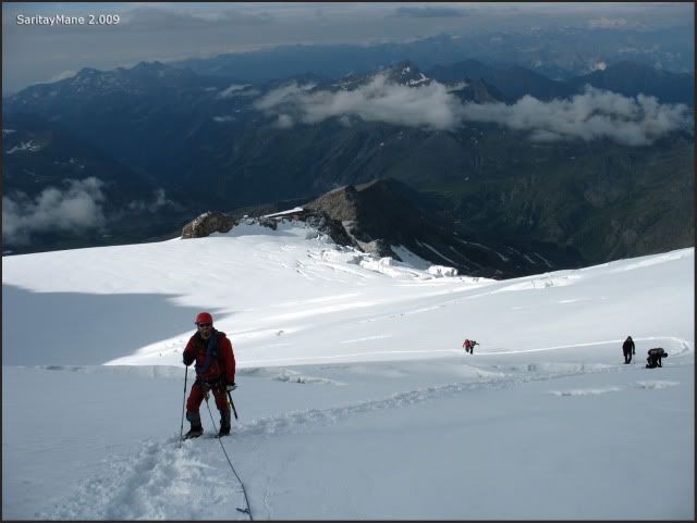
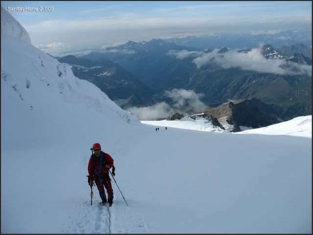
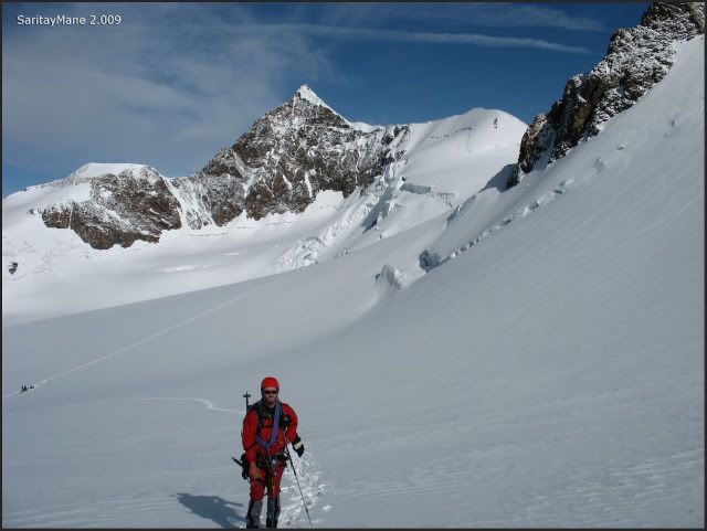
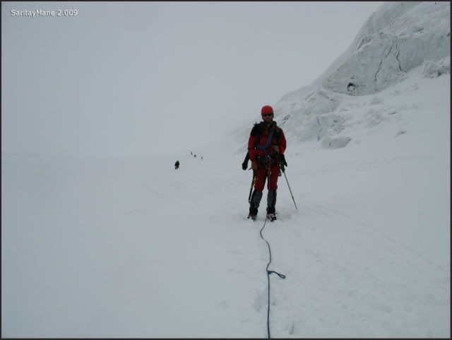
Once on the glacier, we also tie up, and begin the climbing.
Vincentpyramide is close to the hut.
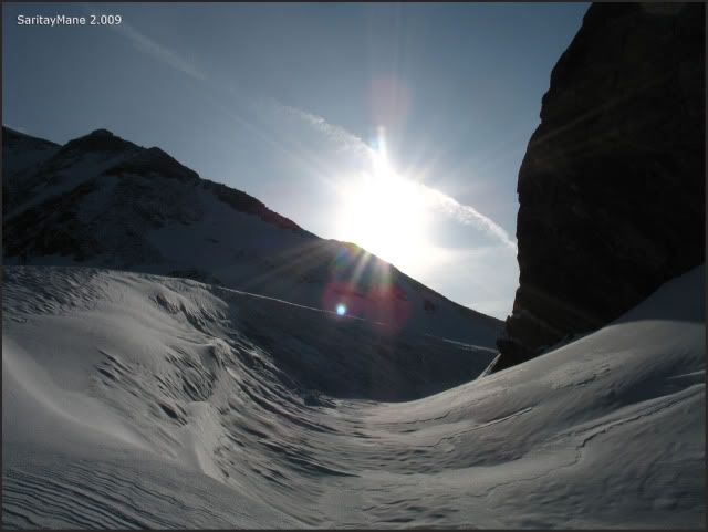
While the sun arises.
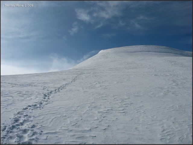
We walk over the Garstelet glacier, following the footprints. This way, we move to North-East, to avoid the amounts of cracks existing in the backside of Gnifetti Hut...
This today's goal.
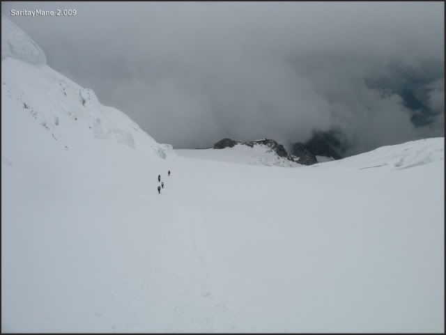
The groups ahead us.
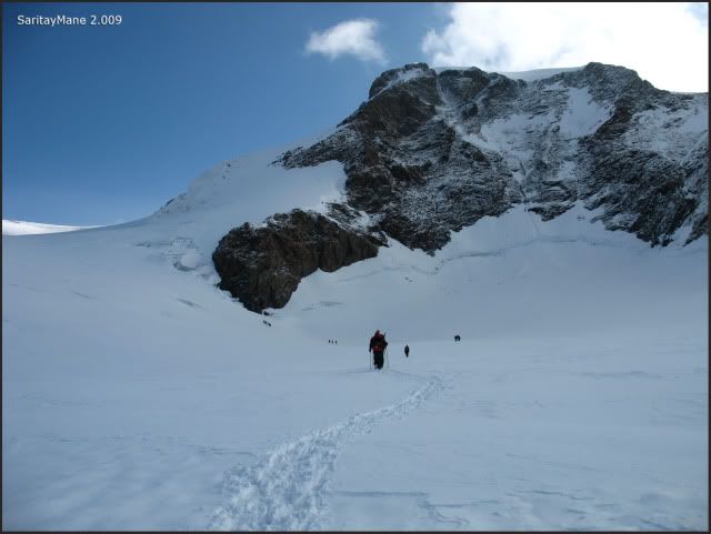
Gnifetti is left back.
Keep on walking.
Following the path.
Beware of cracks...
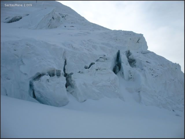
In the backside of Gnifetti, the Garstelet glacier has a lot of cracks. You'd better be careful with ice bridges, and strictly follow the path.
In this part, the cracks are easily visible.
Surrounding the West side of the Vincentpyramide.
It's threatening seracs.
Looking back.
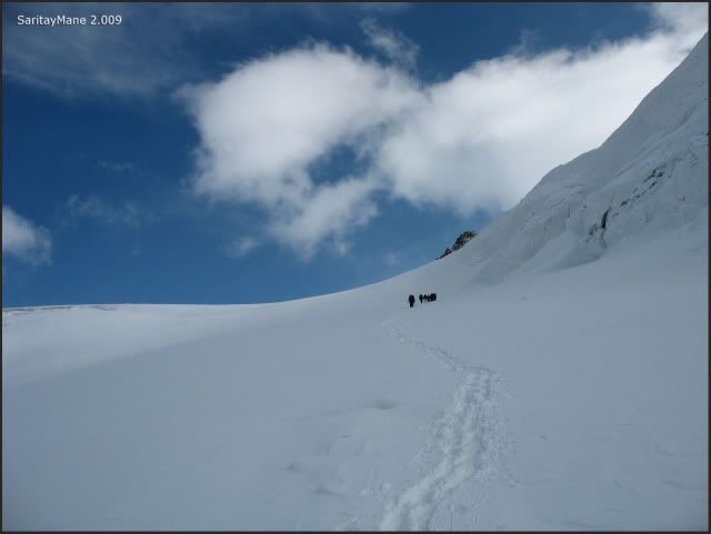
Once arrived at the pass named 'Coll de Lys', we take a detour from the main path, towards the NW slope of the Vincentpyramide. Actually, we move towards the pass named 'Colle Vincent', between the Corno Negro and Vincentpyramide Peaks.
Our main goal.
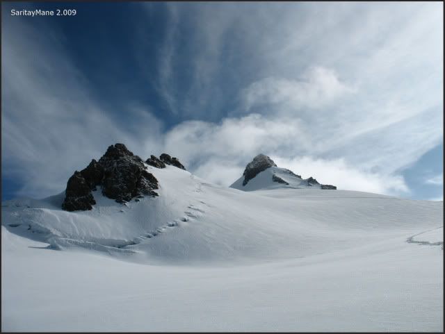
Balmenhorn and Corno Negro Peaks, towards North from this place.
Lyskamm Ost in the back.
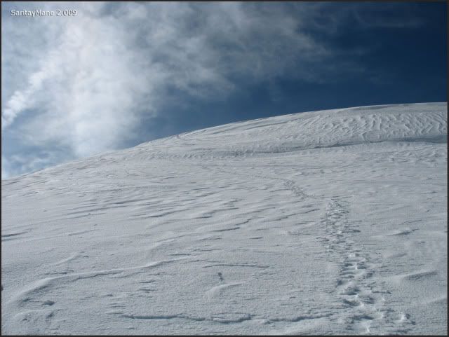
As we follow these footprints.
Nice day.
Surrounding the basis of Balmenhorn peak.
Towards Vincentpyramide.
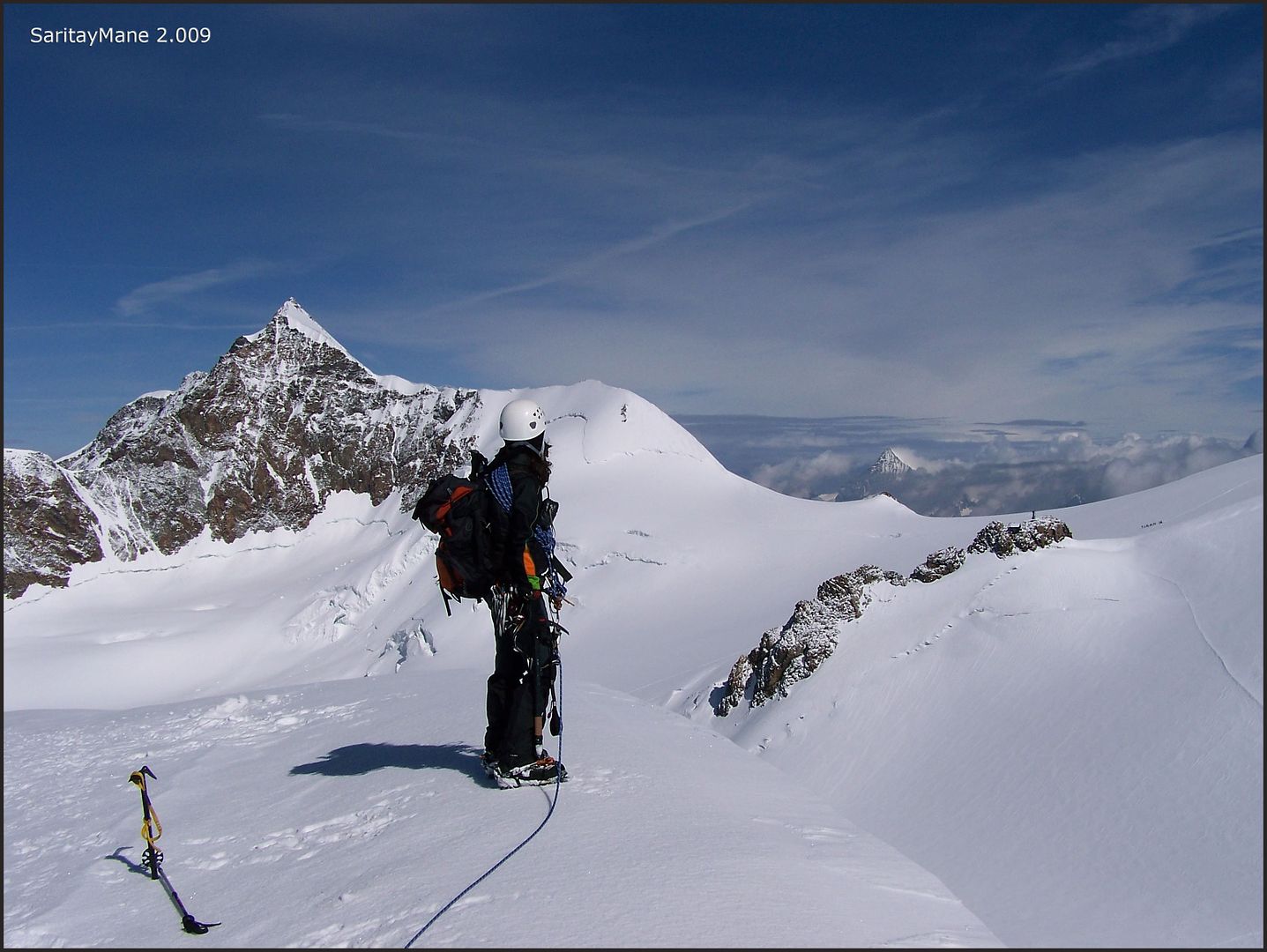
Mane poses ahead the Lyskamm Ost.
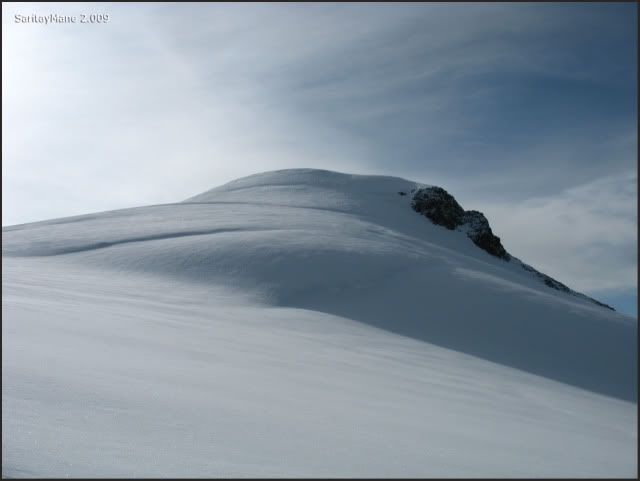
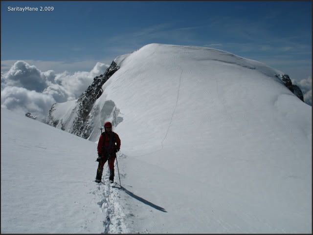
We ascend the NW slope to the Vincentpyramide's Summit.
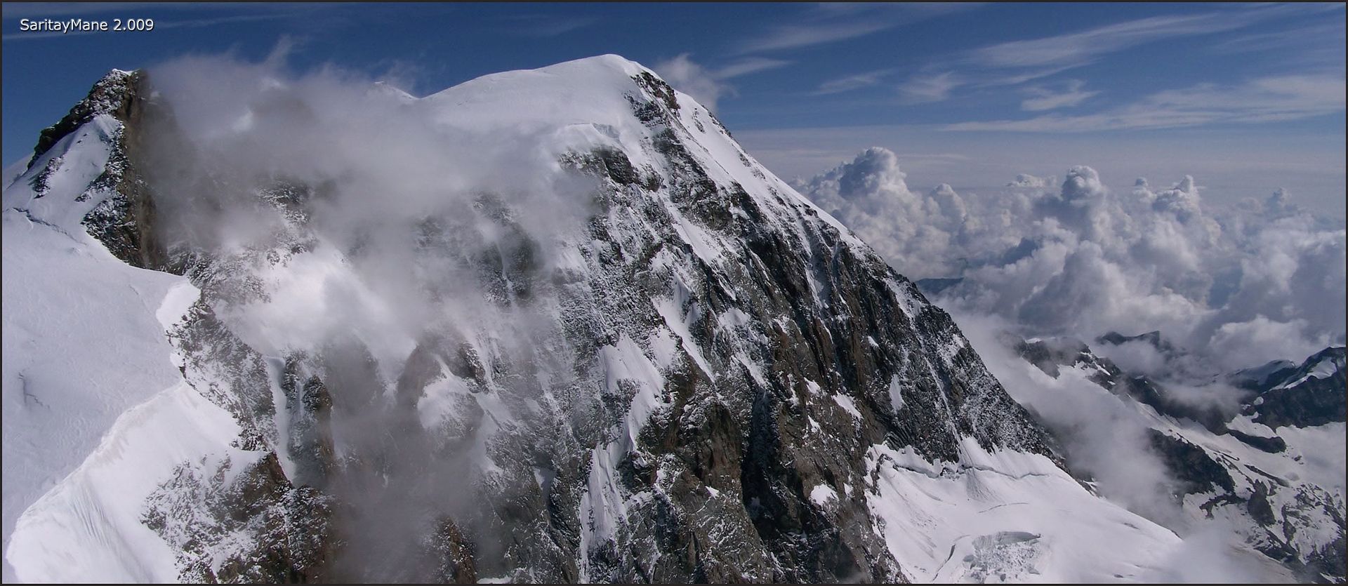
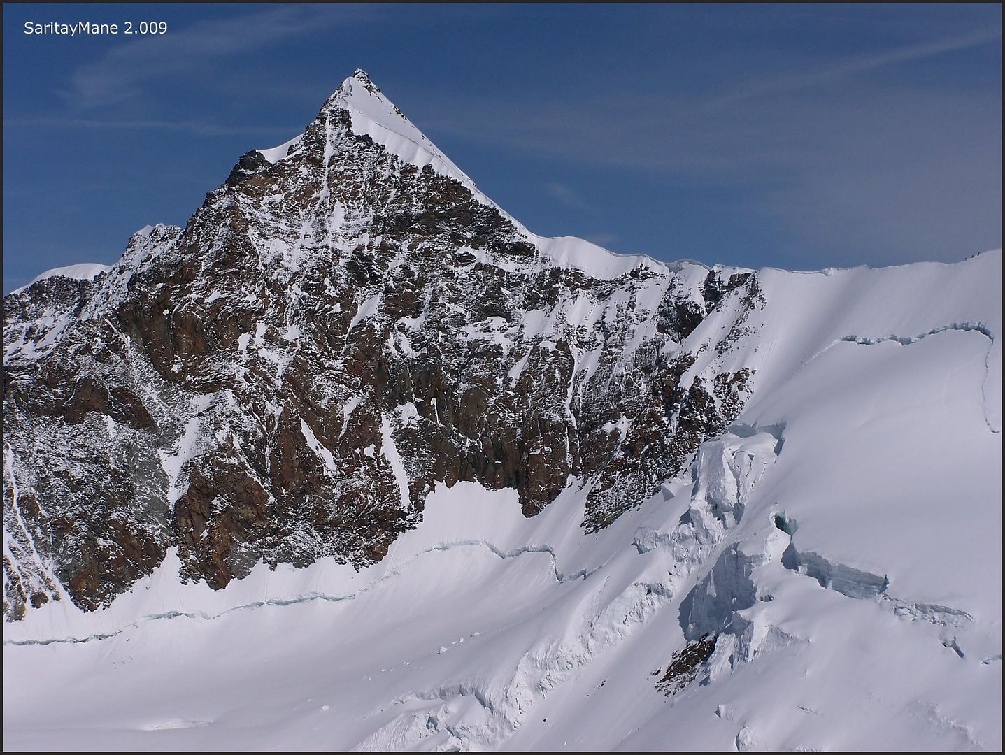
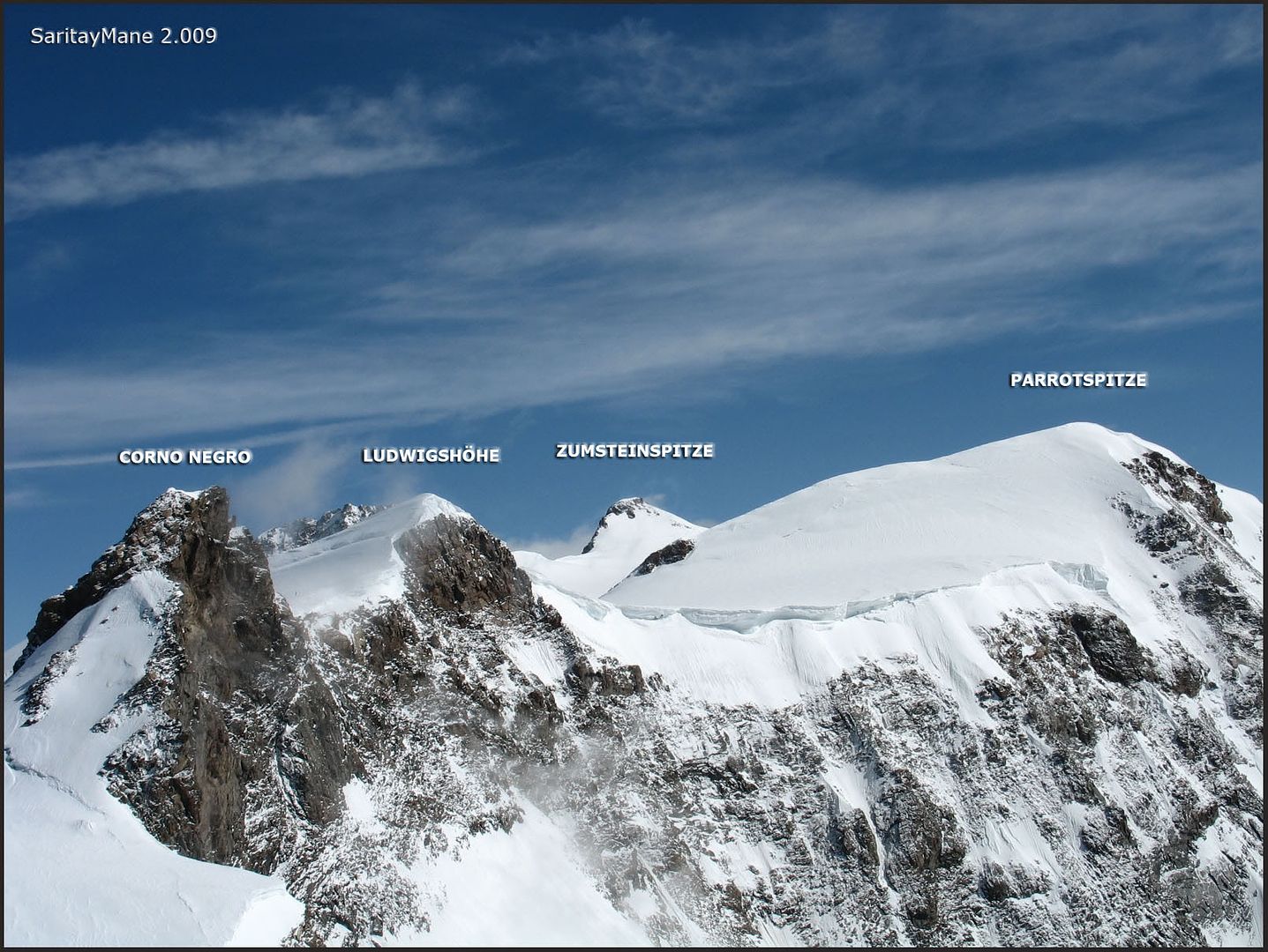
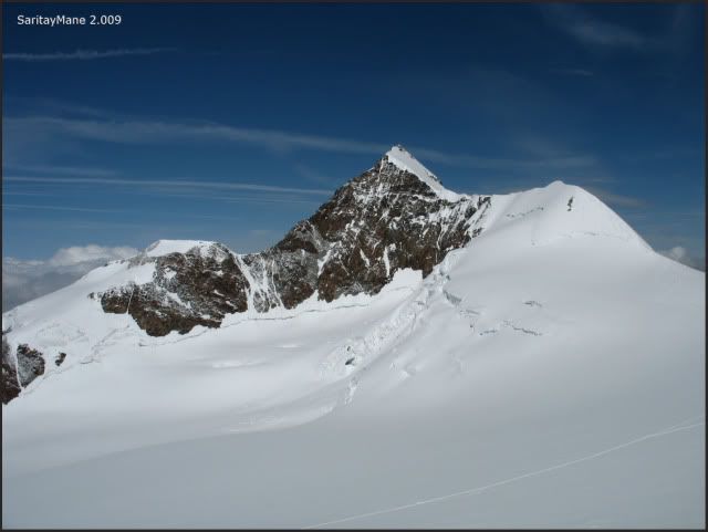
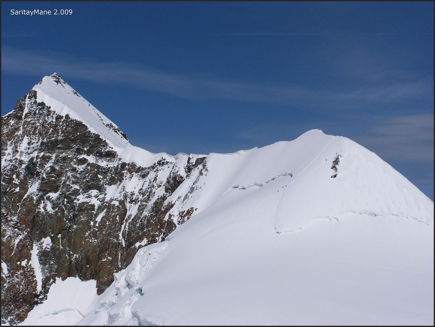
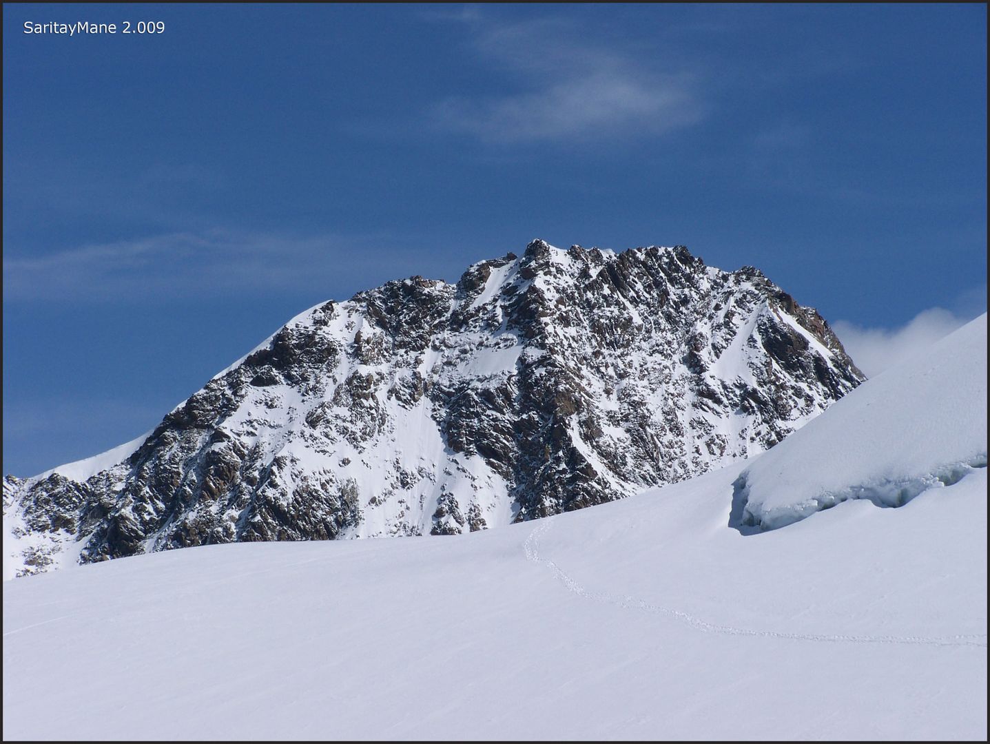
Seeing the Corno Negro, Ludwigshöhe and Parrotspitze Peaks west side.
Remain steps to the summit.
Don't f... with the rope!!
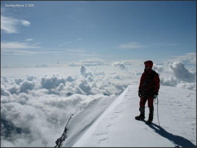
Close to the summit, slope steppens.
Hard to place in such flat summit.
It's cold up here, but sightseen is wonderful here!!
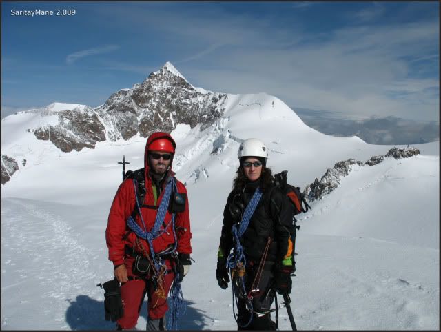
After a few moments waiting on the summit, arrives a group of english climbers coming from another side of the peak. We have a little chat with them and request for taking a picture to us.
Vincentpyramide's Summit (4.215 m – 13.828 ft).
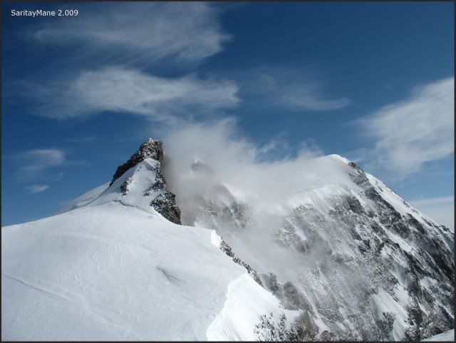
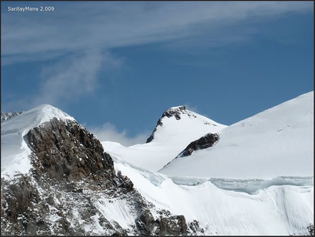
Balmenhorn and Corno Negro Peaks.
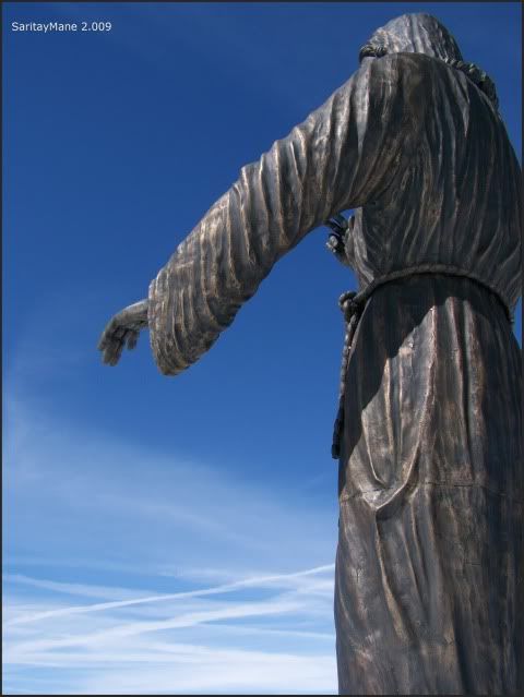
The sculpture of the 'Cristo delle Vette' on the Balmenhorn Peak.
The steep east-side of Corno Negro, Ludwigshöhe and Parrotspitze Peaks.
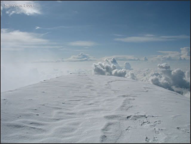
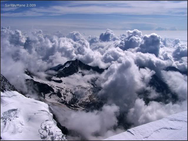
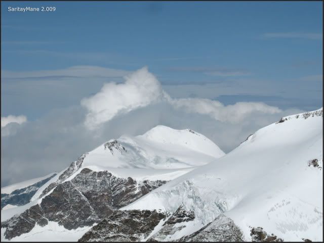
The clouds swim beneath us.
Mane glancing at them.
It's cold and barometric pressure lessens, it's time to get back.
Zooming at the CASTOR, wich we ascended a few days ago.
Now looking at the Liskamm Ost.
Astonishing!
Looking at the Weisshorn Peak, in the background.
Scratched by clouds.
Wonderful range of peaks!
Seeing the ZUMSTEINSPITZE.
As we said before, it's time to move. We intend to go to Balmenhorn before get back.
Begin descending now.
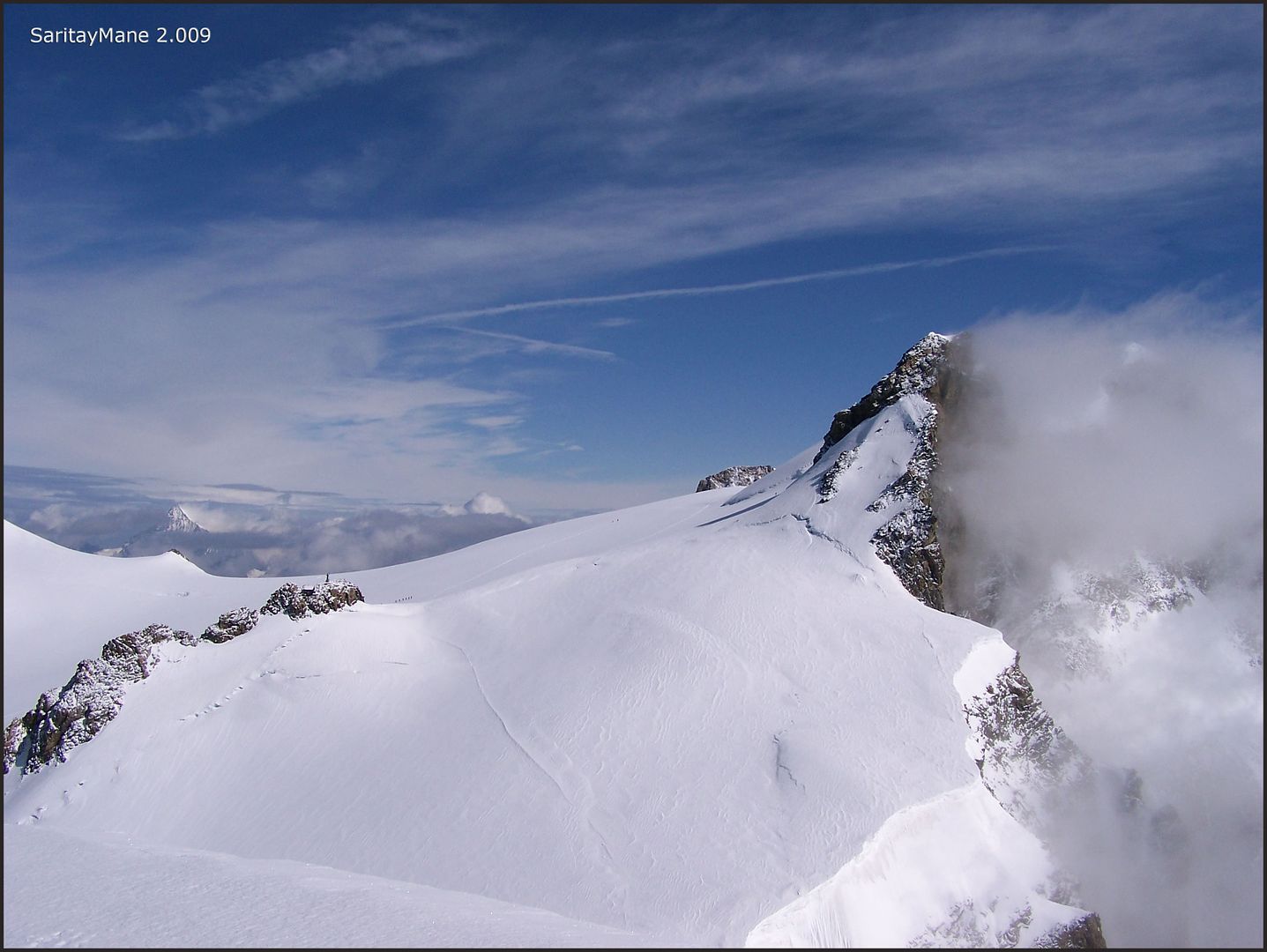
The range from Balmenhorn Peak, to the Corno Negro Peak, on the right.
Close to the Colle Vincent.
Following these footprints.
With the Vincentpyramide on our backs.
There's the equipped way to the summit.
This crack is next to the rocks.
The equipped way, in detail.
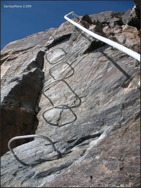
Easily climbed.

On the summit is settled the sculture of 'Cristo delle Vette'. There's also a shelter named 'Cabaña Vivac Giordano'.
For emergency use.
The huge sculpture.
Perspective of Lyskamm Ost...
...climbed by several groups.
Zooming at the Dufourspitze...
... Corno Negro and Lugwidshöhe.
The Vincentpyramide Peak.
Balmenhorn's Summit (4.167 m – 13.671 ft).
We soon descend the equipped way back.
Beware of the rope!!
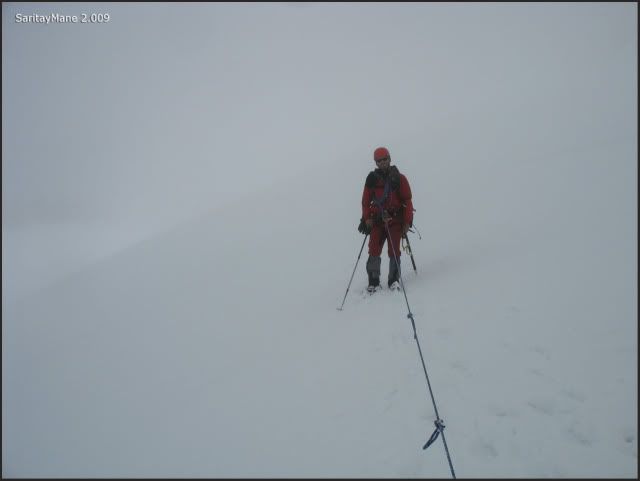
By the time we descend the peak, It gets foggy, clouds surround us, so we'd better move down rapidly.
We see anything.
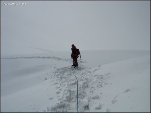
Fortunely, Mane is dreseed on red.
We descend to Colle Vincent and subsequently follow the main path to Gnifetti.
A sort sight at the Lyskamm Ost.
As we said before, the weather forecast is stormy, so we descend even faster.
By this time we're near the hut, and... a few groups are beginning to climb now!!
This is the weather in Alps, so reliable!!
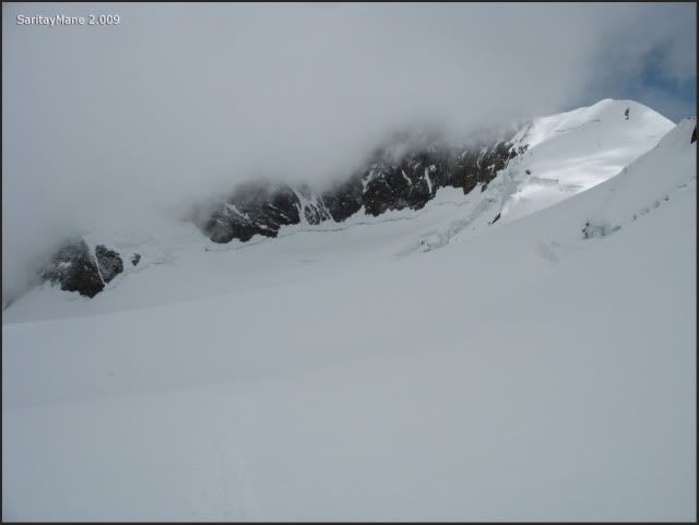
The Gnifetti is covered by clouds.
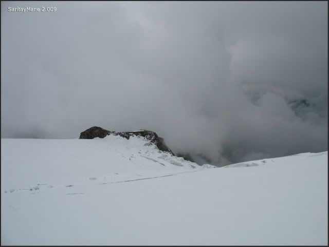
We hardly locate it.
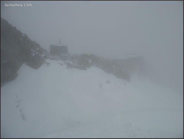
But finally we reach it.
Just in time, because it begins to hail softly.
A misundertanding between the keepers and us causes a problem with the reservation for Cappana Margherita. Apparently is solved by making a little room for us on the floor. We're not very satisfied with this solution, as long as we made a regular reservation, and had accorded with the keepers that we would postpone the reservation one day, without harm.
The weather forecast faces accurate, and it hails and rains all the afternoon and night.
Someone's thinking about tomorrow's climb.
Zumsteinspitze is awaiting...
To look for another Climbings in English Version, click on this link: RANK OF PEAKS. ENGLISH VERSION.


No hay comentarios:
Publicar un comentario