After our touring over Alps on August and afterward’s short visit on Pyrenees, we intend to go to the beach before the summer ends, continuing our Project of SPAIN'S TOP SUMMITS, ascending the top of Alicante's Province. In addition to this, in two days the 8th stage of the Cyclig Tour of Spain will have its finish on this top.
We'll find two tops in this trail:
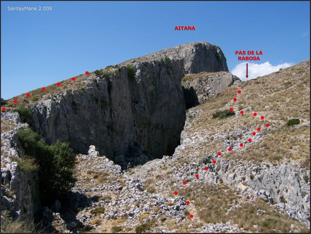
- AITANA (1.558 m – 5.111 ft)
- PENYÓ RAPEL (1.209 m – 3.966 ft)
Spanish version in this link: AITANA (1.558 m)
SITUATION:
Serra d'Aitana (Aitana's Range). Betics Systems.
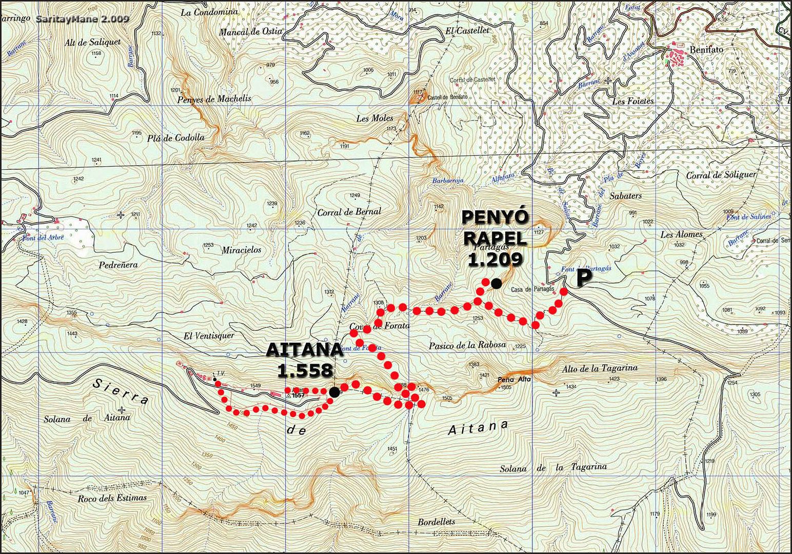
STARTING POINT
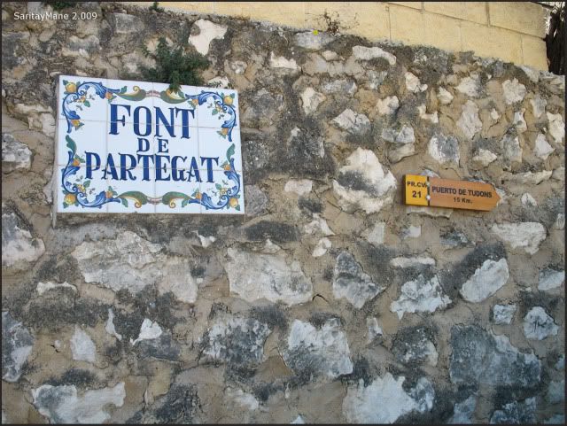
An area called Font de 'Partagat o Partegat', equipped with leisure facilities. Find this area 4 km – 2,5 miles from the villaje of Benifato, on a narrow but asphalted road.
Coming from Benifato, go on with the road to 'Font de Partegat', well signed, over the short path trail marked as PR CV 21. Follow only the landmarks and signs indicating the way of the PR CV 21, on the main road and forgetting any other deviations.
In Winter there should be snow and ice, despite of be placed closed to the south-east coast of Spain.
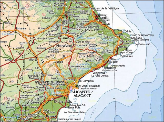
To get to Benifato (Alicante), search on GUIA REPSOL.
CARTOGRAPHY
Marina Baixa Serra d'Aitana 1:20.000. Piolet Editions.
MAP
RESUME
UNEVENESS: 800 m – 2.624 ft (+/-)
OTAL DISTANCE: 12 km – 7,45 miles.
TOTAL TIME: 07:00 hours ( we spent over 01:15 hours bordering the air force facilities of E.V.A. Ner 5).
DIFFICULTY: Easy.
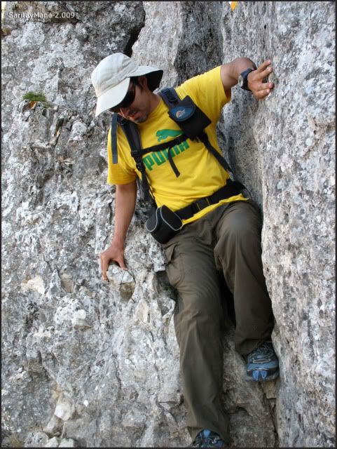
Easy scrumble 2nd grade in the narrow pass named as 'Pas de la Rabosa'.
All the way hiking over an easy path.
EXPOSURE: Any.
HARDNESS: Low. Be careful on the summer, cause it shall be really hot.
GEARS: Don't forget of your most big hat.
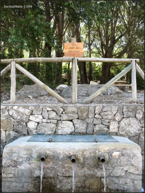
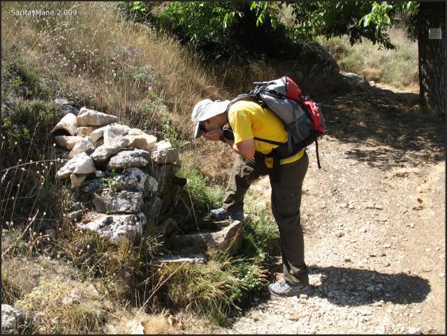
WATER: You shall find two water springs: the first one, named 'Font de Partegat' on the starting point and the other one named 'Font de l'Anouer'. It's indicated as Point of Interest (POI) in our GPS Track Log.
GPS TRACK LOG
Click on: WIKILOC 20090904 AITANA
THE CLIMB
The day before we arrived to L'Asfàs del Pí and take the opportunity to have a bath in Mediterranean waters on the beach named 'Platja de L'Albir'. Hot sun, nice water and many foreigners around here.
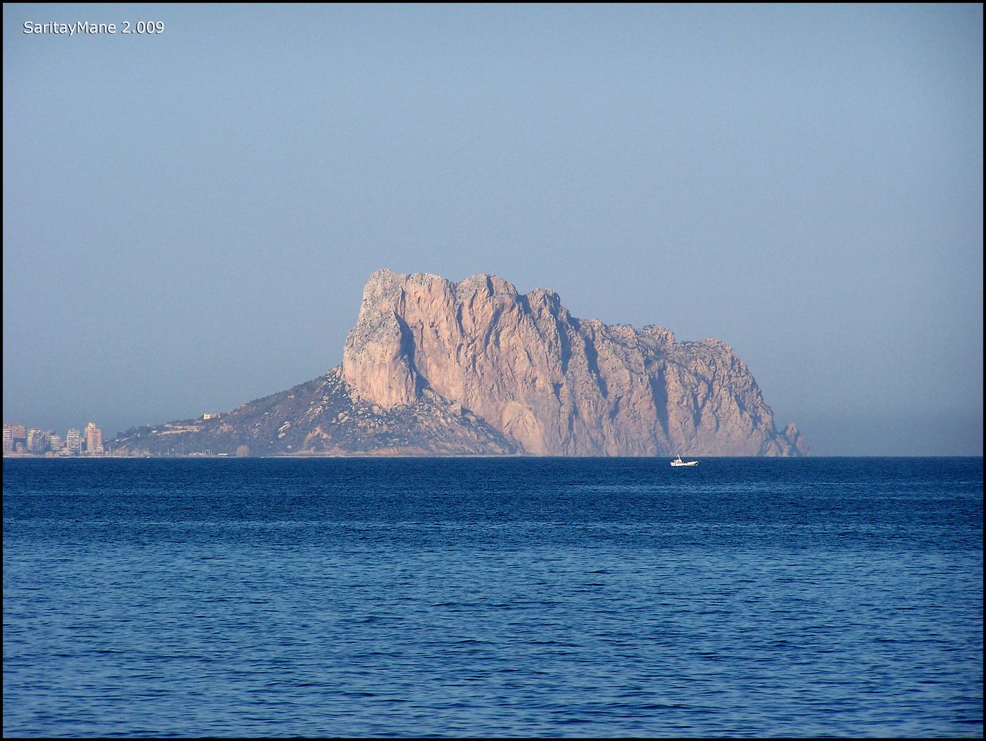
While Mane swims, I keep staring at the rock named 'Peñón de Ifach' next to Calpe...
... placed near here.
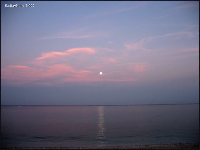
An hour after, It begins to rise the moon.
The Next day, we move to Benifato to climb de Aitana from the area called 'Font de Partegat'.
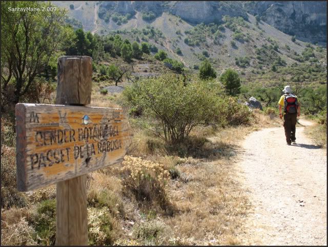
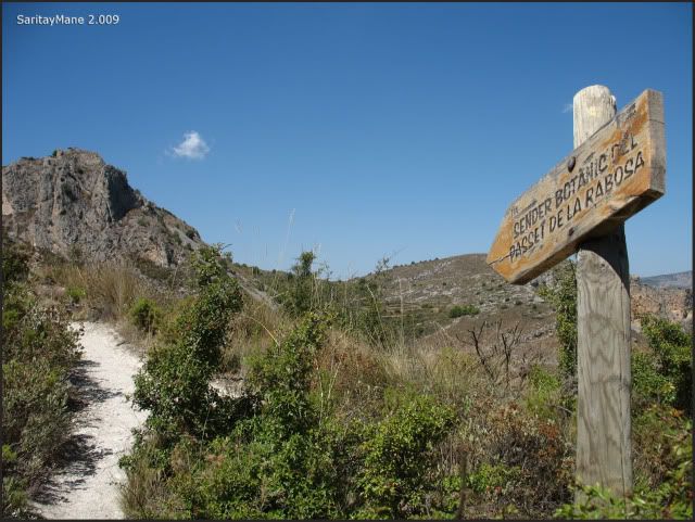
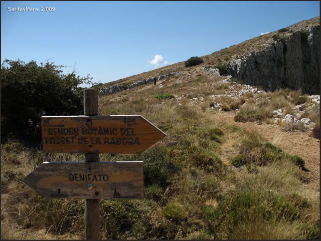
As this sign indicates.
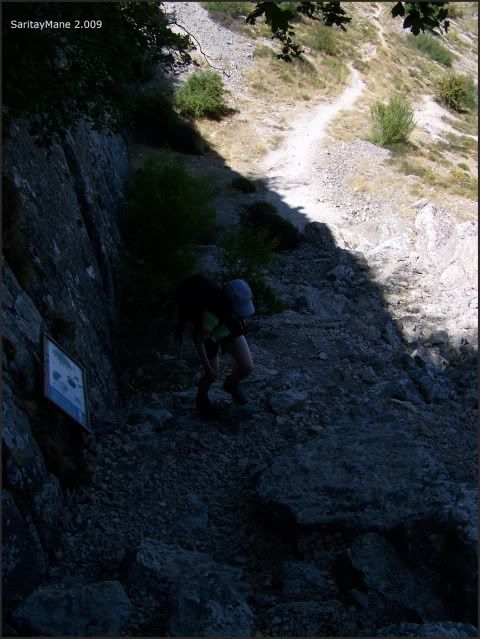
As soon as we get to the leisure area of 'Font de Partegat' our starting point, we check the recreational area, verifying that it's a bit dirty and a mess.
Explaining you this names are not spanish, but valencian, one of the other official languages of Spain as the Spanish itself.
The place called 'Font de Partegat'.
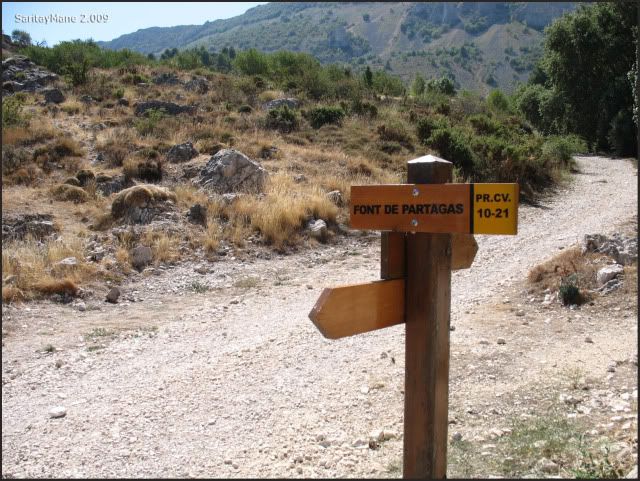
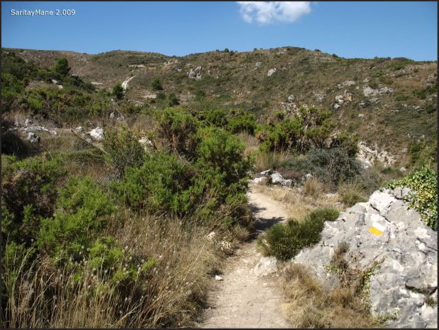
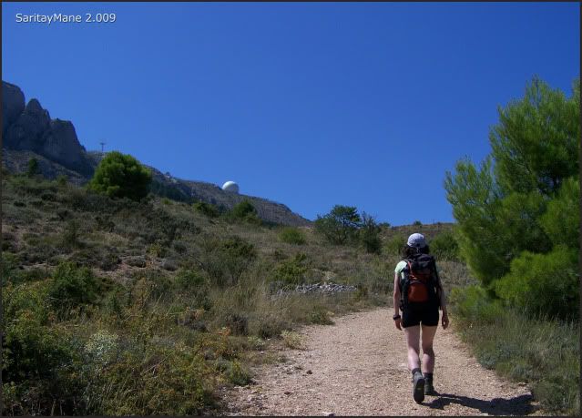
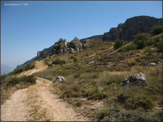
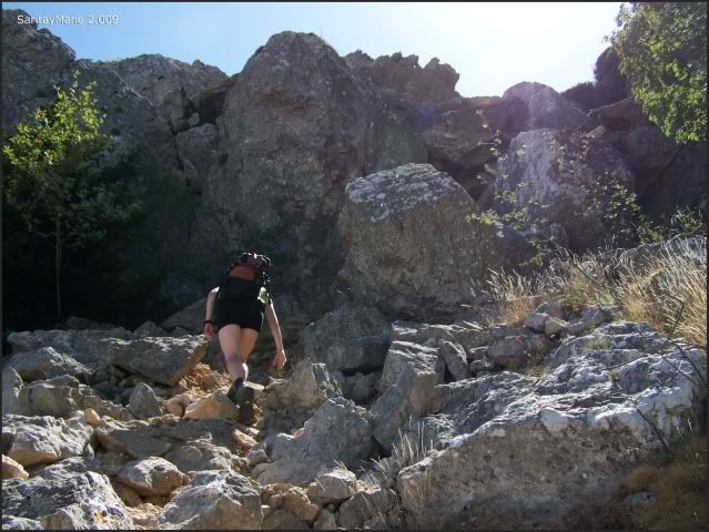
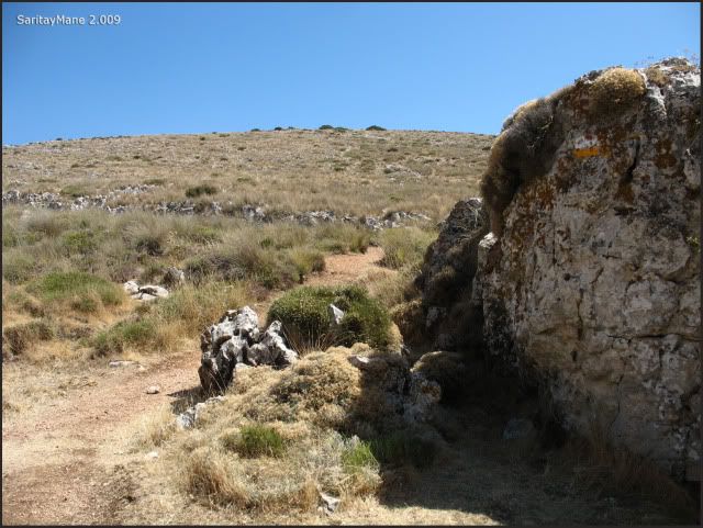
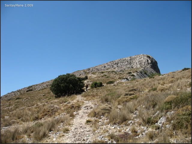
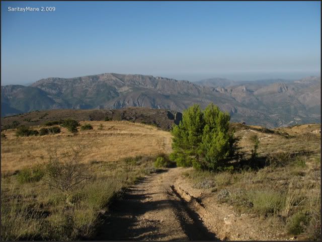
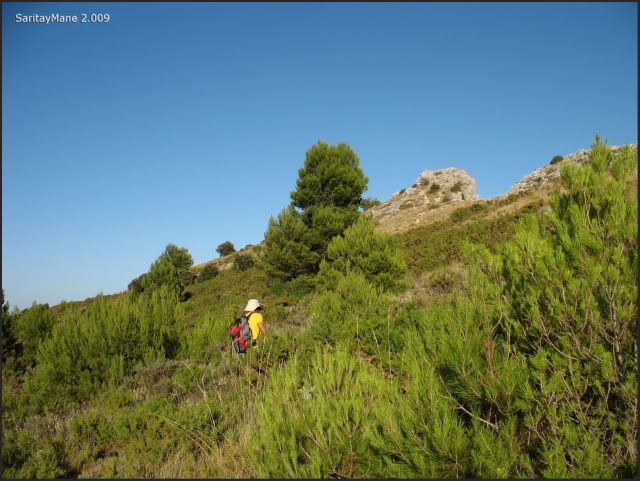
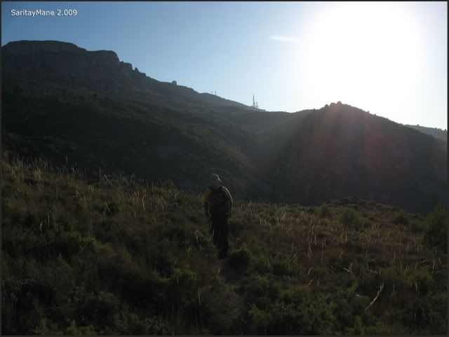
After preparing our back packs and spreading the sunscreen, we begin walking under the hot sun. We follow the path named as PR CV 21, as we said before.
The beginning of the trail.
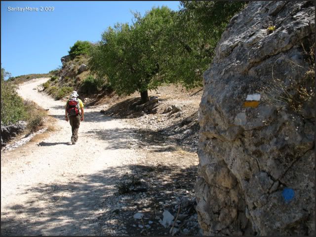
Following the painted prints and blue points.
And the posts indicating the botanical path named 'Sender Botànic del Passet de la Rabosa'.
All the way around.
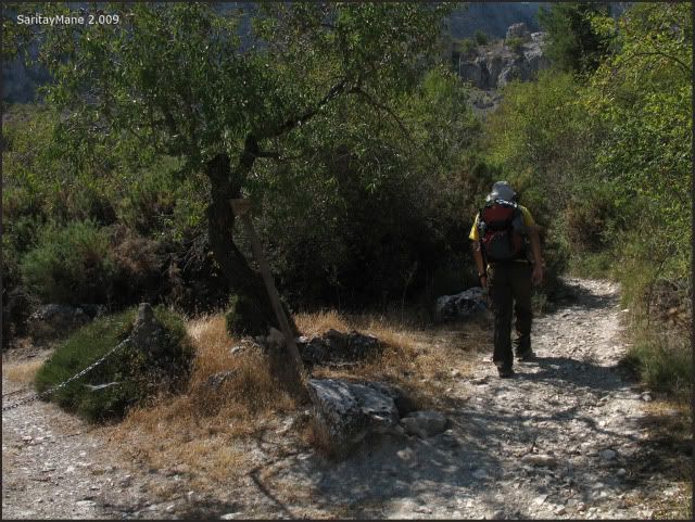
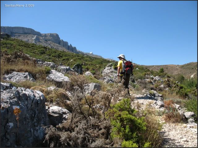
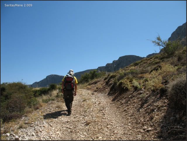
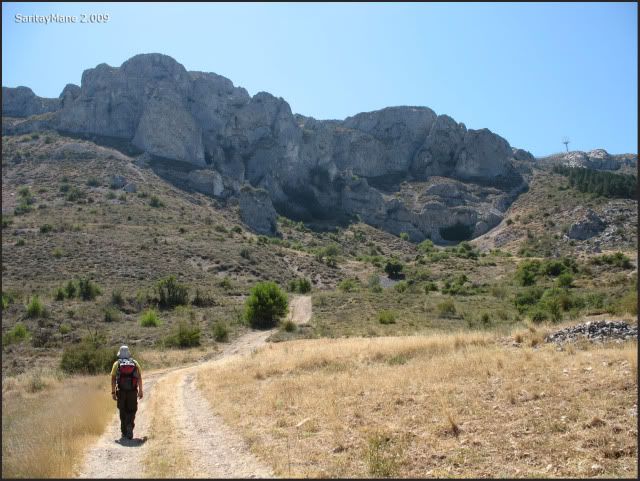
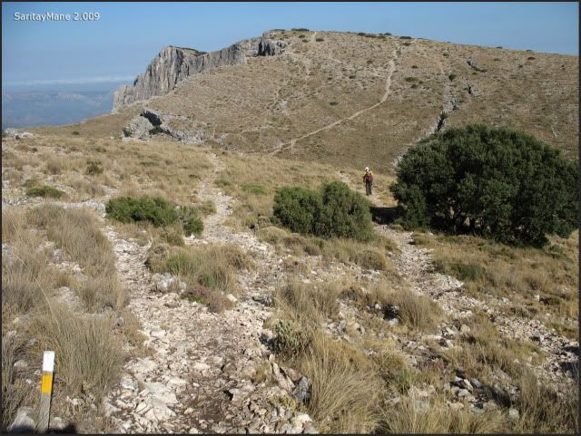
As we move we gain altitude.
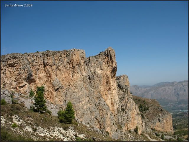
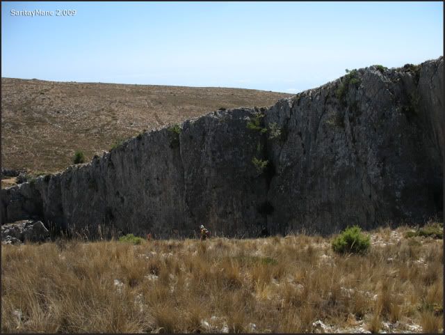
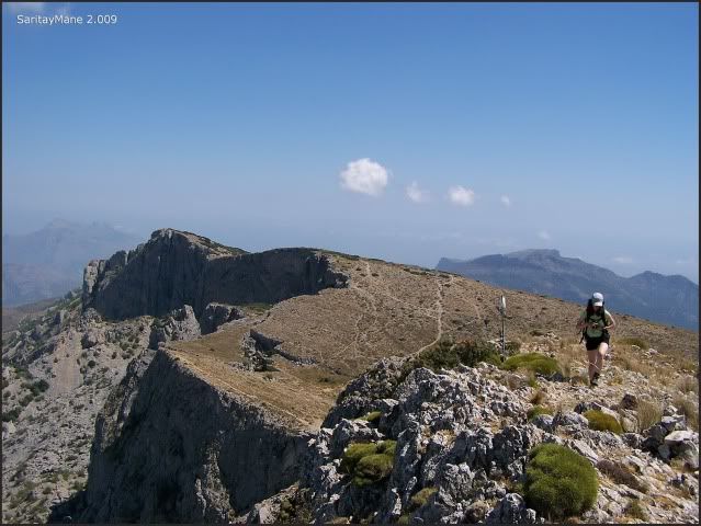
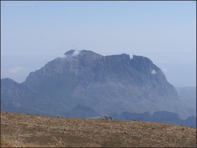
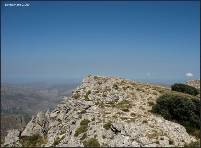
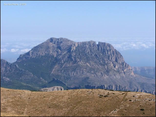
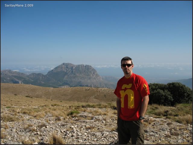
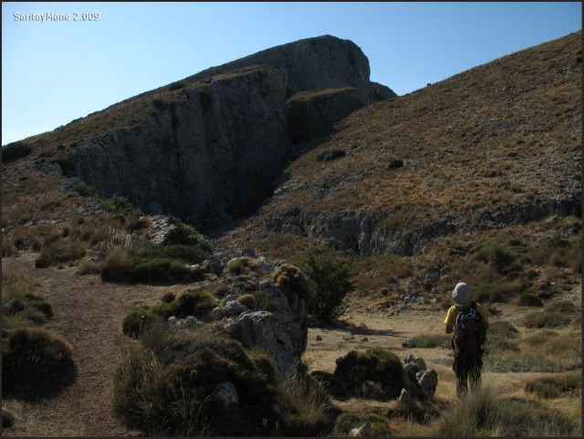
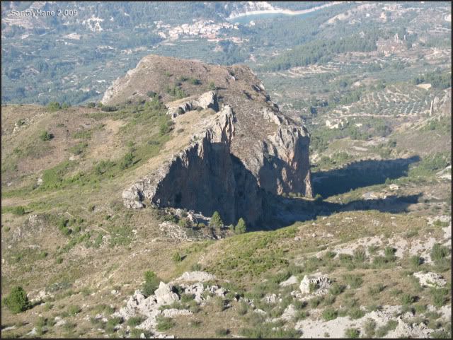
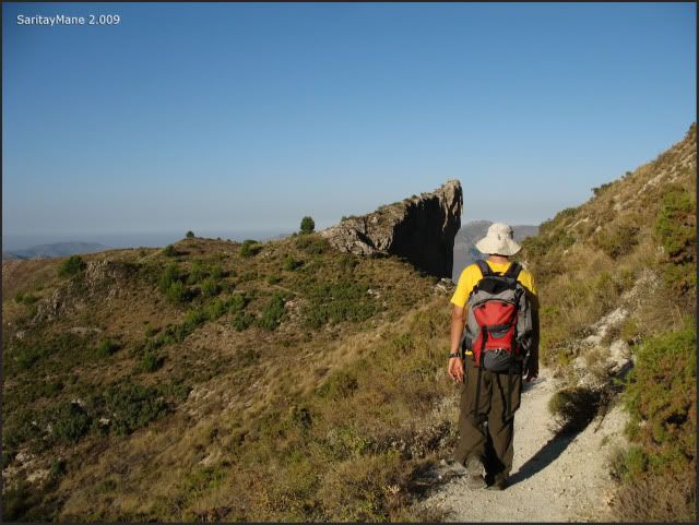
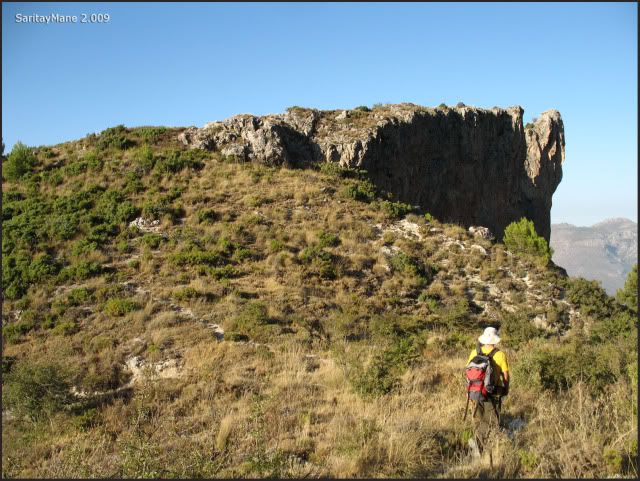
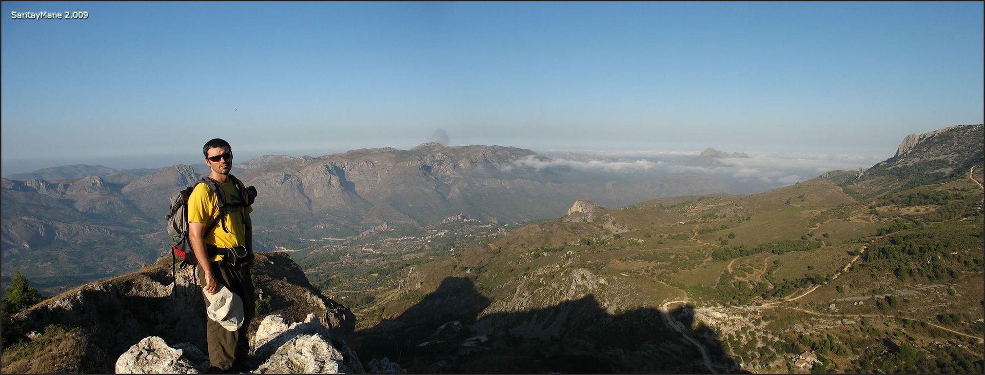
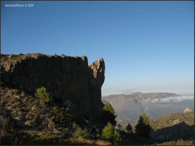
And glancing at the cliffs of the East Face of mount 'Penyó Rapel'.
We reach a pass from where we continue the climbing by following the sign posts of the route named 'Sender Botànic del Passet de la Rabosa'.
Here's one of the signs.
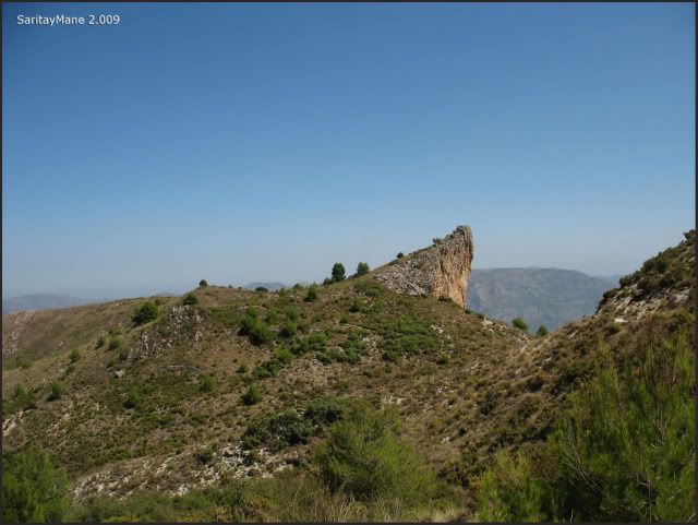
Here's a short path to the Summit of 'Penyó Rapel'.
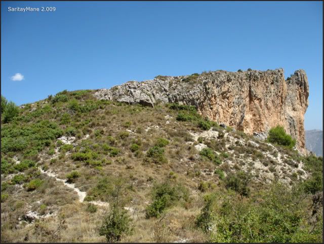
Watching it's shape a few meters forward...
... the path we have been walking from the pass till now.
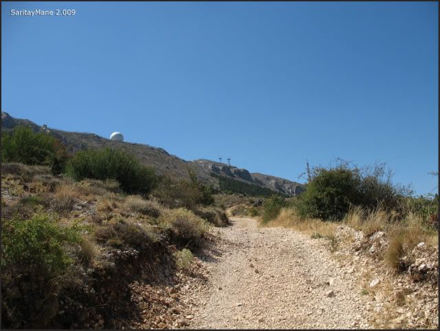
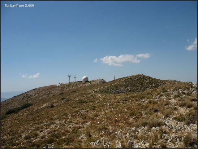
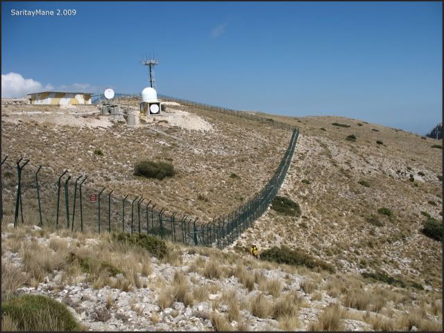
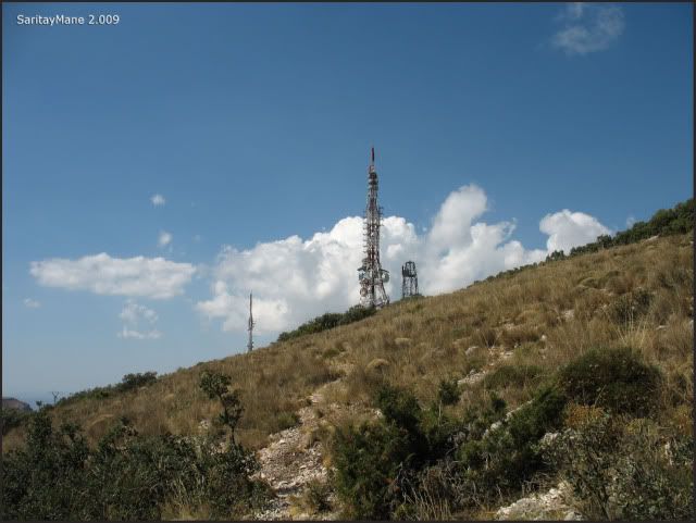
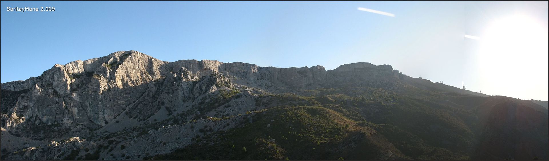
By now we can see the Army facilities over Aitana's Top.
Soon we reach a fork, where we ought to take the left branch, following the path named 'Sender Botànic del Passet de la Rabosa'. Forget the other way.
Not this way...
... but this other.
Untill you find the water spring named 'Font de l'Anouer' or 'Font de l'Arbret' as well.
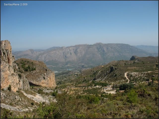
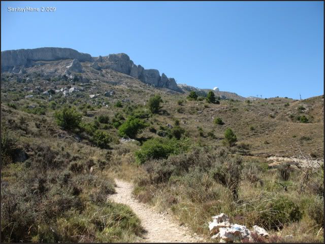
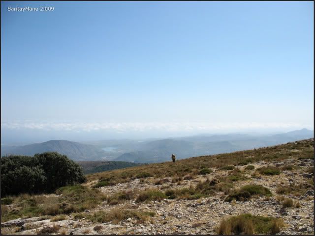
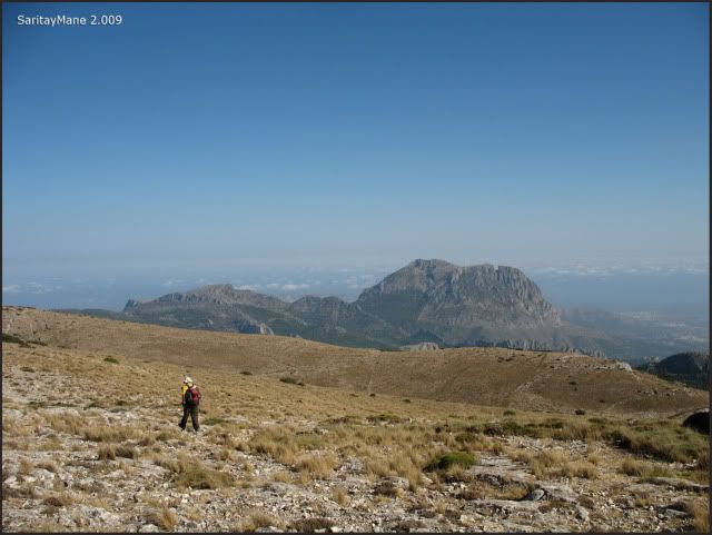
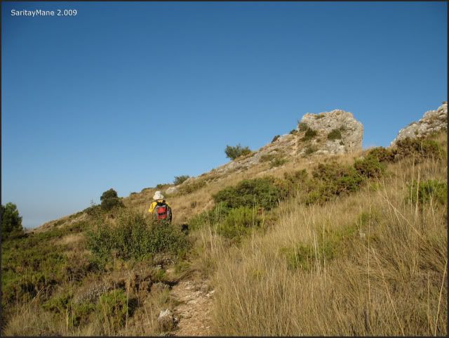
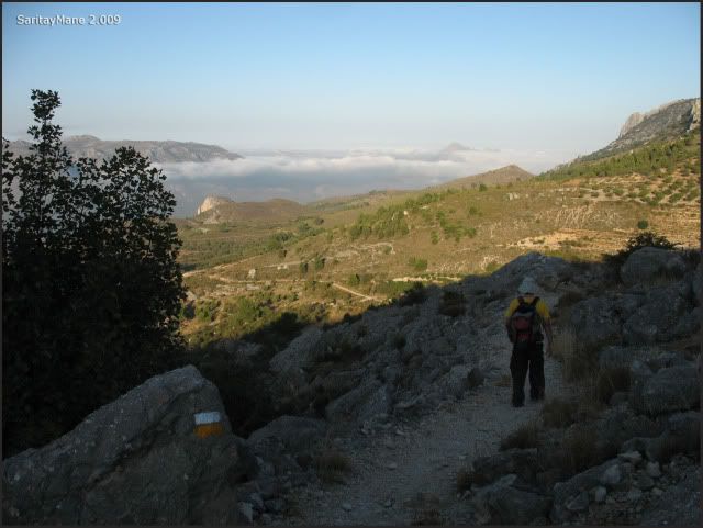
We continue moving as we see the Top of Peak Aitana.
By now, we're more near from there.
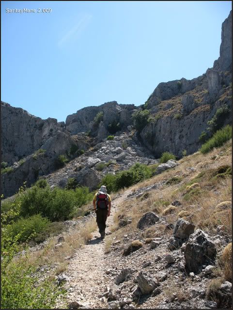
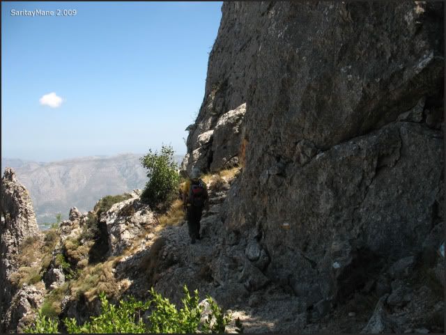
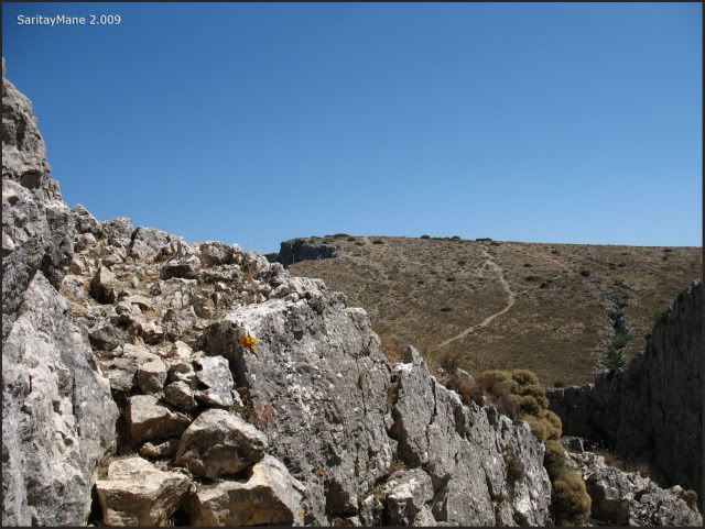
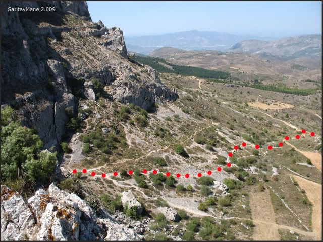
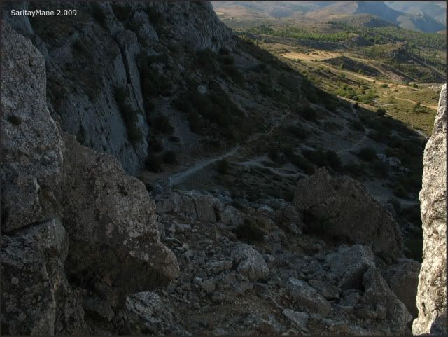
At this point of the route, we detour from the main trail of the PR CV 21, turning on our left, towards South West, to the North Face of Aitana's Range.
On the secondary trail...
... Southwards...
... the way zigzags.
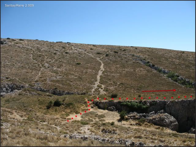
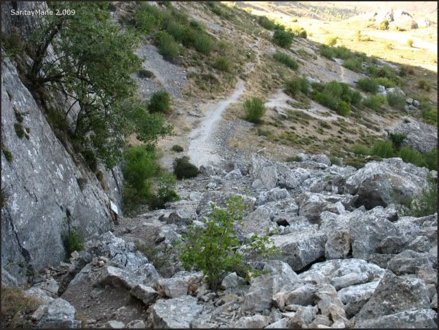
The trail changes into a narrow path, ascending to find near the short path trail (classified as PR - 'Pequeño Recorrido') that we have been following from the spring named 'Font de Partegat'.
Again, on the PR.
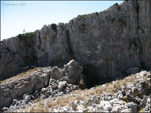
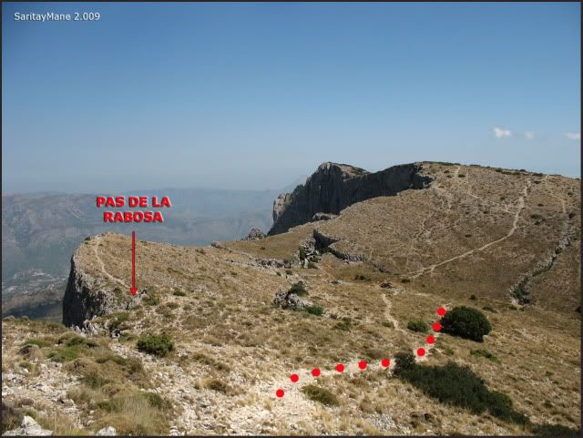
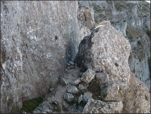
Closet o the pass named 'Pas de la Rabosa'.
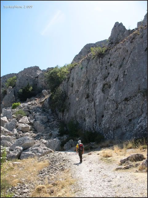
Ascending among the rock blocks...
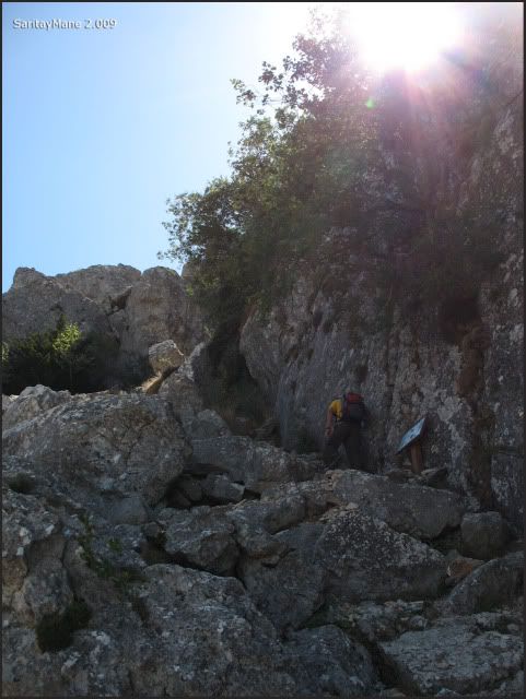
... seizing on the shadow...
... wrong way!...
... we’d better follow the PR prints...
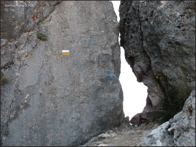
... which drives us both to the pass named 'Pas de la Rabosa'...
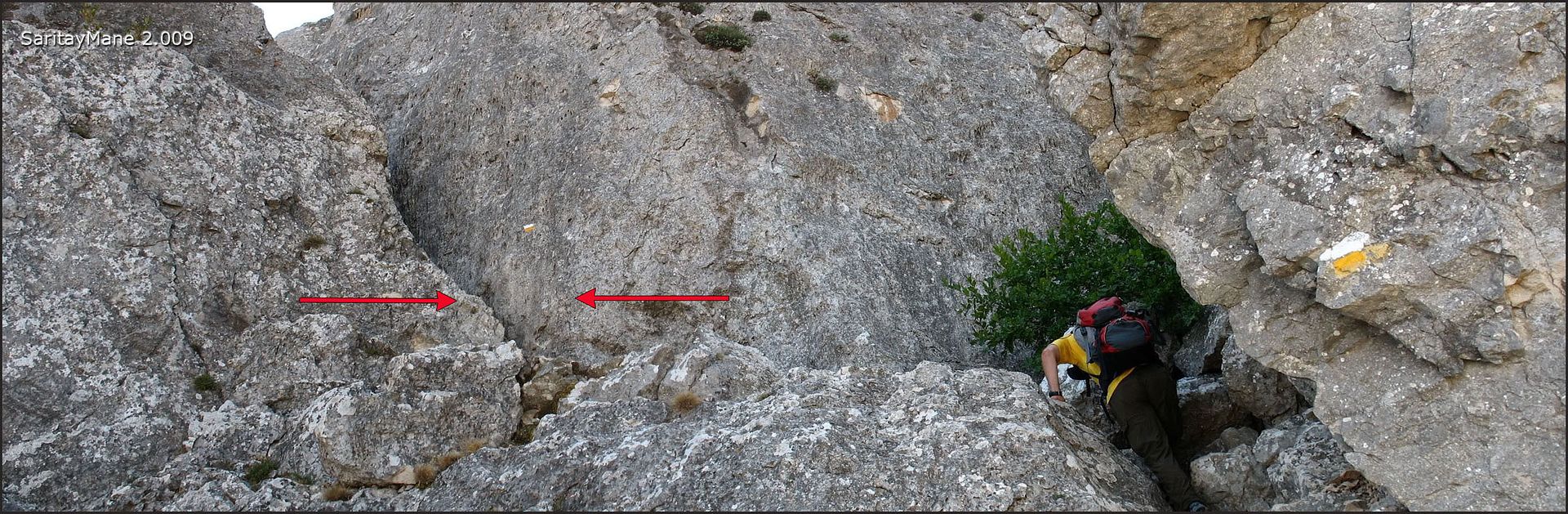
... find a 2nd degree scrumbling, easy to do...
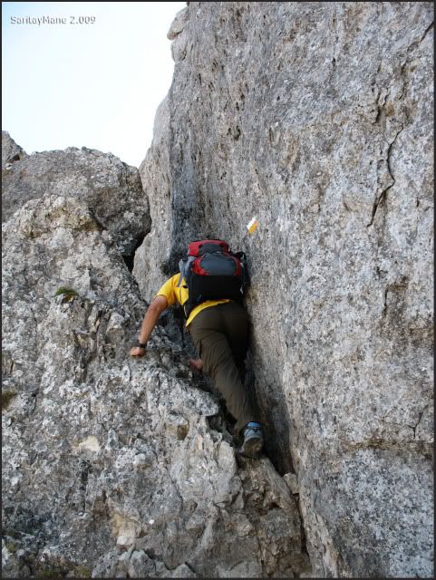
... and reach the thin pass, to the next sunbathed side...
... and follow the prints painted over the rocks...
... while we look at that curious hole made drilling the rock.
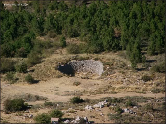
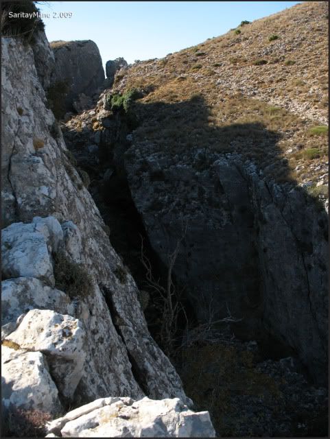
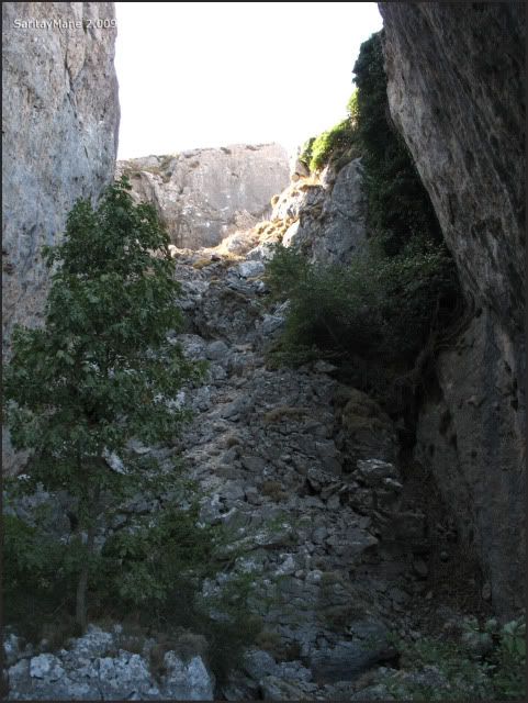
From this point, we will surround towards South West the cave named 'Sima de Partegat', situated a few meters beneath.
Mane goes walking around...
... and I reach an small top next to the pass that we've just crossed...
... seeking our way coming from below...
... and southwards, the way to the summit, by surrounding the cave, as we said before.
Mane looks for the entrance to the cave...
... but we aren't able to find it.
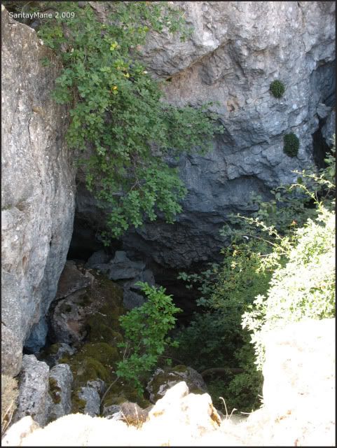
So we'd better go on our way to Aitana. Look, the cave seems like if it had collapsed.
We advance by seeking more PR prints.
Once we find this post sign, we abandon the PR, turning on our right, towards West.
Ascending on the trace.
Looking backwards.
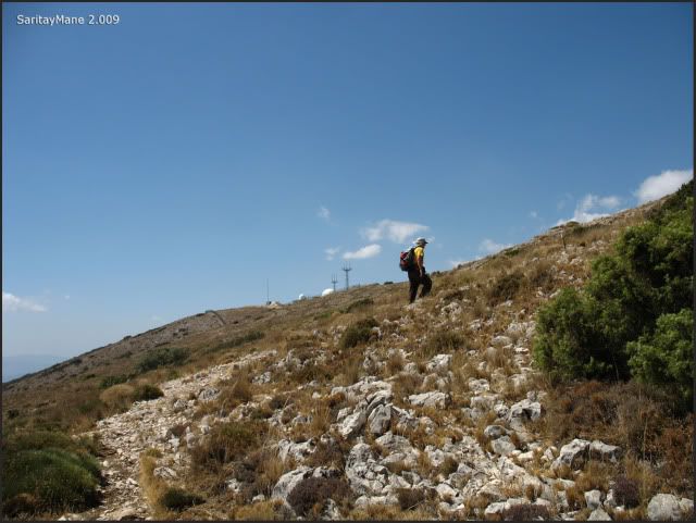
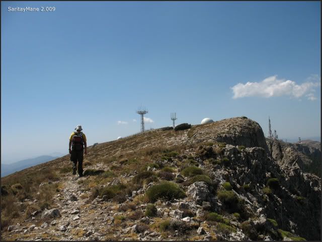
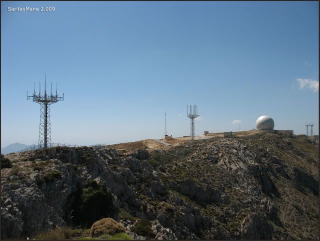
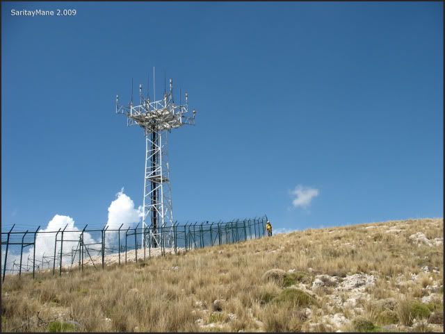
Now we're able to see some aerials.
Over a previous top.
This long is what remains.
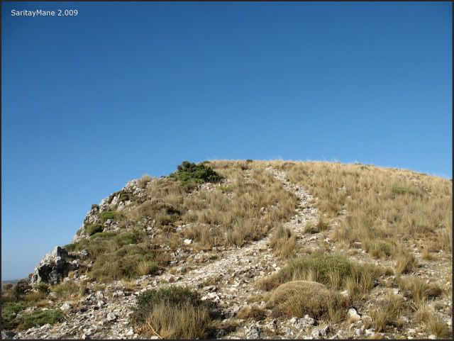
We reach a second top.
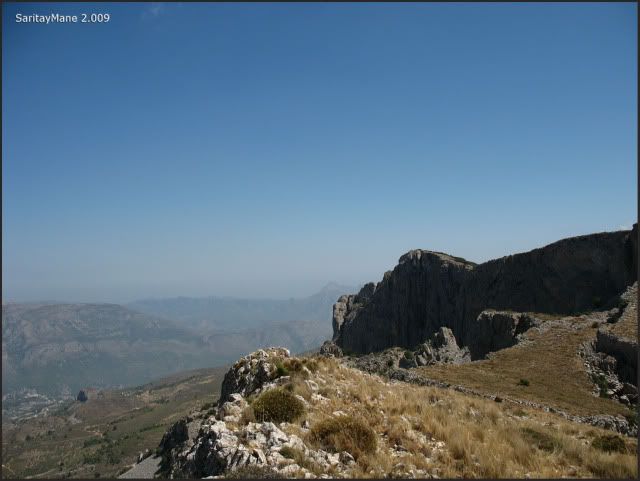
There is the way on our backs, besides the Peak 'Puig Campana'...
... zooming at this last one.
The Aitana is very close to us...
... so there we go.
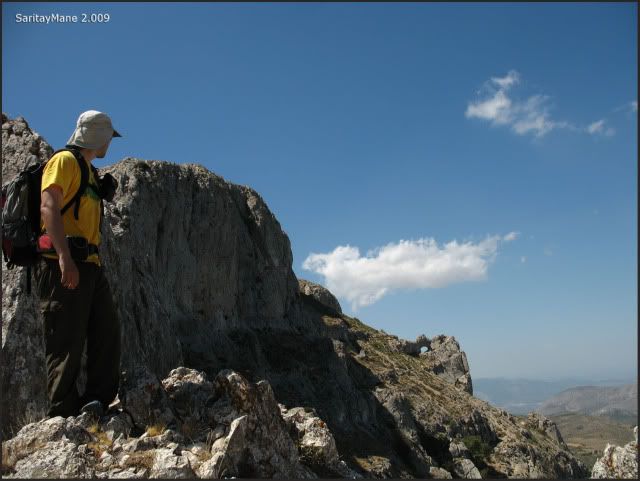
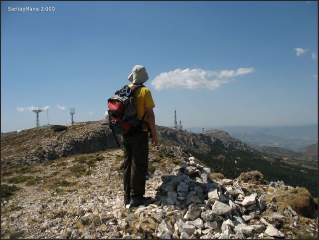
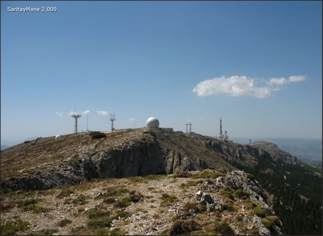
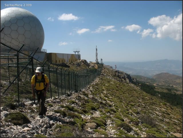
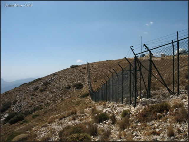
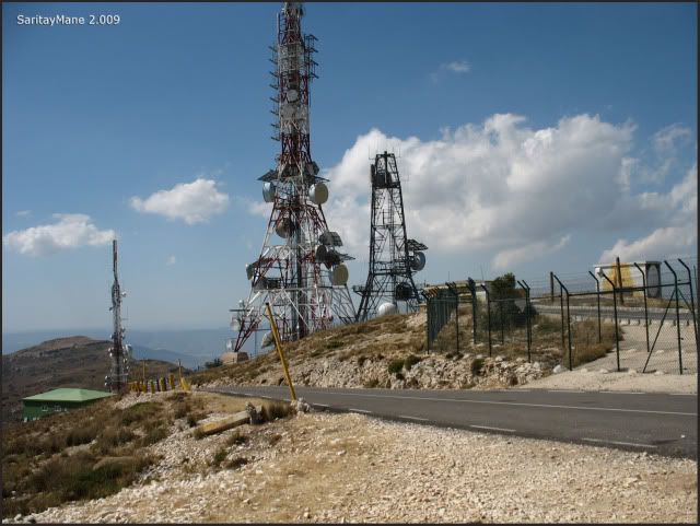
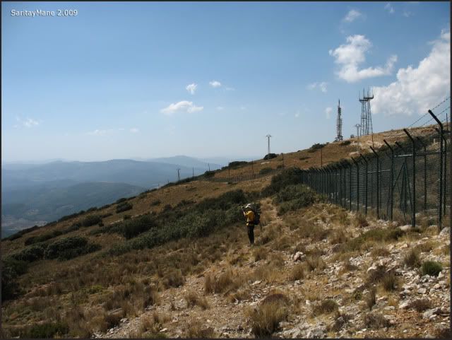
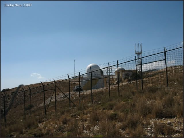
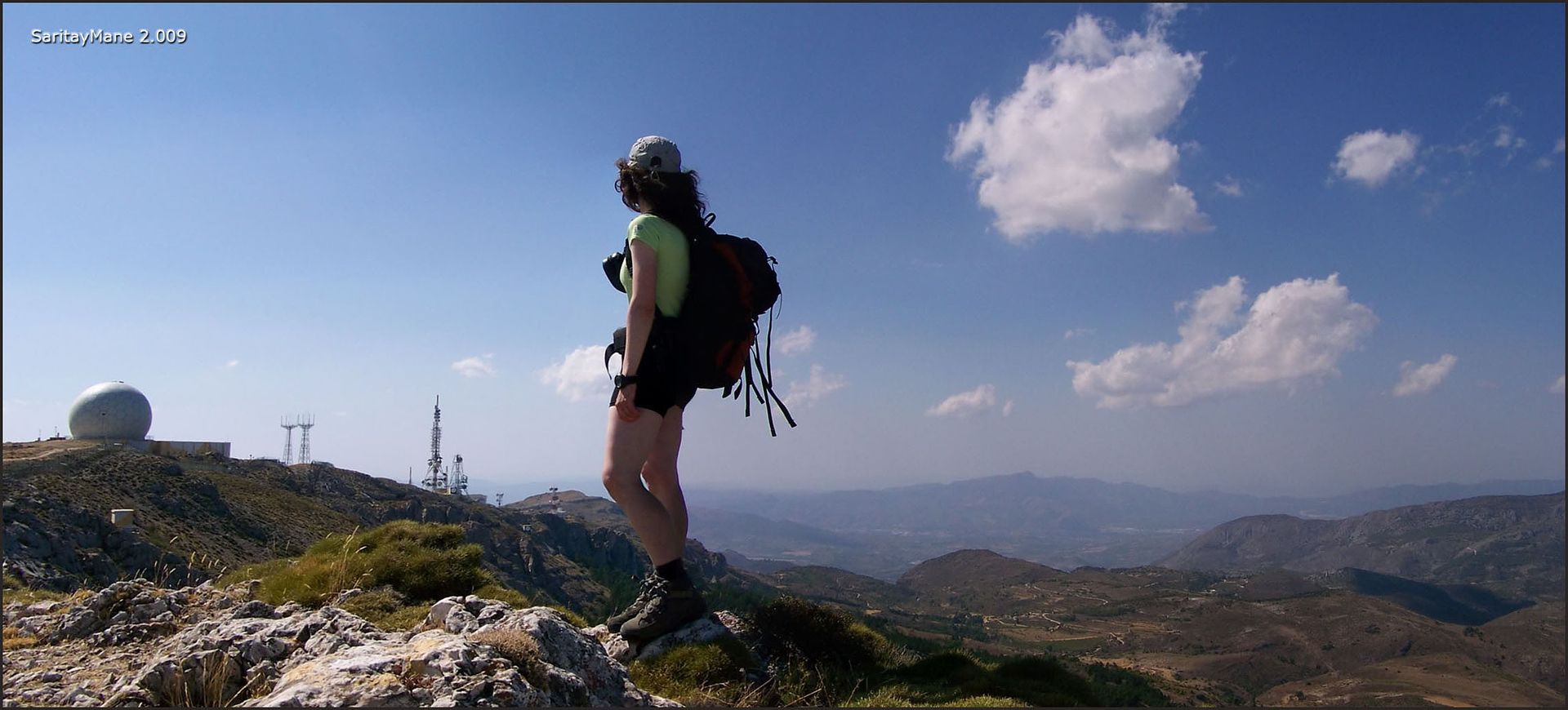
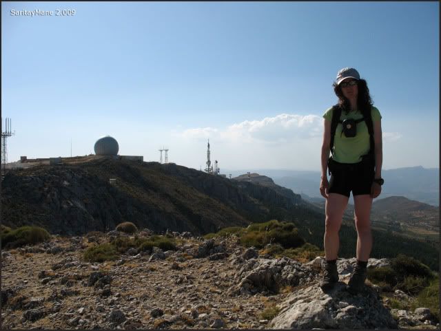
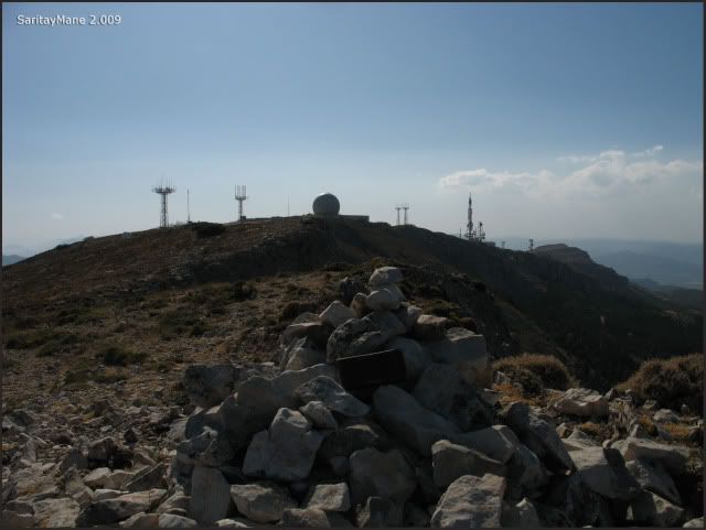
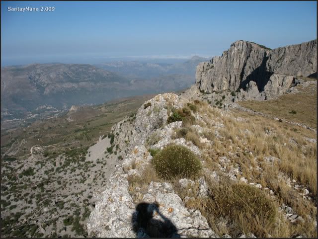
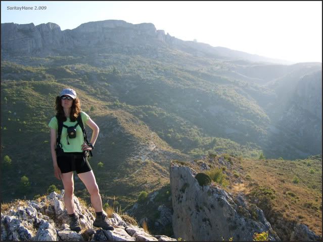
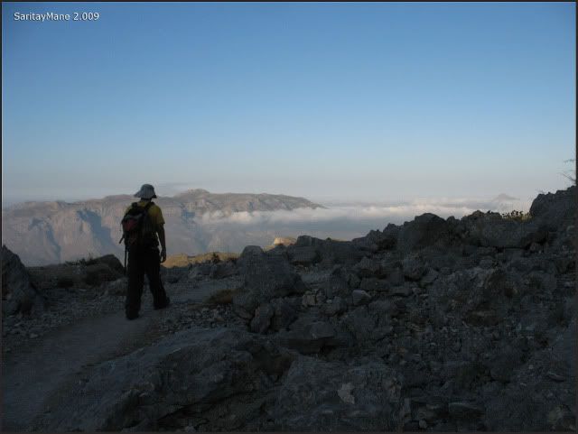
The top of Aitana is placed in the boundaries of the Army facility, so it isn't possible to access to it. However, you can get to a free top out from the wire fence. That's where we go, bordering the fence.
Free Summit of Aitana (1.558 m – 5.111 ft)
From now on, I decide to surround the wire fence, to get to the free top.
So we move on...
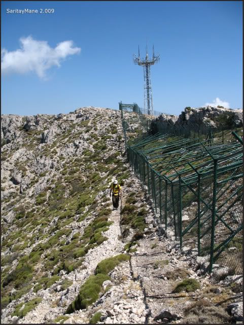
... surrounding the fence...
... the view towards North...
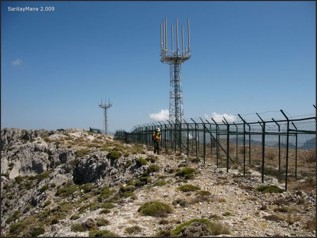
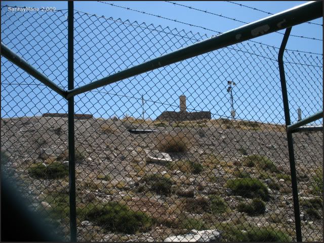
... the milestone is near that radar installation.
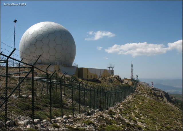
Aitana’s Milestone (1.558 m – 5.111 ft).
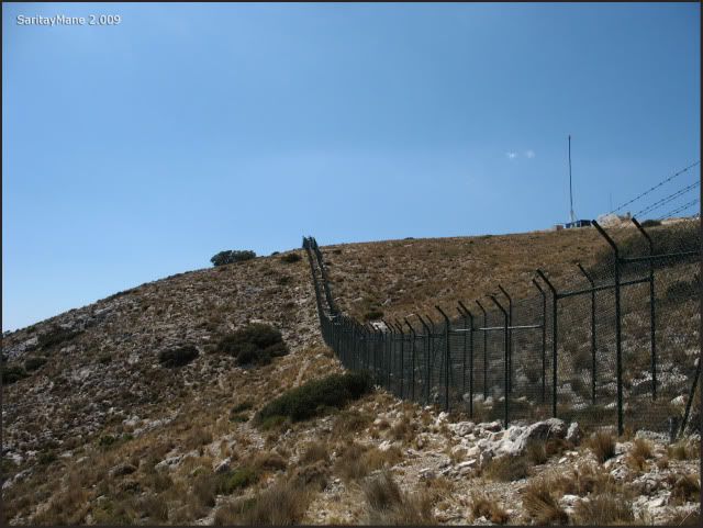
As it's becoming hard to move on over this side of the fence, we decide to get back, in order to surround by the other side...
... so here begins our seeking for the top...
... moving in parallel...
... turning around...
... as the fence goes forth...
... and so forth...
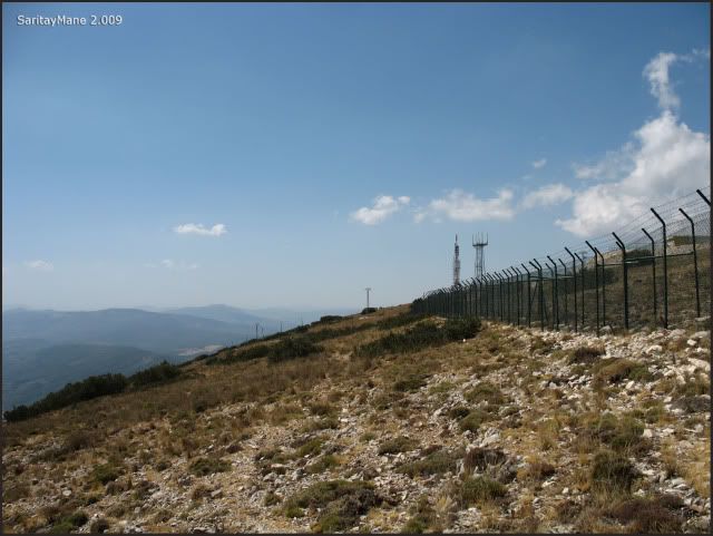
... taking a look on our backs...
... as we follow-up...
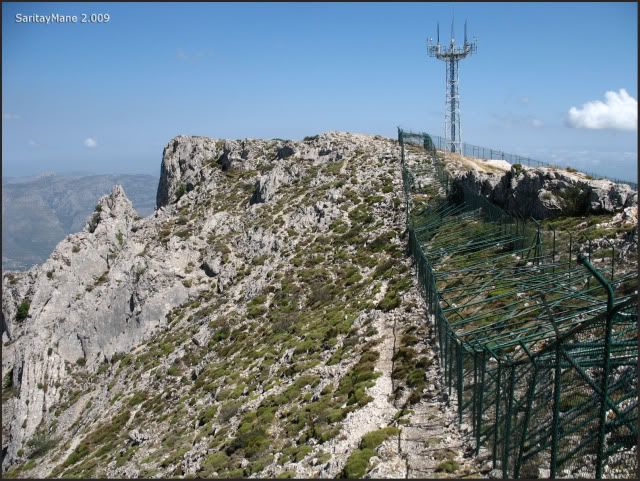
... until we see those aerials...
... next to road that gets into the Army facility....
... but we're not allowed to get in.
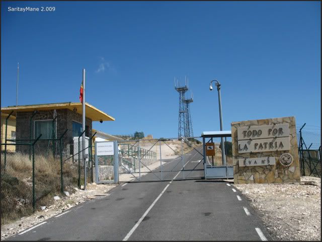
There you can see written the motto of the Spanish Armed Forces: 'All for the motherland' (Todo por la Patria).
What remains is to get back on our way...
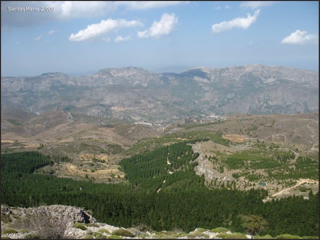
The view of the Peak 'Puig Campana' and Benidorm a little more further...
By now, we’ve spended over 1 hour surrounding the damn wire fence...
... so far, so good...
... I think by now we're suspected to be spies or something like-wise.
That security guard's been following us for the last half hour. It’s something normal, really, a pair of stupid back-packers giving rounds around an Army installation taking pictures.
But at last, we reach the top again.
... last steps.
Summit of Aitana (1.558 m – 5.111 ft).
From above, we take a look at this ancient holes, made to storage ice in the summer, using compressed snow felt in winter, and later covered with branches and plants, as to remain cold during the warm days...
... there are some of them...
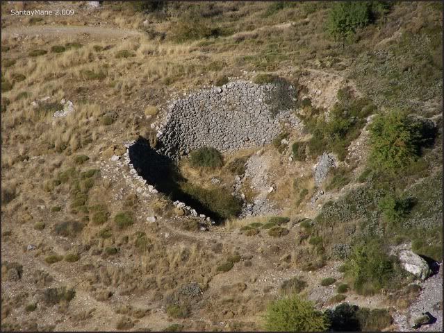
... another one.
Again, the Puig Campana.
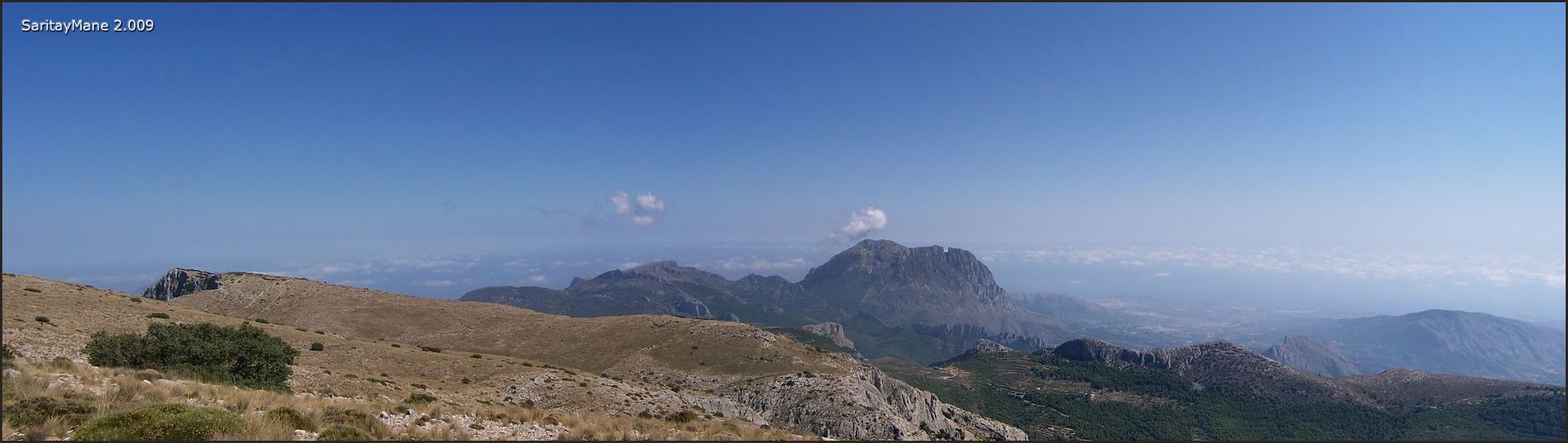
Zooming towards it...
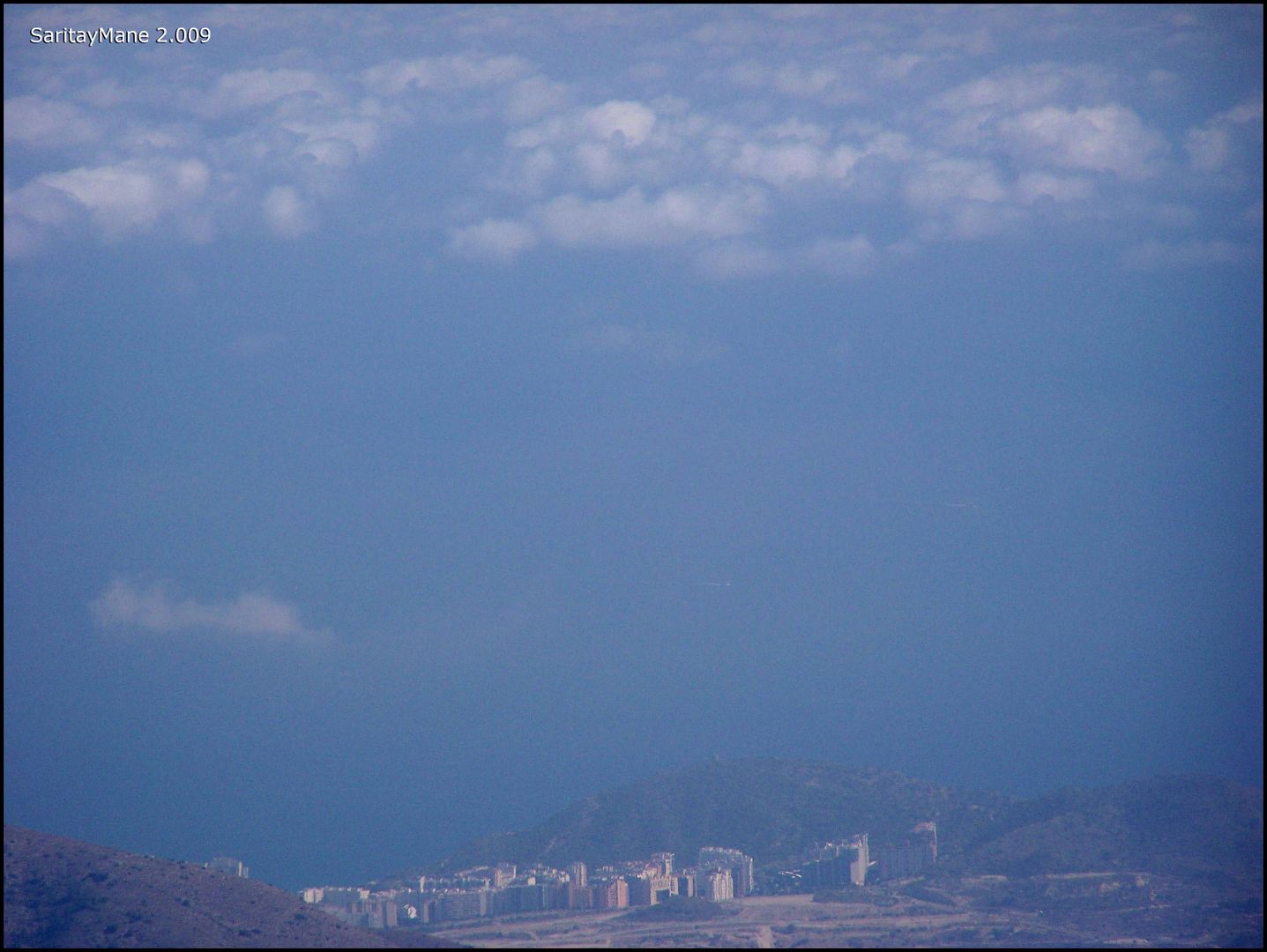
... and far away, the sky crappers over Benidorm.
It takes us over 1 hour to have some meal...We have been enough sunbathed, as to get out of here now. Mane would have preferred to enjoy this hot sun by having a cold beer next to the beach.
Continuing with our project SPAIN'S TOP SUMMITS, well..
And we say good - bye to Aitana.
And begin to return.
On our footsteps.
Following the landmarks.
Back, above the cave.
Taking again the path of 'Sender Botànic del Passet de la Rabosa'. Next to the cave 'Sima del Partegat'.
This time we intend to get through the walls of the cave...
Near the entrance to the cave.
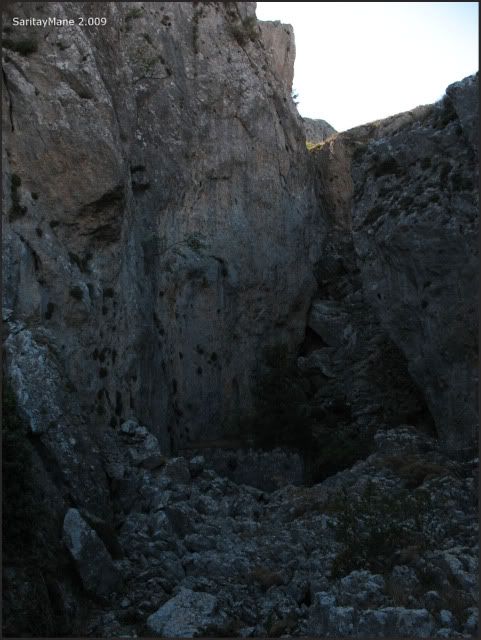
And there's the way upwards.
Finding some kind of stalactites...
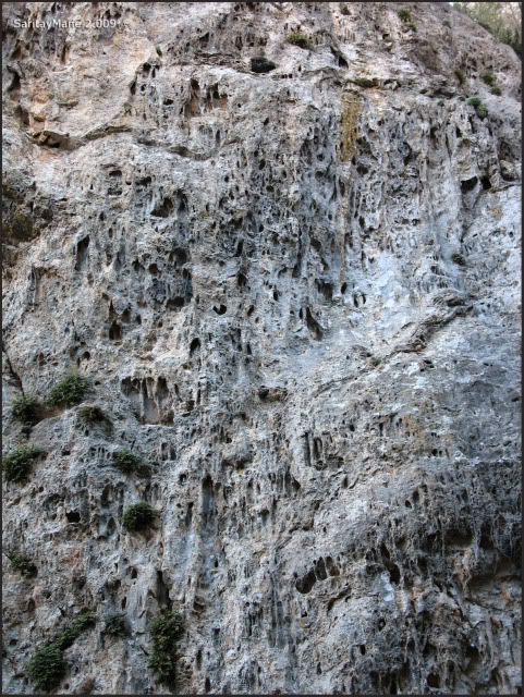
... all around...
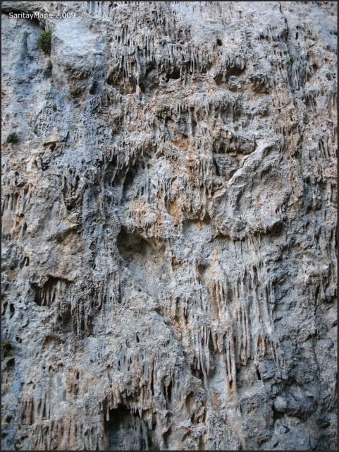
... probably, because this walls were covered under a dome of rock, and the cave collapsed and buried itself, under our feet .
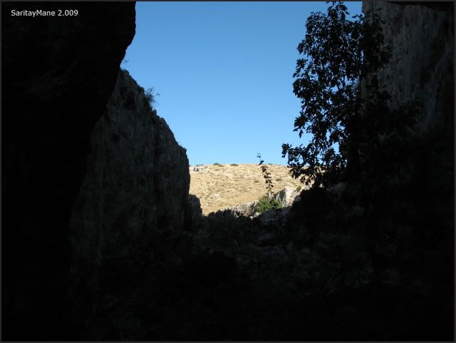
On our way upwards, we reach the pass again.
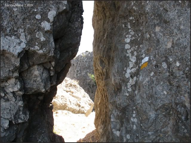
And cross this window of landscape.
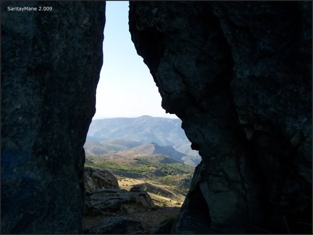
Before crossing, I take the opportunity to take a last view on the top near the pass.
And glance at the sea.
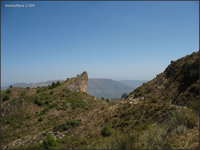
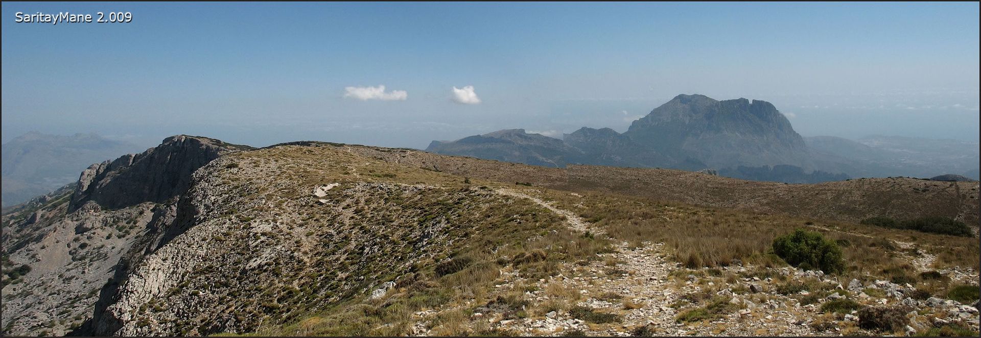
And the 'Penyó Rapel' far away.
There is the way to get back.
Find again the pass named 'Pas de la Rabosa'.
Descending the scrambling.
To follow up with the path.
That gets into a narrow track.
That gets to the crossing on PR CV 21.
By now we're close to 'Penyó Rapel'.
On the pass in front of the summit.
Walking off the path.
Just a few meters.
And reach the highest point.
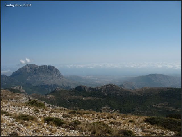
Summit of 'Penyó Rapel' (1.209 m – 3.966 ft).
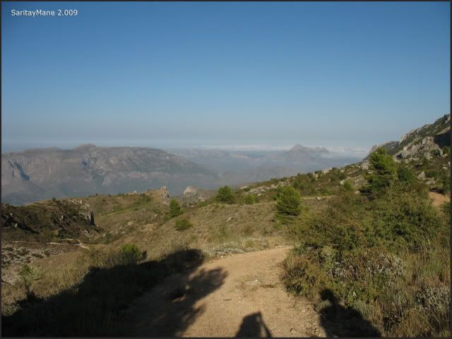
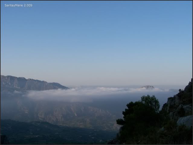
Glancing at the clouds above the sea.
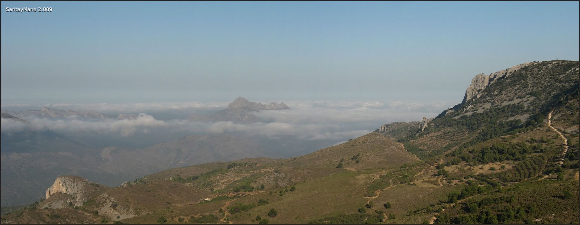
And the North cliffs of Aitana's Range.
Back to the main path.
Loking from the pass towrads 'Penyó Rapel'.
We continue descending.
Watching the low clouds.
Something like mist coming from the coast.
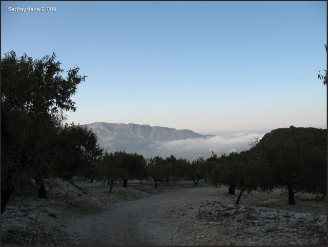
Invading the horizon.
Back in the car, we take the oportunity to refill water, using some bottles that we carry in the car.
During the sunset, the moon raises.
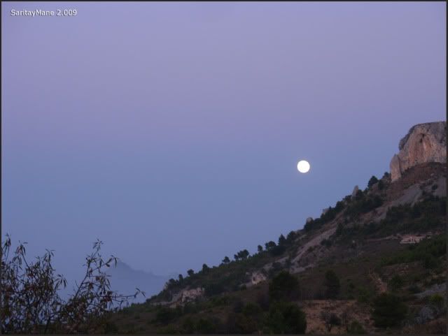
Tomorrow, we'll get back home.
To look for another Climbings in English Version, click on this link: RANK OF PEAKS. ENGLISH VERSION.


No hay comentarios:
Publicar un comentario