After ascending Campbieil and Estarange two days ago, and also Robiñera yesterday, we seize de opportunity to try the Néouvielle. This an emblematic mountain, especially for french climbers. Besides this, it provides its name to the Natural Reseve settled there.
Spanish version in this link: PIC DE NÉOUVIELLE (3.091 m)
French version in this link: PIC DE NÉOUVIELLE (3.091 m). VERSION FRANÇAISE
SITUATION
Reserve Naturelle de Néouvielle. Parc National des Pyrénées. French Pyrennees.
STARTING POINT
Parking aside Lac d'Aubert.
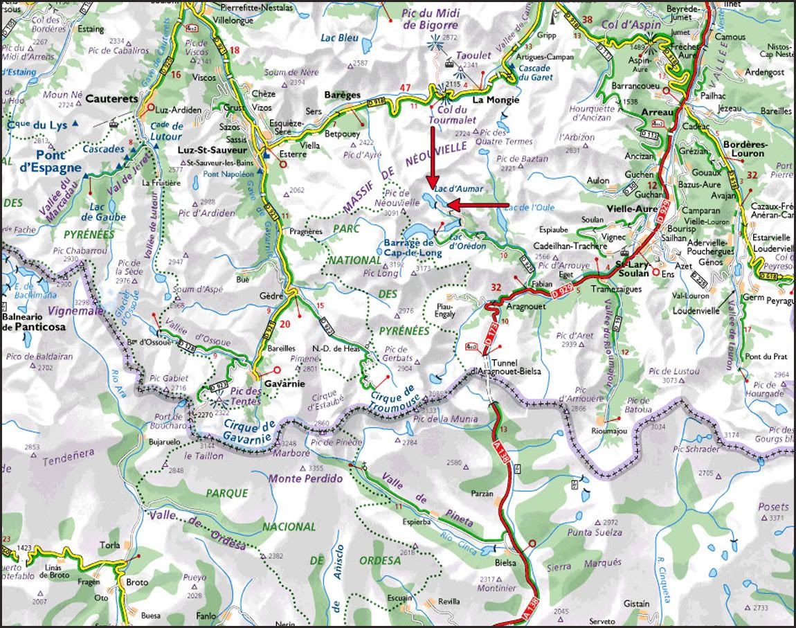
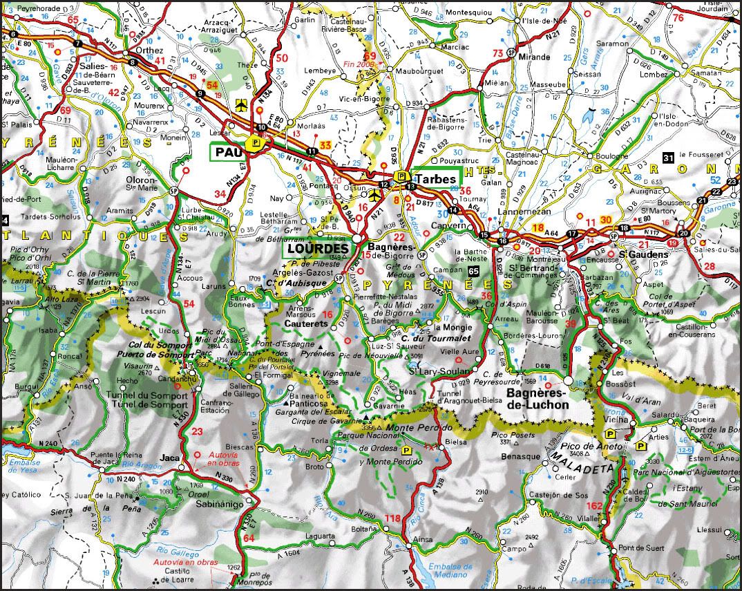
From the village of Fabian, drive the road D-929 towards "Reserve Naturelle de Néouvielle". After a few miles, follow the detour to Lac d’Orédon, where you shall find a tollboth. After this control, go straigh untill. Firstly you’ll find the Lac d’Aumar, secondly you’ll descend a bit to reach the parking next to Lac d’Aubert.
During the summer, personal vehicules are restricted to pass from 09:30 to 18:30 h. You must go on walk or by bus (bus service costs roughly 5 Euros a day return ticket).
However, parking at Lac d’Aubert is for free. Therefore, is preferable to pass the control out from toll-pay hours, avoiding to pass from 09:30 to 18:30.
During the winter, road isn’t available because of the snow.
To get to Fabian (Aragnouet, France), search in GUIA REPSOL or in VIA MICHELIN.
CARTOGRAPHY
Carte de Randonnée nº 1748 ET Néouvielle 1:25.000. Institut Geographique National de France.
MAP
Propiedad del Institut Geographique National de France.
SUMMARY
UNEVENESS: 1,100 m – 3,608 ft (+/-)
TOTAL DISTANCE: 10 km - 6.21 miles.
TOTAL TIME: 06:30 hours.
DIFFICULTY: Grade II.
40º steep slopes when reaching the NE crest of "Pic de Néouvielle".
Grade I climbing over the crest, specially when it's closed to the summit. Descending the NW crest you shall find a bit of scramble as well.
GEARS: Basic winter equipment.
THE CLIMB:
After resting at Bielsa, early we pass the tunnel of the same name.We reach the tollbooth and move to the parking of "Lac d’Aubert".
Prepare our backpacks and begin by following the path surrounding the lake towards the dam.
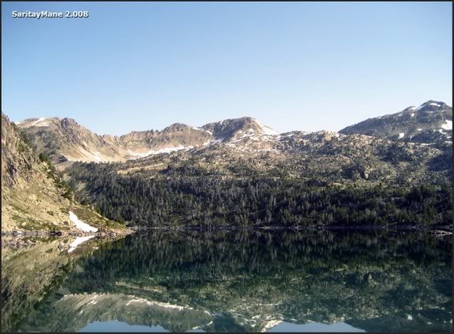
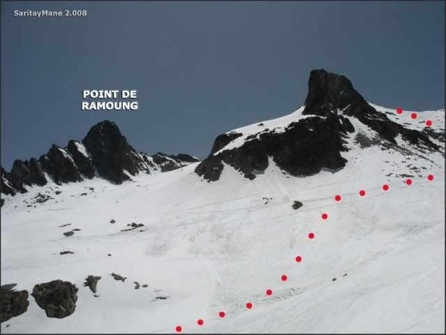
By now, we can see the crest to the Ramoung.
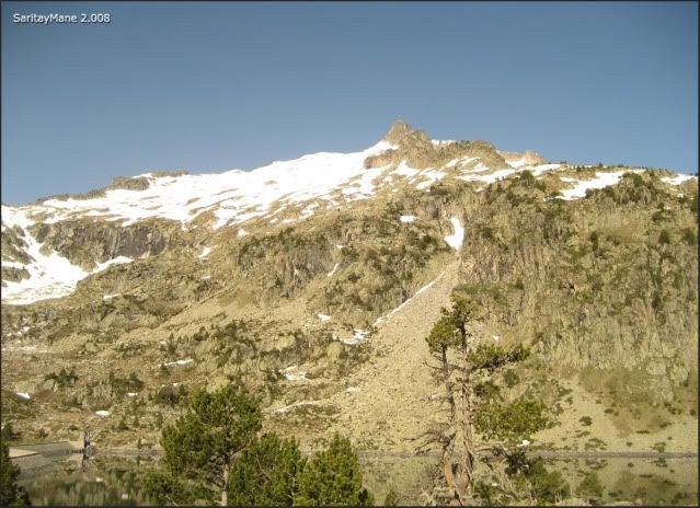
The mountains that surround the "Lac d'Aubert".
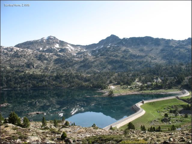
After the dam, go towards SW, looking for the "Brèque de Barris"; a breach in the ridge of peak Ramoung. By the way, we leave back the path we have been following. Actually, that path goes to "Lac de Cap de Long".
The "Lac d'Aubert" and the path we’ve been following.
This is where we must continue.
A few meters up, "Les Laquettes" on our backs.
Following the landmarks, we reach the "Brèque de Barris".
We can see where to follow.
I’m ahead mane.
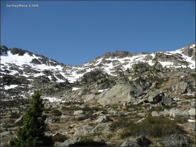
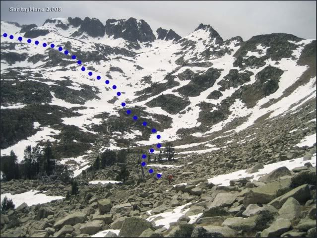
We’ve got to get across the blocks, through the breach, untill find snow. At this point, we take a gap to put on crmpons and drink some water.
The Néouvielle seems closer.
This is where we have come from.
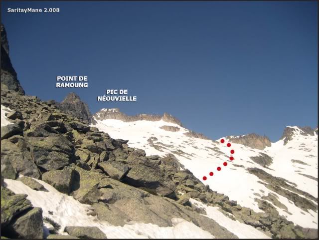
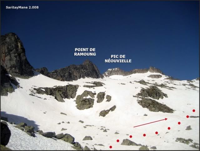
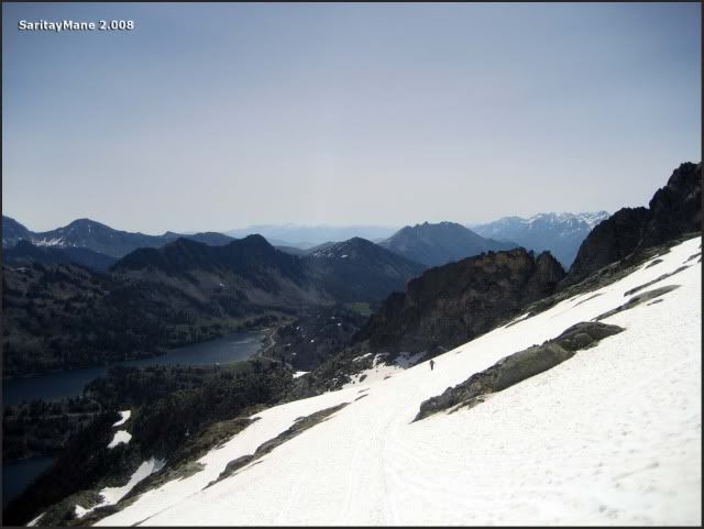
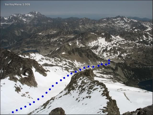
From this point walk Eastwards, to surround the NE ridge of Néouvielle, untill the small cirque of this peak.
Gaining altitude fast.
While we starring at "Point Ramoung".
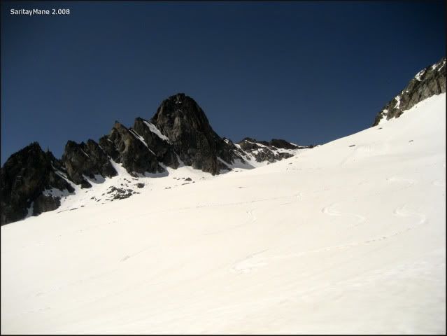
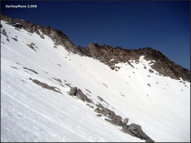
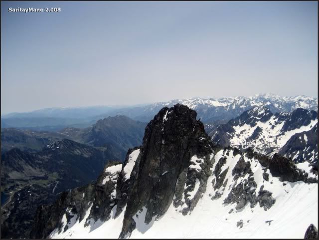
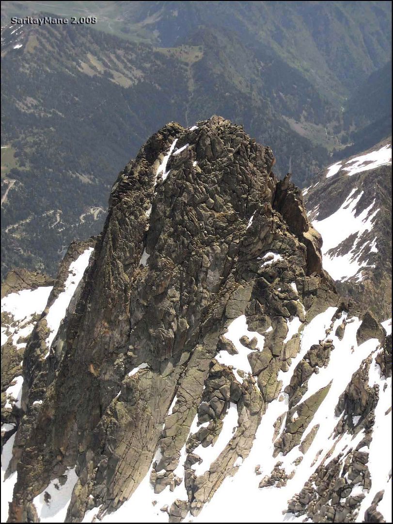
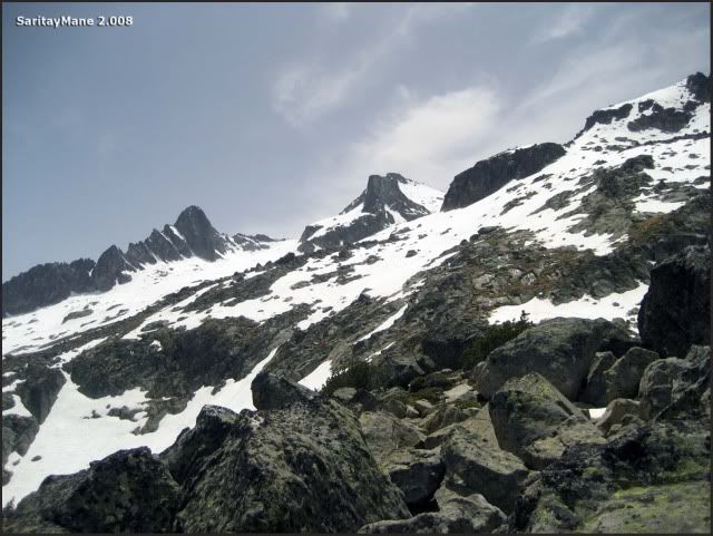
The NW Crest of Néouvielle.
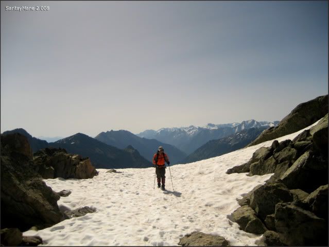
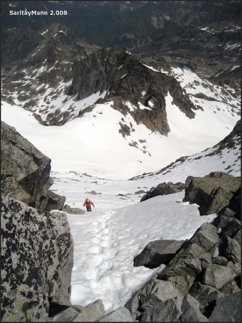
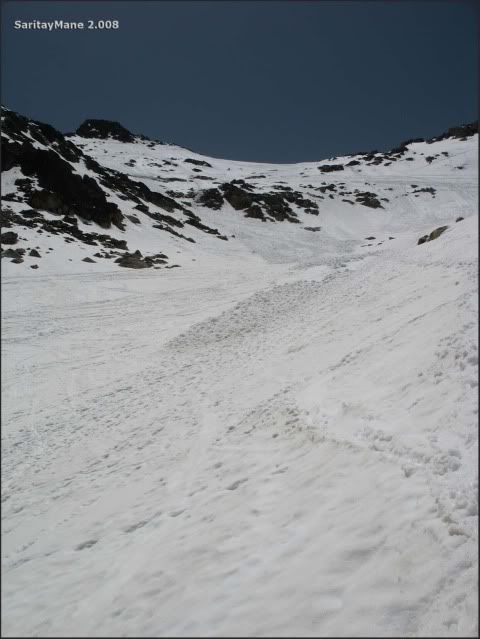
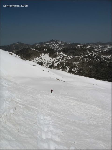
Once we’ve surrounded the NE ridge, the slope quite steepens. Snow feels sooooft...
Somebody is ahead.
The famous "Midi de Bigorre", with its astronomic observatory.
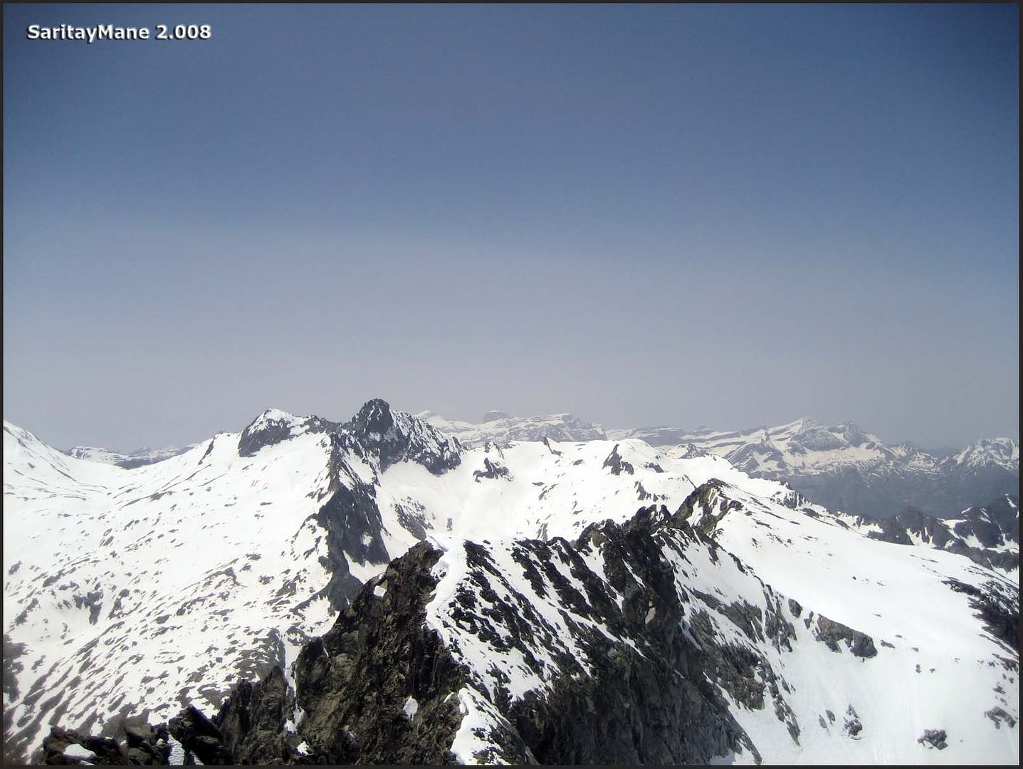
The NW ridge that encloses the cirque of Néouvielle.
While we ascend the slope.
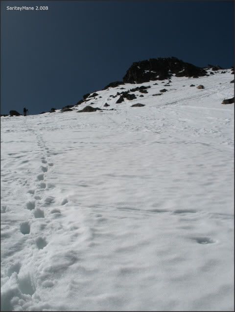
By the way, this gets harder.
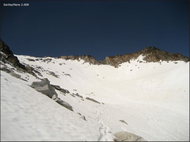
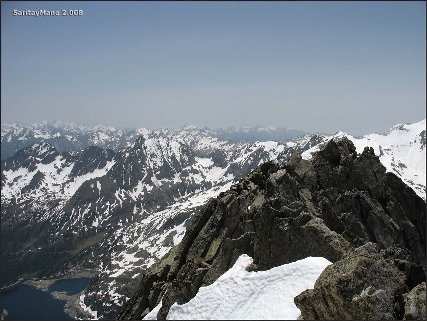
Finally, we reach the NE crest.
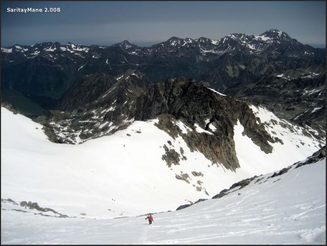
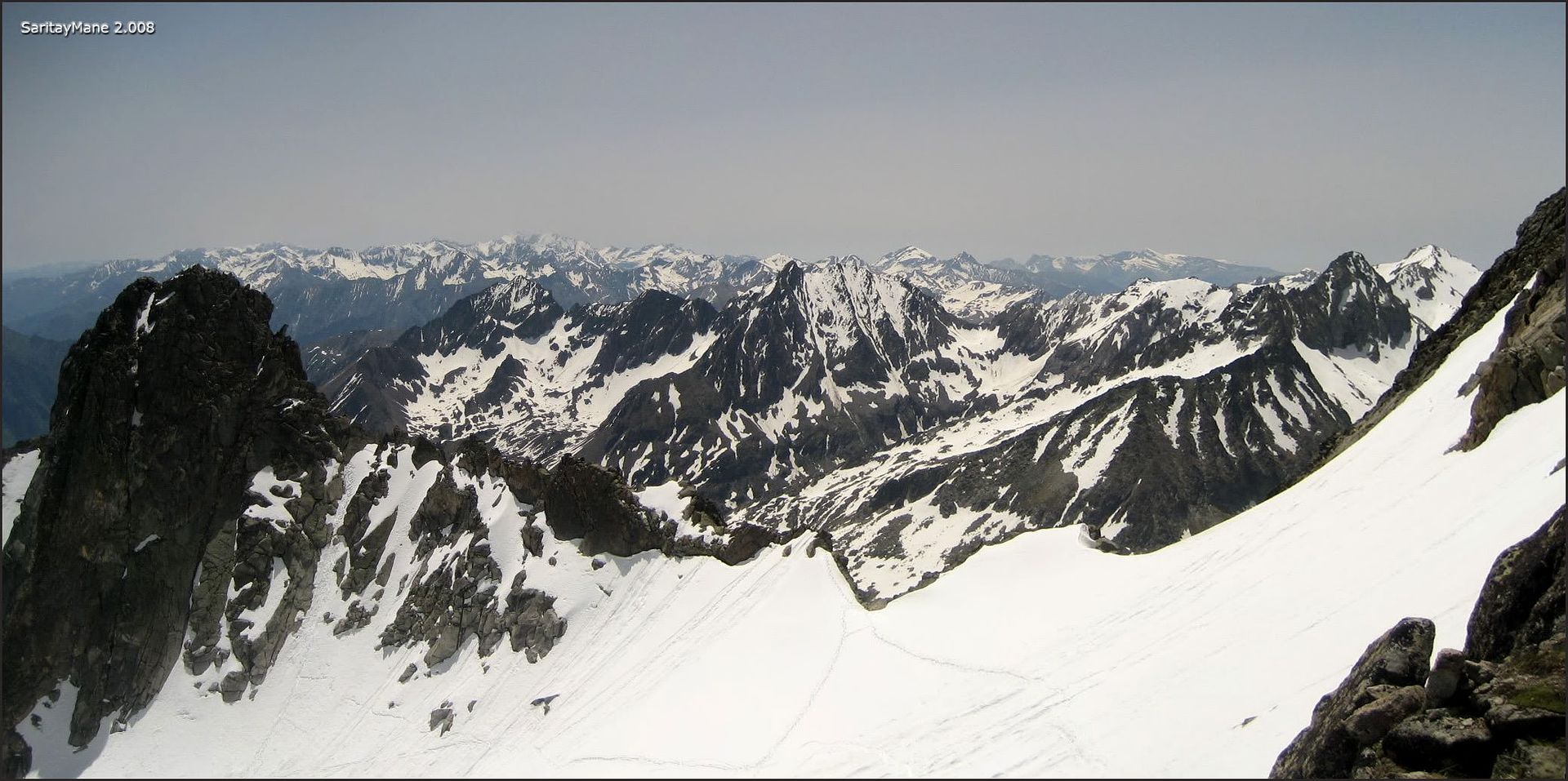
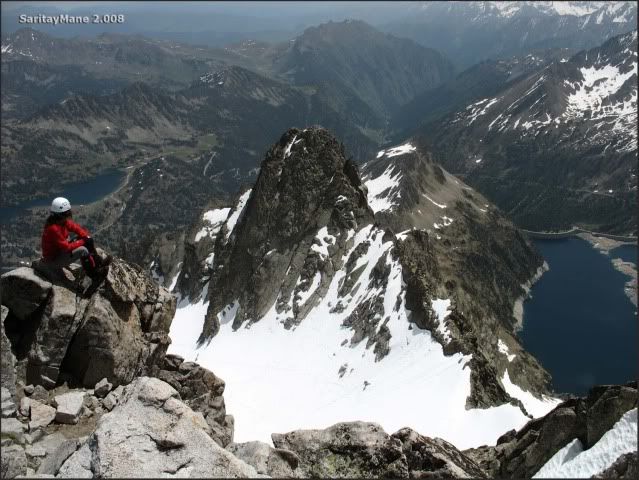
The astonishing "Ramoung".
Escorted by multiple mountains.
From this point, we follow the crest, looking for the basis of the peak, where we’ll make our last steps to the summit.
Looking at the Lac d'Aubert, where we left the car.
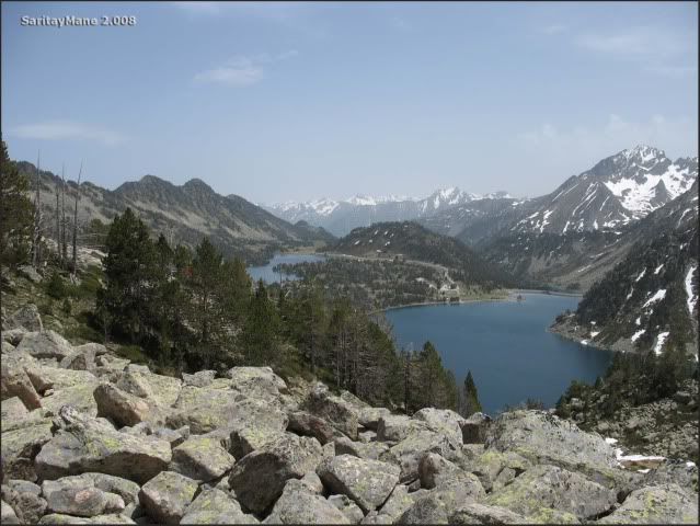
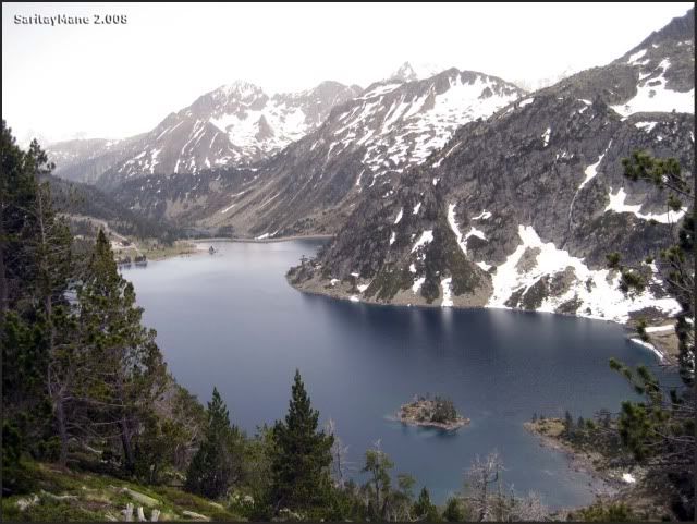
There’s the Lac de Cap de Long, where we were a pair of days ago.
Here we’ve found the first blocks on the crest.
Getting off the crampons.
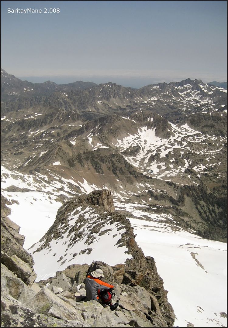
From this point, as we said before, we must follow the las meters to the basis of the peak.
Follow the landmarks, to get the easiest way.
Finally, a short scrumble, this how it seems.
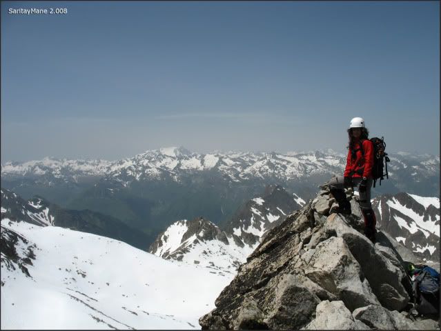
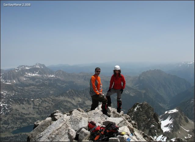
Reaching the summit.
Summit of "Pic de Néouvielle" (3,091 m – 10,141 ft).
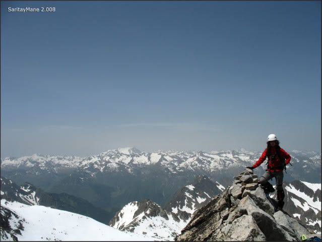
A 'pit stop' for resting and take something for supper.
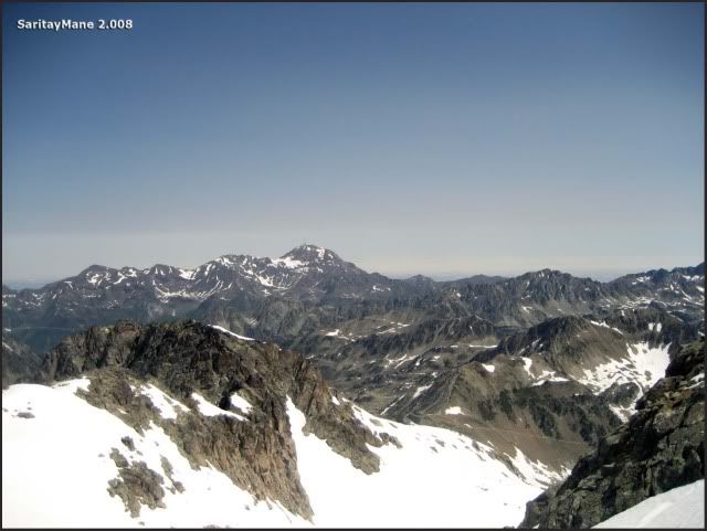
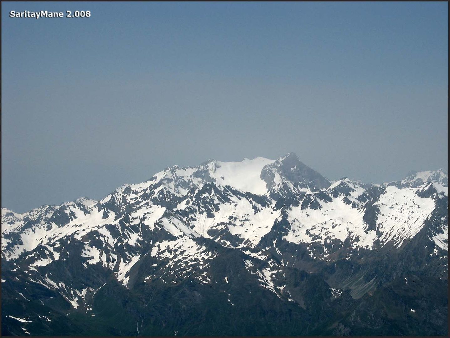
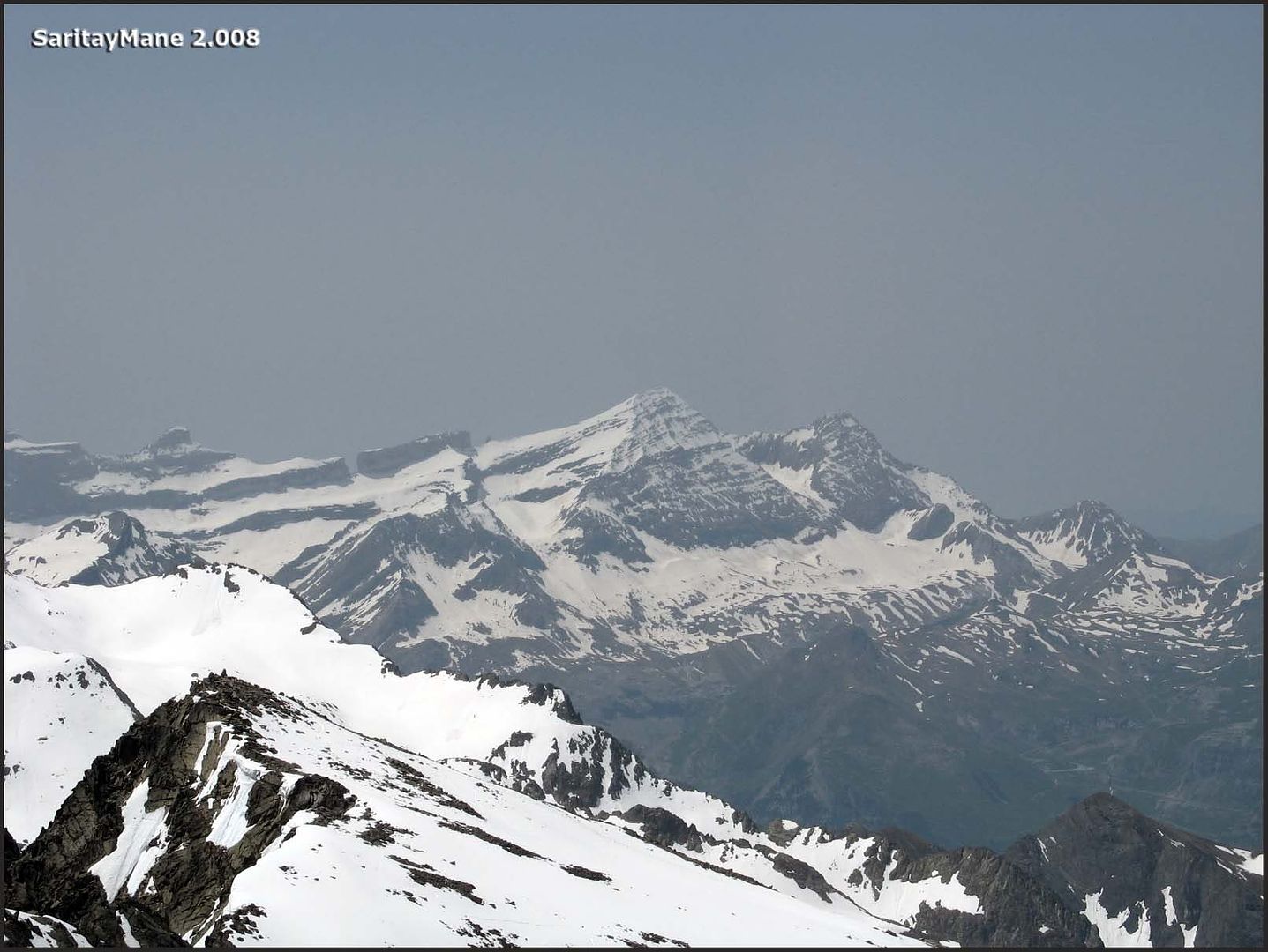
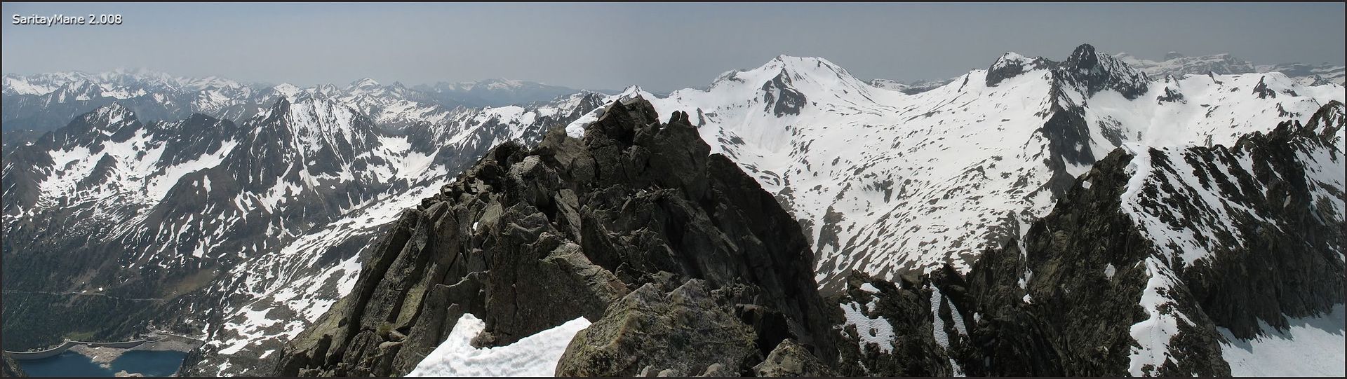
The Massif of Vignemale.
A bit closer.
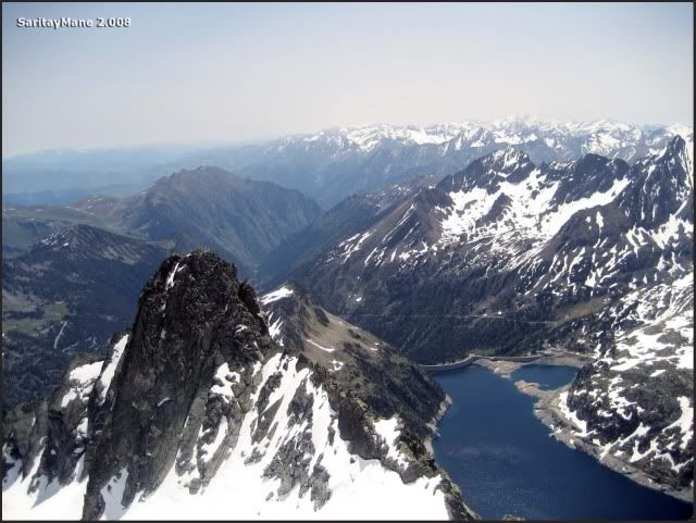
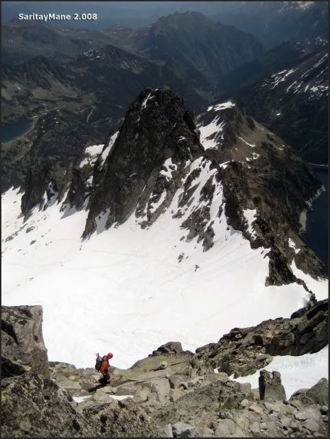
Peak Taillón and the crack named "Brecha de Roland" on left-hand.
"Pic Long" and summits of Ordesa in the background.
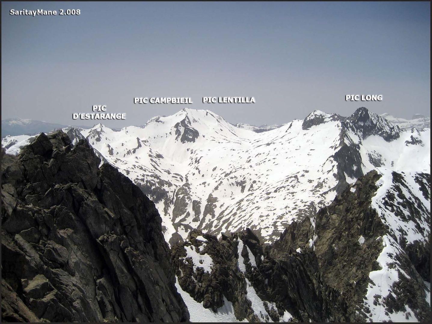
Peaks Campbieil, Lentilla and Estarange which we visited two days ago.
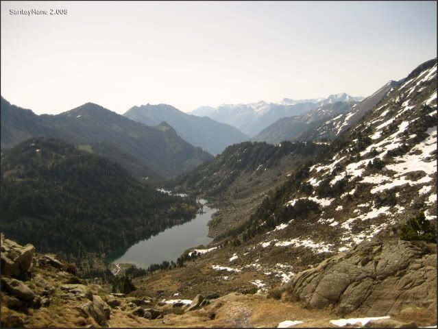
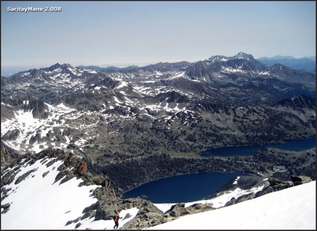
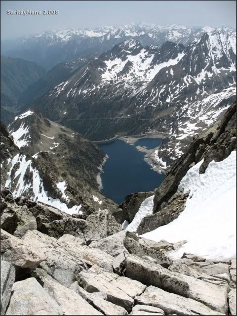
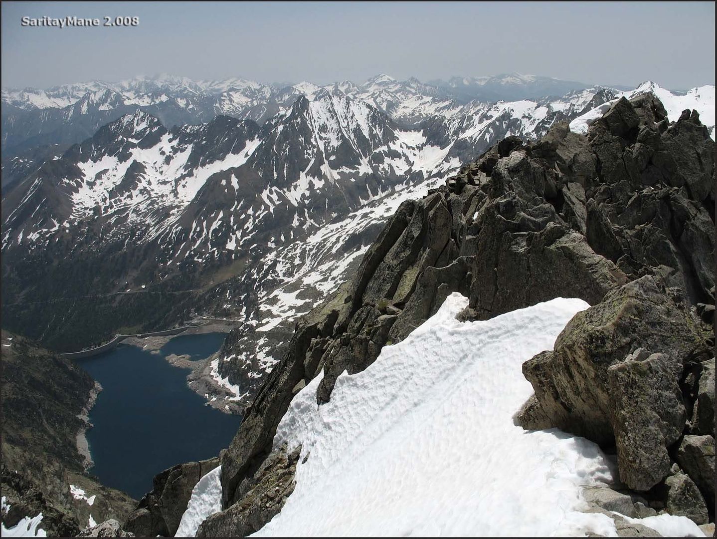
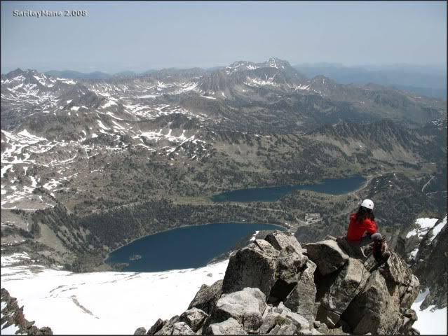
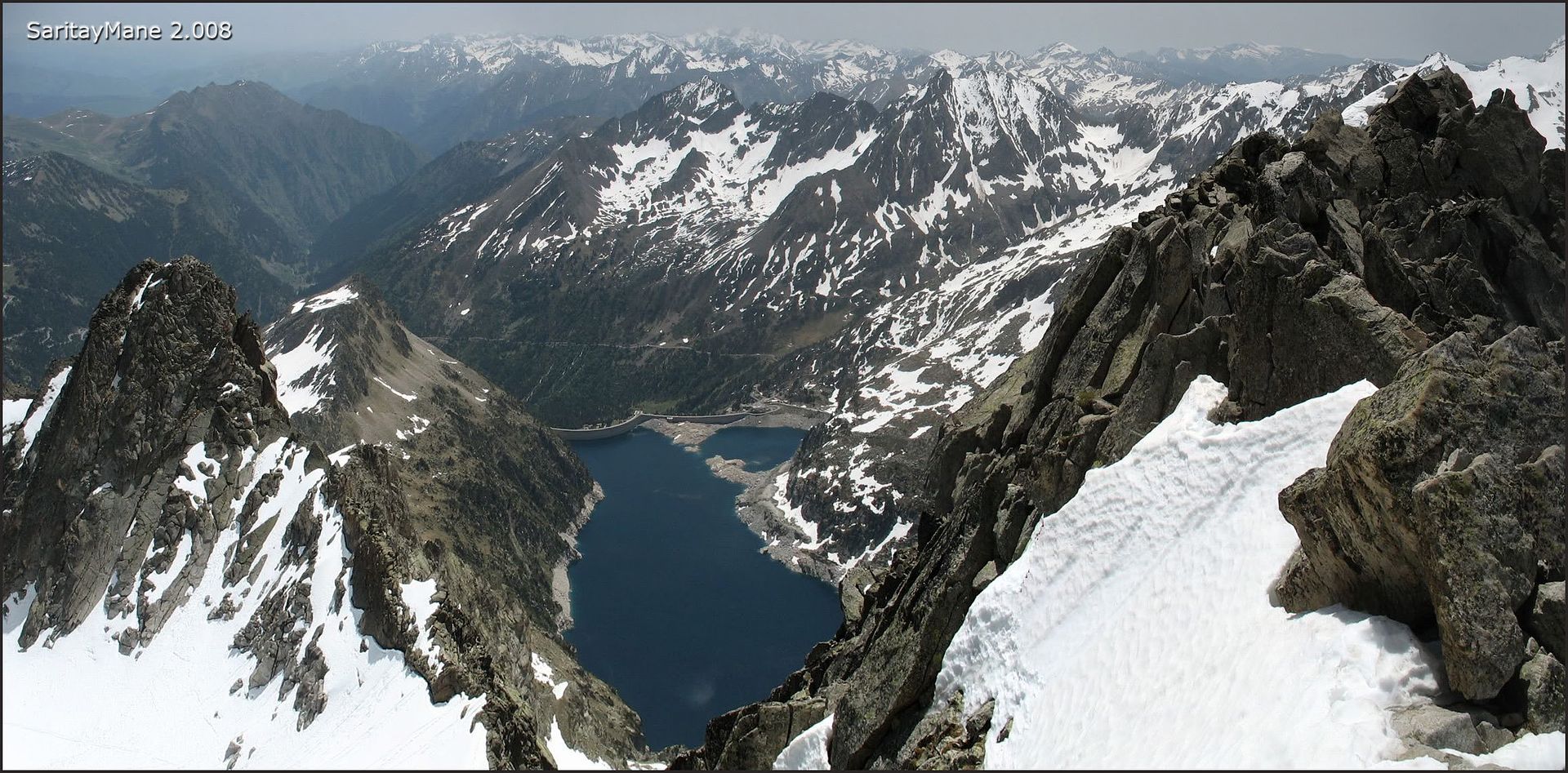
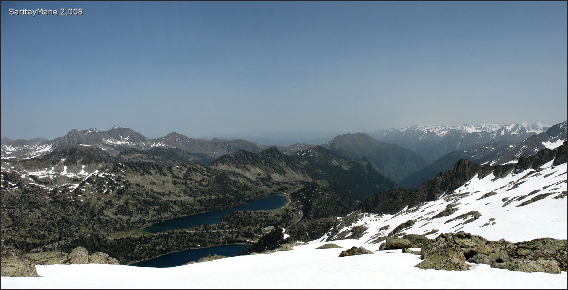
The "Lac de Cap de Long" 1,000 meters in the hollow of the valley.
And the "Pointe de Ramoung", continuously glanced by both of us.
Closer.
From this wonderful watchtower.
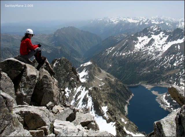
The "Lac d'Aubert".
This is going to be our way back.
A panoramic, orchestrated by the "Midi de Bigorre".
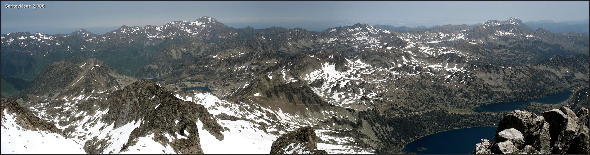
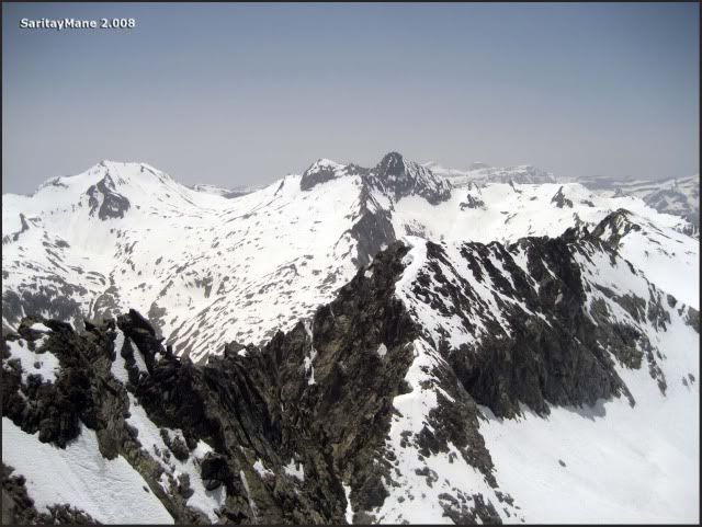
A panoramic towards Pic Long area. See the crest towards the Peak Trois Consellers on first shot....
... another one, towards "Lac de Cap de Long".
The last picture on the top.
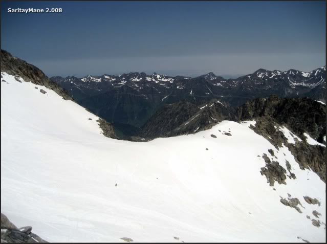
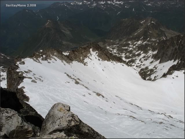
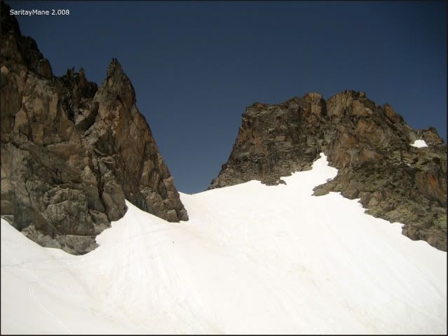
We intend to descent over the NW Crest, following to the "Breche de Chausenque". From this point. It’s expected to engage the path surrounding the "Lac d’Aubert" over North.
That’s where we’ll descend.
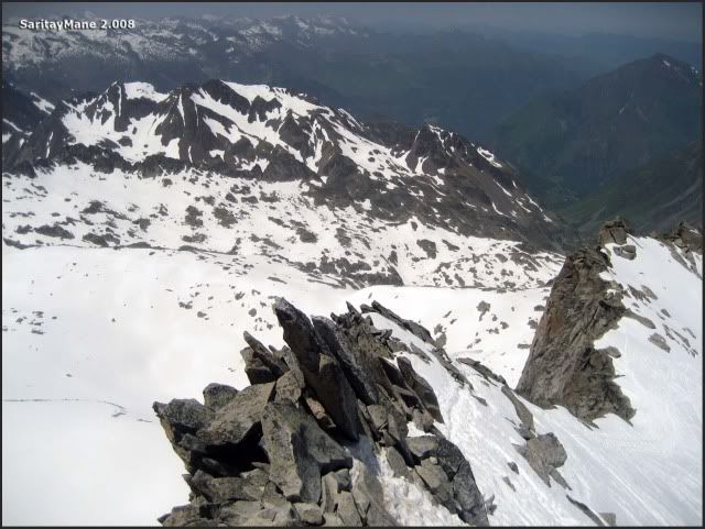
Last steps on the NW Crest.
From this point, we take a better shot of the crest towards the Peak Trois Consellers.
Finally, we leave back the NW Crest. It’s hard to walk over this melted snow.
Bye Bye, Néouvielle.
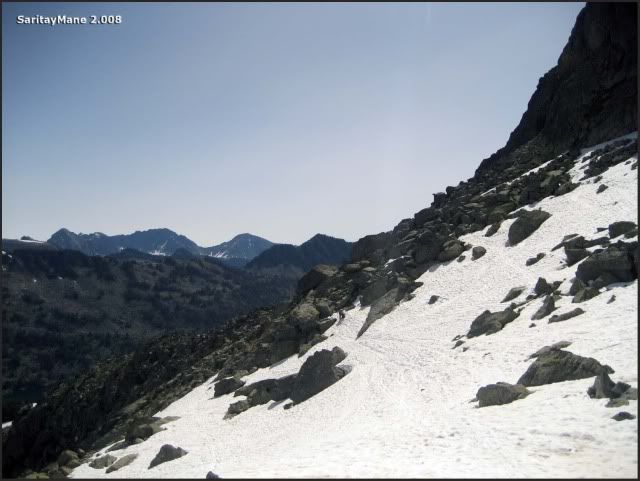
Following the descent.
There’s the "Breche de Chausenque".
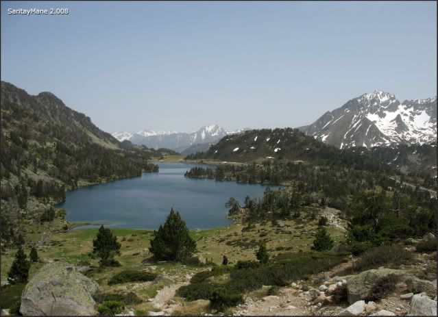
Looking at the "Lac d'Aumar".
This is our way, coming from the Néouvielle.
From this point, we intend to reach the path coming from the pass named "Hourquette d'Aubert" to the "Lac d’Aubert", over north.
Looking back.
Surrounding the "Lac d'Aubert", across North.
Over this chaos made of blocks.
This is where we come from.
At last, we have to ascend a few meters to reach the path that we were intending to find.
At this point, we follow straight the path.
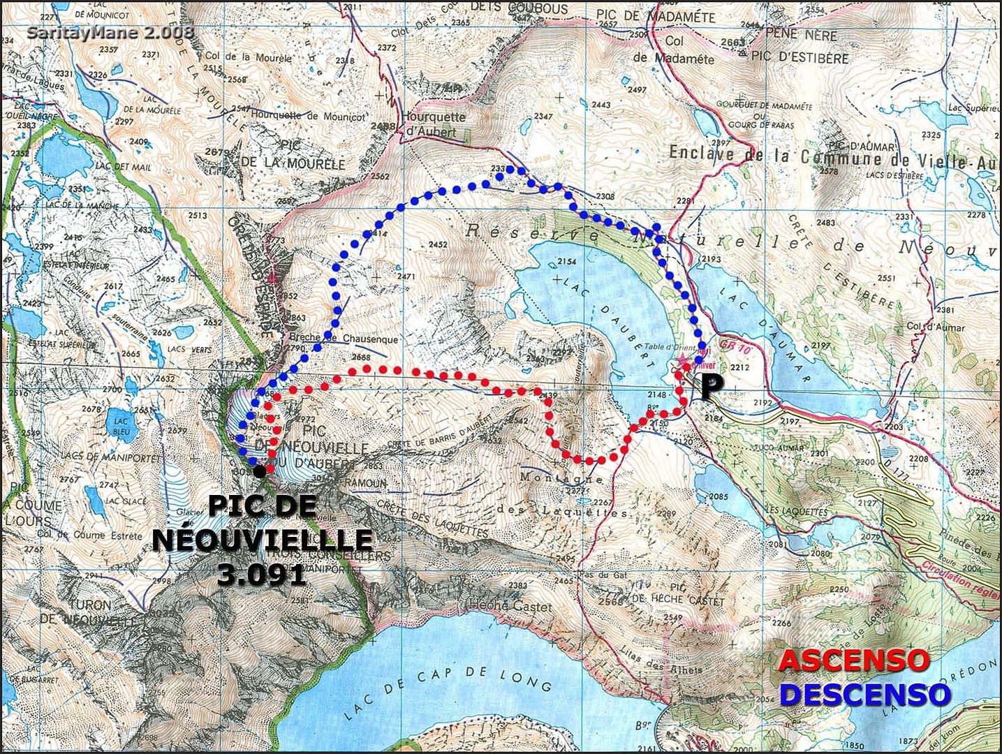
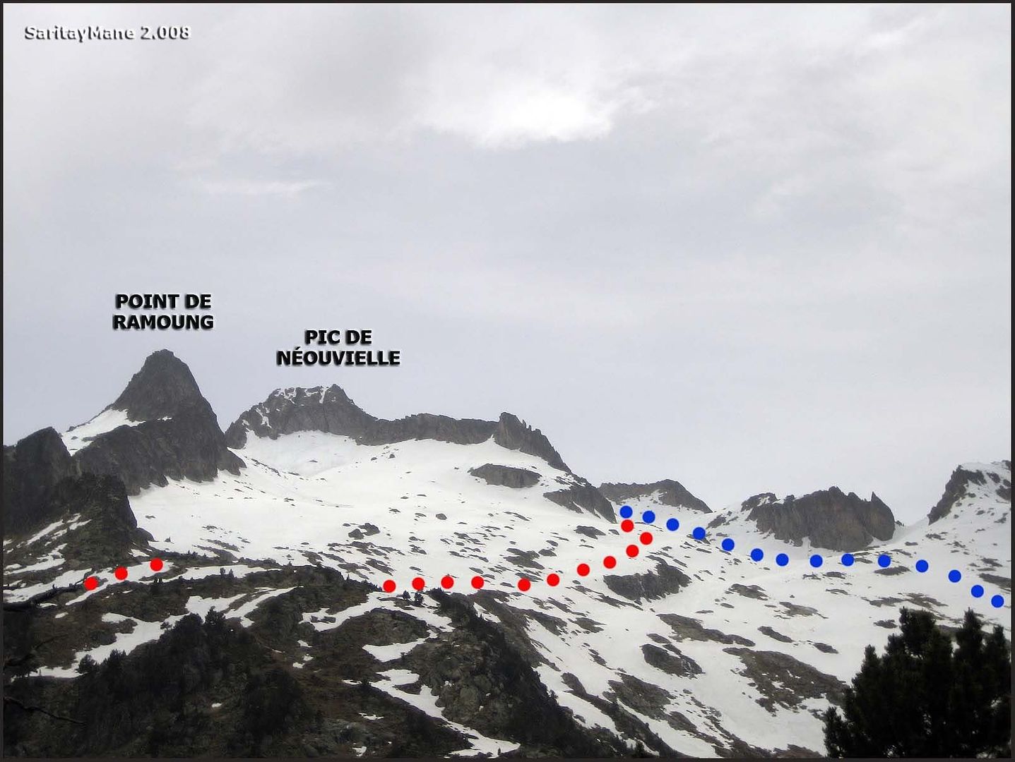
In this scheme is outlined the way up (in red) and down (in blue).
Finally, back at the "Lac d'Aumar", surrounding the its left shore we shall reach the starting point.
We take the opportunity to have some meal near the parking. it feels hot cause of the summer sun, so that we’d better stand under a shape.
Finally, don’t forget to pass the tollbooth after 18:30 if possible, so you shall avoid to pay the due. We didn’t and it cost us 5 Eu, nevertheless we’re novices here. So we’ll notice this next time.
From now on, we are on our way for homecoming.
For further information for another Climbings in English Version, click on this link: RANK OF PEAKS. ENGLISH VERSION.


No hay comentarios:
Publicar un comentario